


Last update
27 Jul 2005

This page is maintained by
Mark Fielding
All content Copyright © The University of Reading unless otherwise stated.
Clouds, Water Vapour and Climate (CWVC) Project
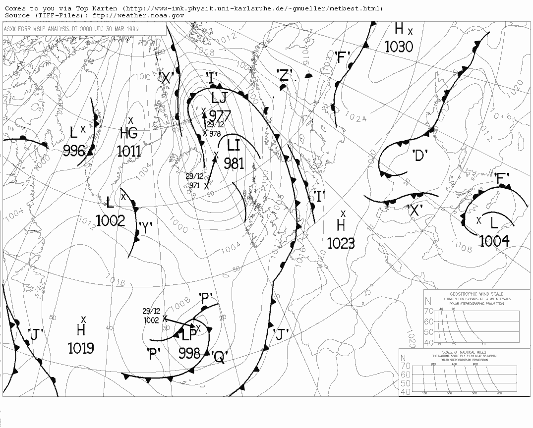
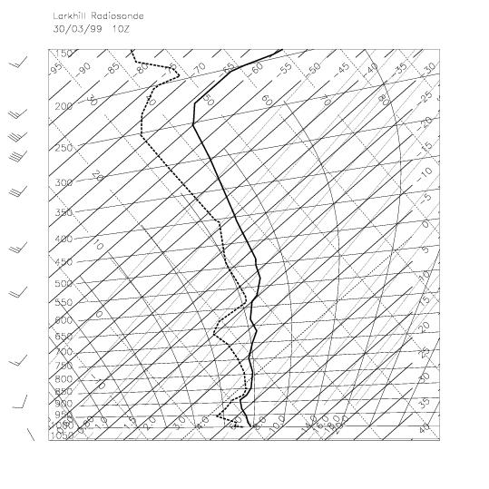
This is an ongoing project involving flights of the UK Met Office C-130 aircraft over Chilbolton, to study the nature of embedded convection other and mixed-phase processes in warm-fronts. Colleagues at UMIST are simulating these case studies with the Met Office Large Eddy Model. The radar data from these cases will shortly be available at the British Atmospheric Data Centre.CWVC Flight I (30 March 1999)
Embedded convection in a warm front was sampled by the radar and the aircraft. The Hallett-Mossop process was active, generating high concentrations of small ice crystals which grew rapidly into pristine columns that were visible to the radar as a region of high ZDR.
 Quarterly
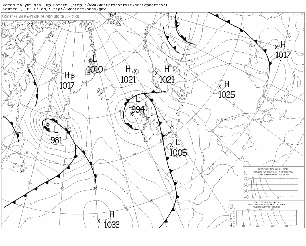
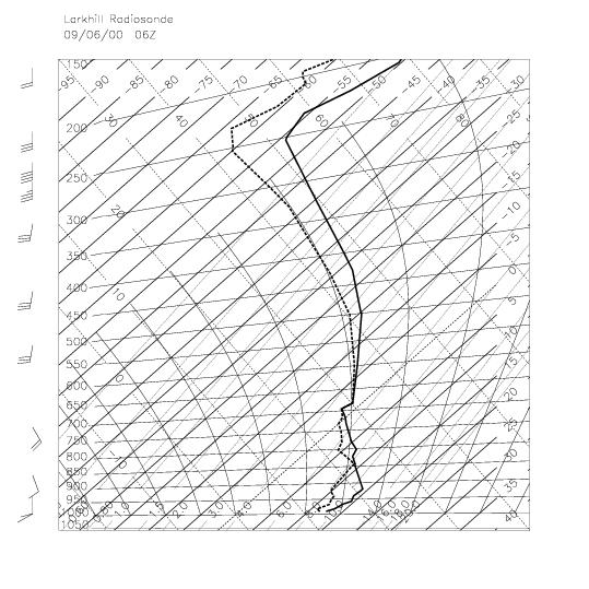
Journal paper on this case (PDF): Hogan et al. (2002)Scans of Z, ZDR, LDR, V and PHI_DPFrontiers animation | Synoptic chart 00Z | Larkhill sonde ascent 10Z
Quarterly
Journal paper on this case (PDF): Hogan et al. (2002)Scans of Z, ZDR, LDR, V and PHI_DPFrontiers animation | Synoptic chart 00Z | Larkhill sonde ascent 10Z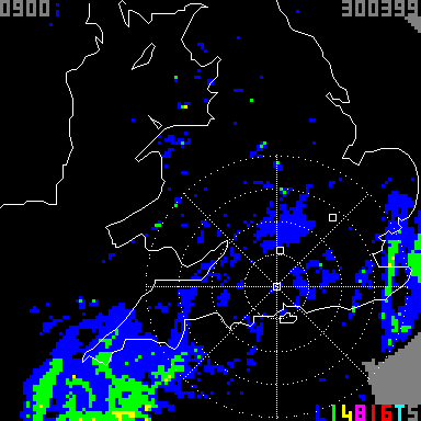
 Older images of Z and ZDRPreliminary analysis: 3D visualisationComparison with the UK Met Office mesoscale model (by Damian Wilson)A look at the velocity structure
CWVC Flight II (9 June 2000)
Showery precipitation, followed by altocumulus. Very high values of ZDR (up to around 6 dB) were observed by the radar near the top of the cloud, while the aircraft reported liquid water and dendrite crystals.
Overview of radar
observationsScans of Z, ZDR, LDR, V and PHI_DPFrontiers animation | Synoptic chart 00Z | Larkhill sonde ascent 06Z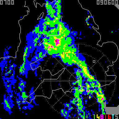
 Comparison with the UK Met Office mesoscale model (by Damian Wilson)
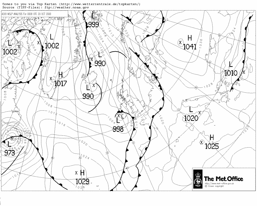
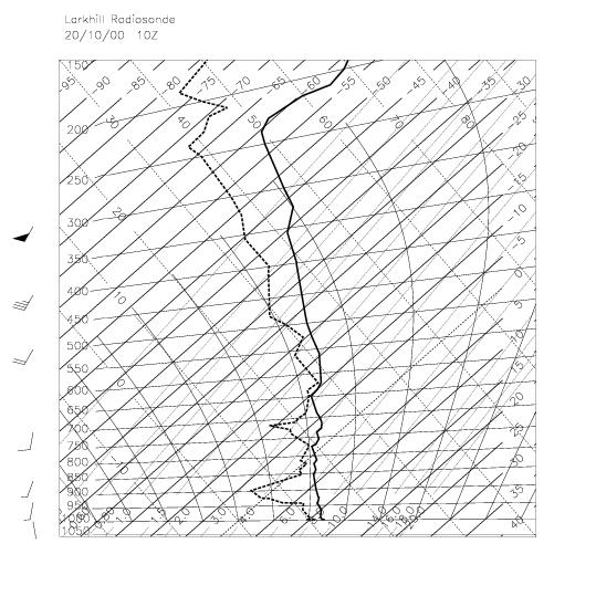
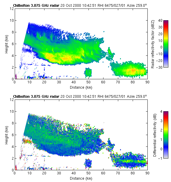
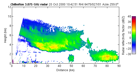
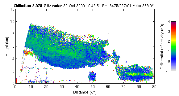
CWVC Flight III (20 October 2000)
A thick ice cloud, with fall streaks penetrating a suspected liquid water layer at -11°C and rapid ice growth indicated by the increase in radar reflectivity.
Quarterly Journal
paper on this case (PDF): Field et al. (2004)Overview of radar
observationsScans of Z, ZDR, LDR, V and PHI_DPFrontiers animation | Synoptic chart 00Z
| Larkhill sonde ascent 10Z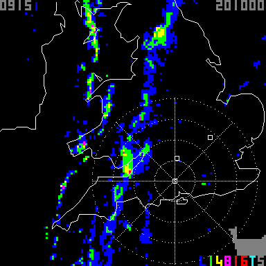
 Animation of Z and ZDR
| Animation of Z only
| Animation of ZDR only
| MPEG of Z and ZDR
| MPEG of Z only
Animation of Z and ZDR
| Animation of Z only
| Animation of ZDR only
| MPEG of Z and ZDR
| MPEG of Z only
 Comparison with the UK Met Office mesoscale model (by Damian Wilson)
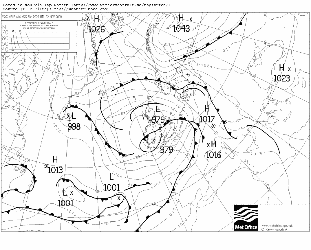
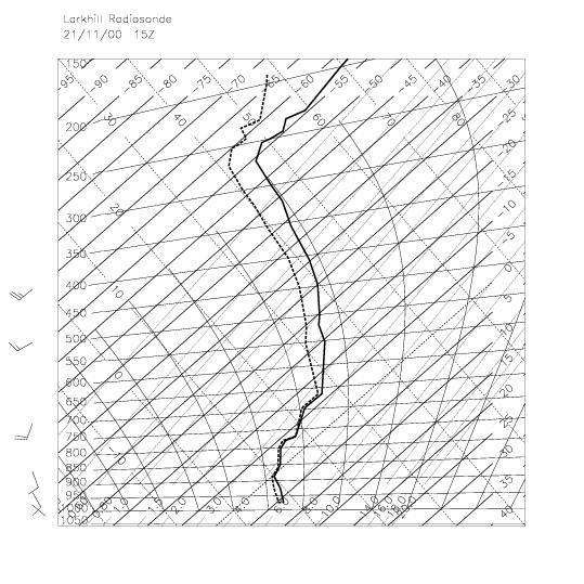
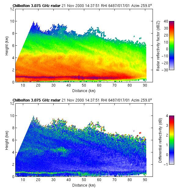
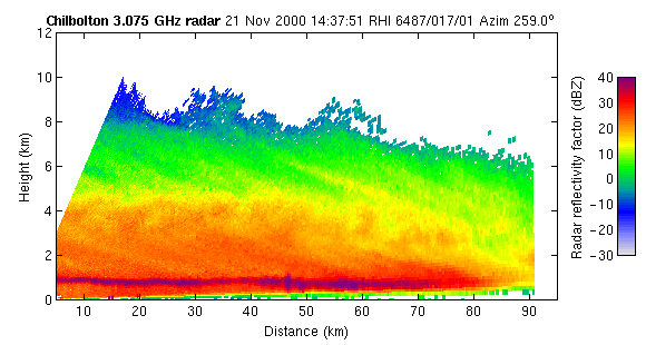
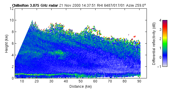
CWVC Flight IV (21 November 2000)
Initially very uniform nimbostratus, in which later an embedded convective plume was observed and tracked. A mixed-phase mid-level cloud was present towards the rear of the system.
Quarterly Journal
paper on this case (PDF): Field et al. (2004)Overview of radar
observationsScans of Z, ZDR, LDR, V and PHI_DPFrontiers animation | Synoptic chart 00Z 22 November 2000
| Larkhill sonde ascent 15Z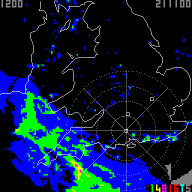
 Animation of Z and ZDR
| Animation of Z only
| Animation of ZDR only
| MPEG of Z and ZDR
Animation of Z and ZDR
| Animation of Z only
| Animation of ZDR only
| MPEG of Z and ZDR
 Comparison with the UK Met Office mesoscale model (by Damian Wilson)
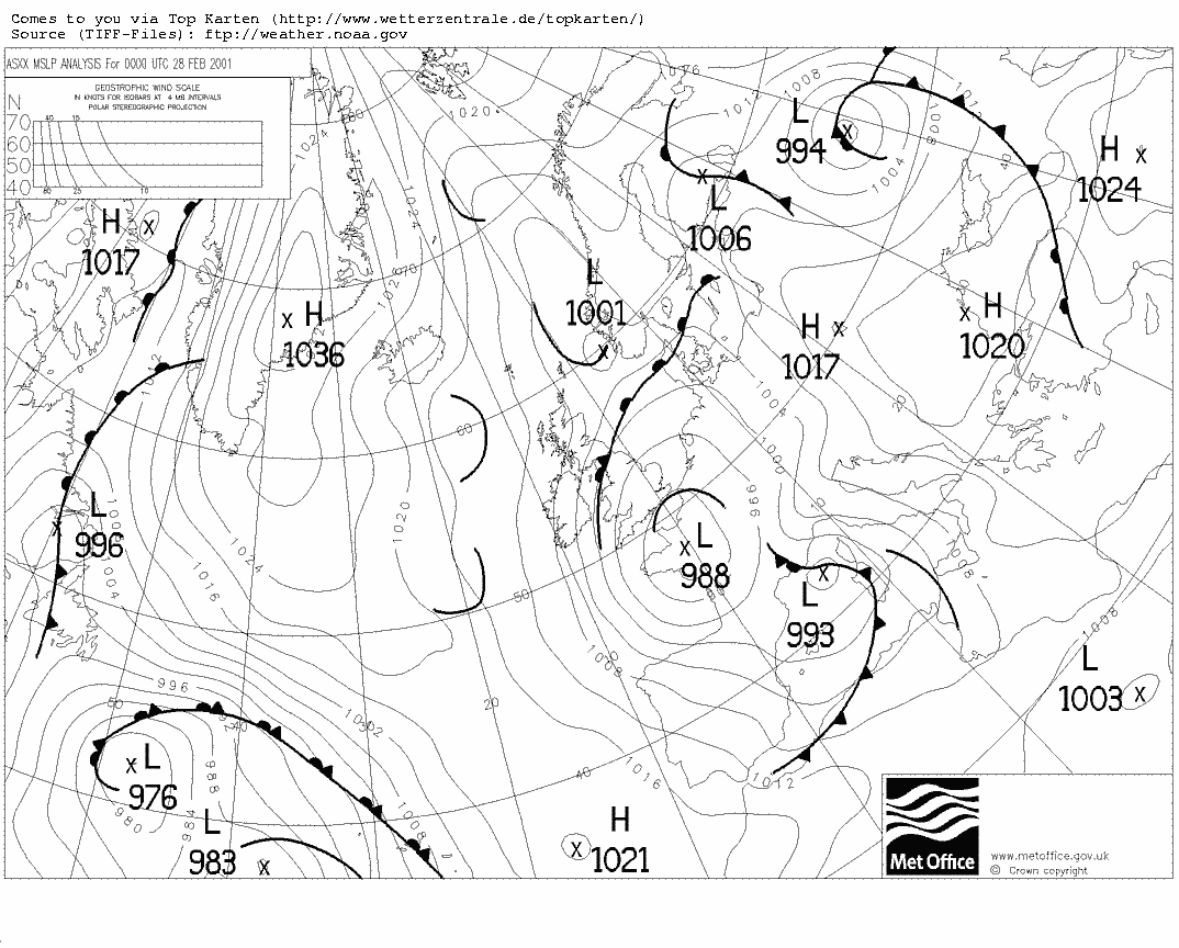
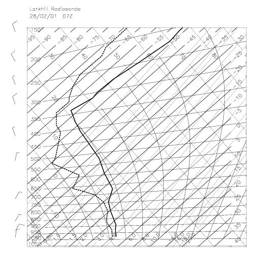
CWVC Flight V (28 February 2001)
A mixed-phase boundary layer cloud extending from 0°C at the surface to -12°C at cloud top. The ground-based cloud radar indicated considerable small scale vertical velocity structure.
Overview of radar
observationsScans of Z, ZDR, LDR, V and PHI_DPFrontiers animation | Synoptic chart 00Z
| Larkhill sonde ascent
07Z
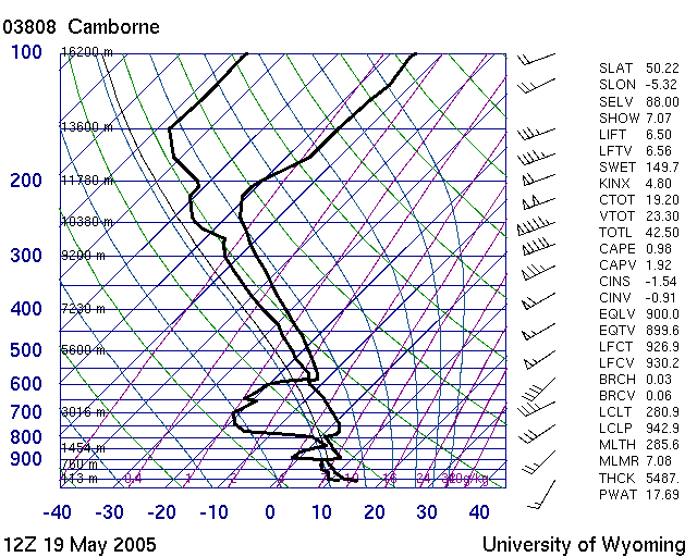
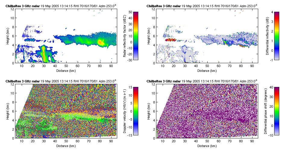
CWVC Flight VI (19 May 2005)
A mixture of broken cirrus and altocumulus
Copernicus
cloud radarSynoptic Chart 00Z | Camborne sonde ascent
12Z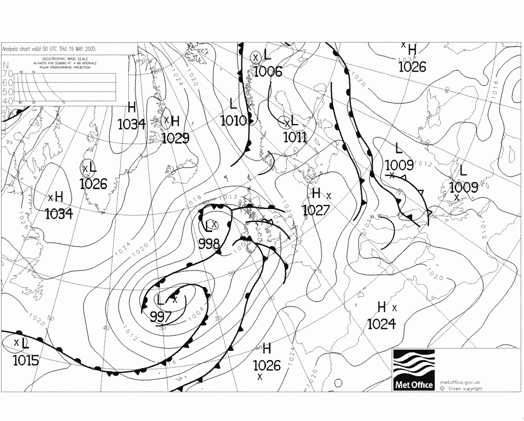
 Scan showing mixed-phase
altocumulus with high ZDR, plus some cirrus
Scan showing mixed-phase
altocumulus with high ZDR, plus some cirrus
CWVC Flight VII (26 May 2005)
Not a very successful flight due to the failure of the CAMRa radar. There were two overheads of Chilbolton, at 10.05 and 11.19 UTC, so the comparisons with the Copernicus radar and Acrobat radar may be interesting.
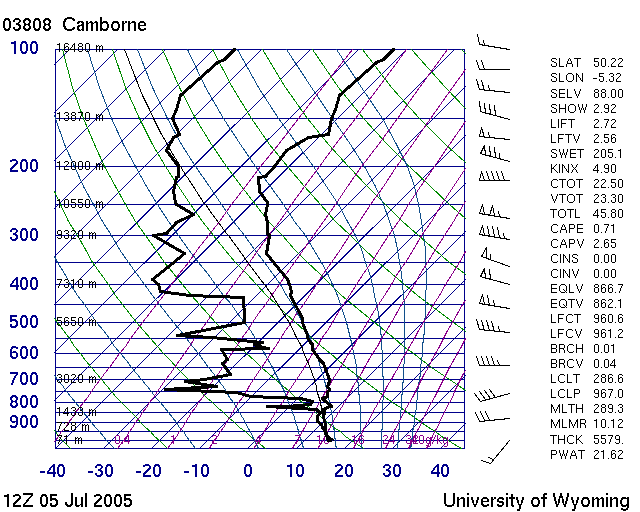
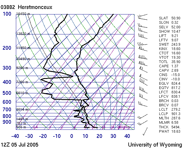
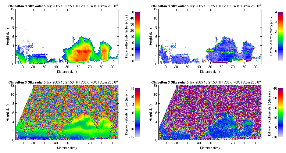
CWVC Flight VIII (5 July 2005)
An interesting flight with precipitating mixed-phase cloud observed by the aircraft. Initially the inhomogeneous fallstreak-like features were observed, as in the first scan below. The aircraft flew directly over Chilbolton at 12.55 & 13.00 UTC at 4 km altitude, at which time a mixture of columns, plates, droplets, and shortly afterwards graupel was reported. Later in the flight a shallow shower cloud (the one in the second scan below) was sampled in detail as it was advected towards the radar. Vertical winds of up to 2 m/s were reported, as well as supercooled 250-microns droplets. The Hallett-Mossop mechanism is therefore likely to have been active in this cloud. An overhead of Chilbolton occurred at around 14.20 UTC when the shower passed overhead. The last run of the day was at 1.5 km altitude in the low clouds and included an overhead of Chilbolton in light rain.
Animations of the scan sequence would be very informative. Note that there is an offset in the velocity measurements.
Copernicus
cloud radarSynoptic Chart 00Z | Camborne sonde ascent 12Z | Herstmonceux sonde ascent 12Z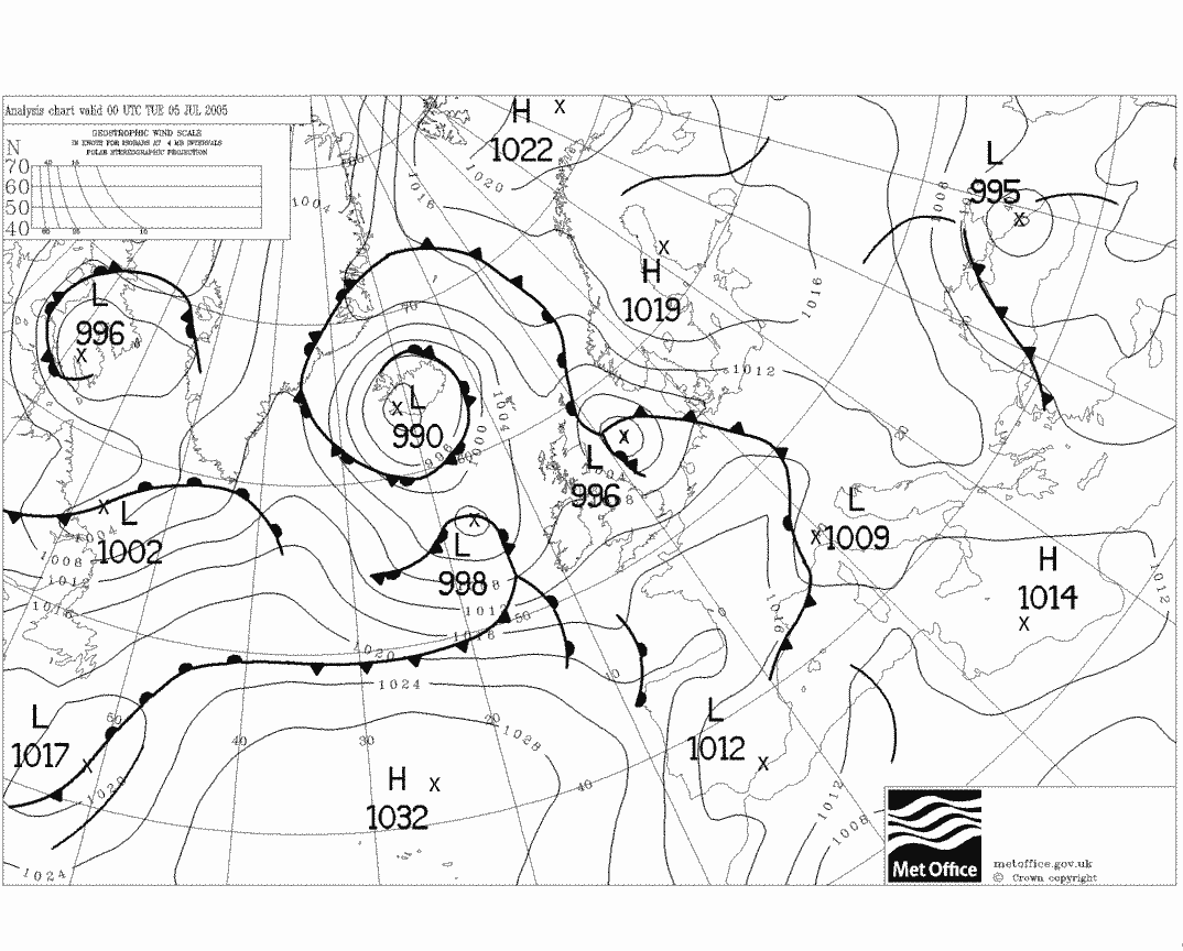
 Scan at 11.37 UTC showing
possible generating cells at 5 km and ice falling in strong wind
shear
Scan at 11.37 UTC showing
possible generating cells at 5 km and ice falling in strong wind
shear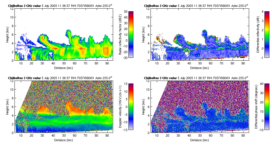 Scan at 13.28 UTC showing
a shower cloud that was extensively samped; note the velocity
perturbation in the updraft
Scan at 13.28 UTC showing
a shower cloud that was extensively samped; note the velocity
perturbation in the updraft
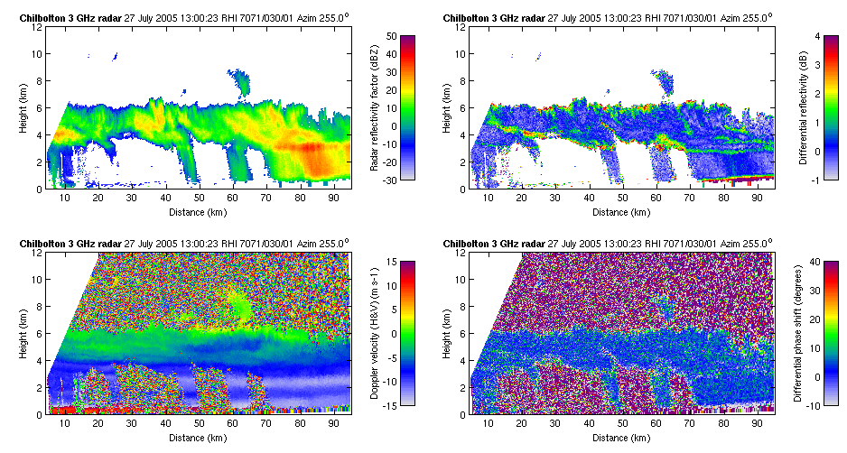
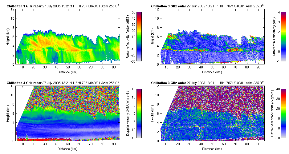
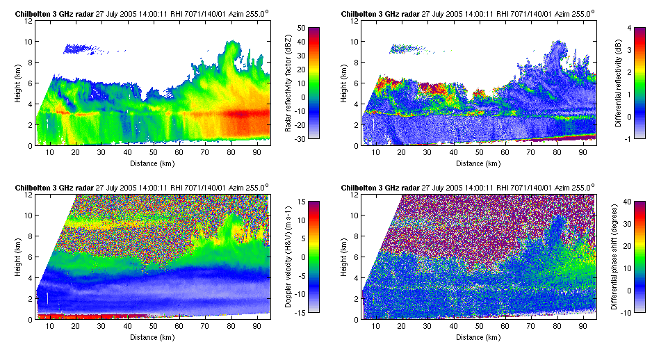
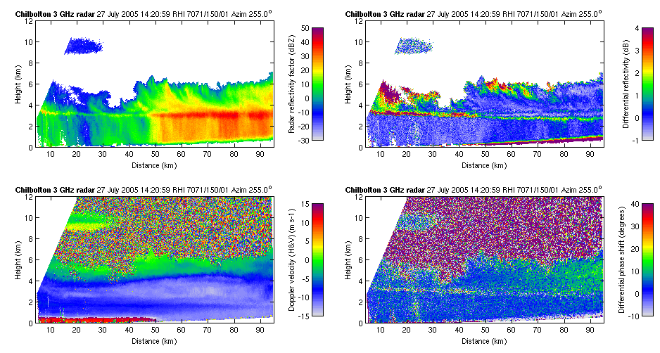
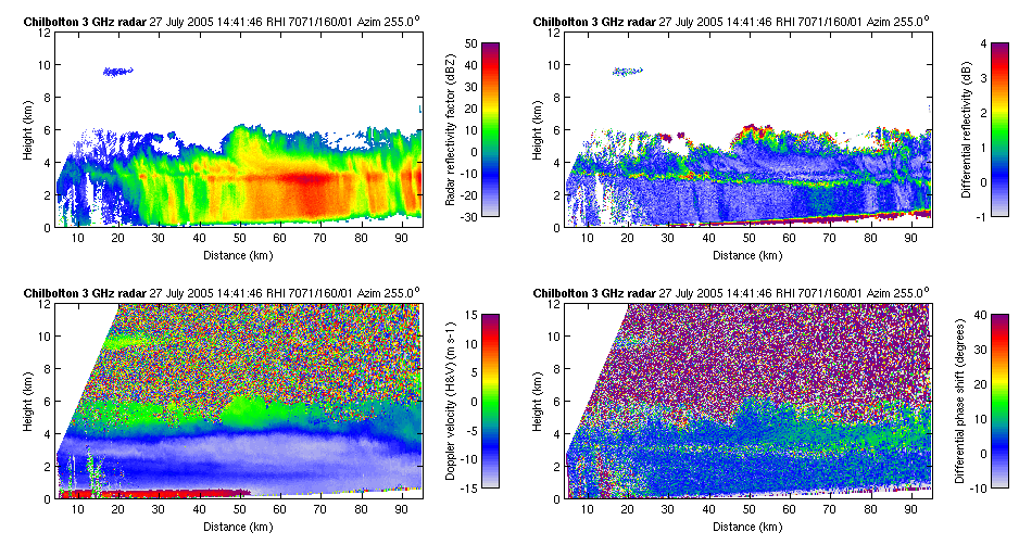
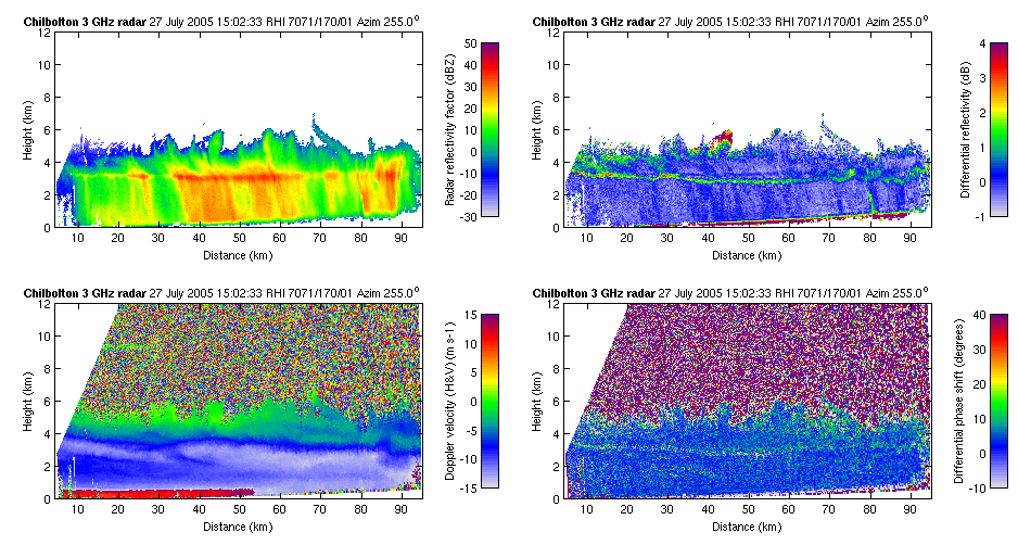
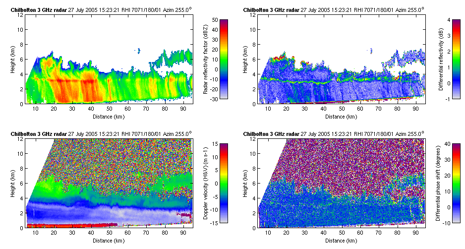
CWVC Flight IX (27 July 2005)
13.00 UTC|
13.21 UTC|
14.00 UTC|
14.21 UTC|
14.42 UTC|
15.03 UTC|
15.23 UTC