Clear skies in many places overnight led to a widespread air frost on the 2nd although N and E parts of Scotland were slightly warmer as cloud and snow continued to affect these parts. Parts of East Anglia and the Midlands had a misty start to the day, while some snow fell overnight in parts of Ireland, the Channel Islands and E areas of England. Overnight snow also fell in parts of Wales and SW England. During the day rain and snow affected many areas - during the morning snow affected places from NE England to the East Midlands and this area of snow then moved S and further W into Wales in the afternoon. Further wintry precipitation affected N England, again slowly moving S'wards. N and E Scotland and East Anglia were also affected by snowfall during the day and the snow reached Dublin and Cent S England in the evening. By midnight an E'ly surface flow was established across all areas and at 2100GMT snow depths included 37cm at Aviemore and 23cm at Eskdalemuir. Ahead of the snow, S parts of Britain and Ireland again had a sunny day - further N it was a duller day. In Scotland, a number of roads across the country were closed including parts of the M9. Rail services between Inverness and Central Scotland were also affected by poor weather. (Isles of Scilly 7.3C, Loch Glascarnoch -0.5C maximum, Katesbridge -9.9C minimum, Aberporth 11.2mm, Odiham 7.3h.)
The 3rd dawned with another widespread air frost and temperatures widely below -10C across inland areas of Scotland. Overnight there was some further sleet and snow in E Scotland, NE England, with a few light falls in the E Midlands, Cent S England and S Wales. 0900GMT snow depths included 35cm at Aviemore, 17cm at Spadeadam, 22cm at Albermarle and 10cm at Leek. With the surface E'ly flow turning N'ly as the day progressed, snowfalls during the day continued to be largely in the E and N of Britain, as far S as Kent and Sussex. Cornwall and parts of S Ireland had some rain during the day and in many parts of Cent Scotland and N England the temperature failed to rise above 0C during the day. Away from the areas of rain and snow most parts of England, Wales and Ireland had a sunny day. In the evening there were snow showers in E Ireland. (Isles of Scilly 7.8C, Aviemore -3.9C maximum, Braemar -16.7C minimum, Rosehearty 6.0mm, Woodford 7.0h.)
Away from the Northern Isles and a few parts of N Scotland, the 4th dawned with a widespread, sharp air frost. There was some snwofall across the Northern Isles and N Scotland associated with frontal systems - parts of the Midlands and Cent S England had freezing mist or fog by dawn, and this led to falls of snow grains falling in places. As the fronts moved S through Scotland and into N England and N Ireland by 2400GMT, they brought falls of snow with them. There were also snow showers in places ahead of the fronts, including the Channel Islands and in parts of S Ireland. In many parts of England and Scotland the temperature remained below 0C during the day - despite it being a mainly sunny day here and in S Ireland. 0900GMT snow depths incldued 34cm at Aviemore, 24cm at Redesdale and 23cm at Eskdalemuir. In Scotland, Fife Council became the first local authority to confirm that its supply of grit was exhausted after it received less than it had ordered from suppliers. (Belmullet 5.4C, Eskdalemuir -3.9C maximum, Eskdalemuir -14.0C minimum, Altnaharra 12.4mm, North Wyke 7.7h.)
S'ward-moving fronts spawned a shallow low across S England on the 5th that drew an area of wintry precipitation over the area, giving heavy falls in places. The day began with a widespread air frost although many places in W Ireland and W Wales escaped this. Frontal snow affected many parts of Scotland and N England with lesser falls in places as far S as the Channel islands and S Ireland. During the morning thunder was reported from Lerwick and Belmullet. The snow moved into the Midlands and by the evening parts of S England had occurred in parts of S England. Snow depths at 2400GMT included 10cm at Lerwick and Benson, and 40cm at Spadeadam. Across Wales some schools were closed by the snow. S and E Ireland and S parts of Scotland had a sunny day - elsewhere it was generally cloudy.(St Catherine's Point 5.9C, Drumalbin -2.3C maximum, Dalwhinnie -10.8C minimum, Crosby 18.0mm, Dublin Airport 6.5h.)
There was a widespread air frost into the 6th. Snow continued to fall in many areas overnight with the heaviest falls tending to be in parts of S England. Snow depths reported at 0600-0900GMT included 10cm at Lerwick, 47cm at Aviemore, 31cm at Redesdale, 24cm at Odiham and 11cm at Dunkeswell. The Scottish First Minister Alex Salmond said Scotland was experiencing its worst winter since 1963. Further weather-related deaths were reported in Wales, Shetland and Aberdeenshire. Across England and Wales some 8000 schools were closed. Further wintry weather affected most areas during the morning but then started to die down in the afternoon and evening. Thunder was heard in the Dublin area in the afternoon and by the evening falling snow wass largely confined to E Britain and some Se parts of England; by 2400GMT falls wre still being reported from Jersey to Lerwick. As the snow spread south, many Cent parts of the UK had some dry and brighter weather but this led to frost and ice developing quickly in the evening as the temperature fell. W Ireland, N England and S Scotland saw the best of the sunshine with S England remaining rather cloudy; many areas again remained below 0C during the day. (Belmullet 5.0C, Kinlochewe -5.3C maximum, Loch Glascarnoch -12.9C minimum, Chivenor 9.8mm, Cork Airport 7.3h.)
Clear skies and a snow cover early on the 7th led to some low temperatures across Britain; according to the Met Office the coldest spots were across parts of Oxfordshire, Manchester and Devon where temperatures came very close to exceeding the extreme recorded lows. Overnight snow continued to affect parts of Scotland and E England and during the day snow showers continued to affect E areas in particular; however, falls also occurred in parts of SW England and S Wales. Daytime temperatures remained below 0C in many inland areas. Over 10,000 schools closed across the UK owing to ice and lying snow and disrupted transport. The National Grid issued its second alert in three days, asking suppliers to provide more gas and some businesses to switch to other power sources as gas usage hit record levels. Away from the snowy areas it was mostly dry and sunny. (Valentia 5.9C, Loch Glascarnoch -8.5C maximum, Benson -17.7C minimum, Rosehearty 6.2mm, North Wyke 7.8h.)
MSL pressure rose on the 8th to reach 1038mb over NW Irel;and by 2400GMT. The day dawned with a widespread, sharp air frost - notably in Wales, SW England and in parts of Scotland. Overnight snow fell across parts of Scotland and E England - and also penetrated into to some Cent parts of England. 0900GMT snow depths included 10cm at Lerwick, 41cm at Aviemore, 40cm at Carlisle and 13cm at Sennybridge. In E areas the snow showers continued for much of the day with some heavy accumulations over parts of Yorkshire; some snow continued to reach parts of the Midlands and cent S England. Many places had long sunny spells but daytime temperatures were again widely below 0C. In the evening milder air pushed into N Scotland producing rain and sleet falls on frozen ground; by 2400GMT Rosehearty was reporting a temperature of 1.9C. (Isles of Scilly 5.3C, Tulloch Bridge -7.7C maximum, Altnaharra -22.3C minimum, Rosehearty 13.8mm, Cork Airport 7.4h.)
Pressure on the 9th remained high across N Britain. There was a widespread frost to start the day. Snow showers persisted in E parts of the UK throughout the night and then continued during the day, with snow again spreading to Cent areas. Across the far southeast snow showers merged to give longer periods of snow with fresh accumulations across Kent and East Sussex. E and N parts of Ireland also saw further snowfalls while strengthening winds led to drifting of deep snow over high ground. Much of Cent England, Wales and W Ireland had a sunny day but in inland areas temperatures failed to reach 0-C in many places. Fresh snow caused major disruption for motorists, with roads near the Dover coastline being most affected. The A258 and A256 were both blocked by snow earlier in the day with residents in the Deal and Sandwich area virtually cut off from the rest of the county. The Army were called in to help the emergency services in Kent; a spokesman for the Ministry of Defence said the Argyll and Sutherland Highlanders regiment based in Canterbury had supplied soldiers and vehicles to help firefighters. He also said the 36 Engineer Regiment in Maidstone had been using its Land Rovers to deliver meals to the elderly and vulnerable. (Belmullet 5.5C, Okehampton -3.3C maximum, Tulloch Bridge -14.5C minimum, Aultbea 12.6mm, Camborne 7.6h.)
High pressure to the NE of Scotland on the 10th meant an E'ly surface flow across much of the British Isles. Away from a few coastal areas there was a widespread air frost, following some early snowfalls in Wales and S and Cent parts of England. There were also some light falls across Scotland, E England and the Channel Islands before dawn. In places the falls of snow continued throughout the day, not easin until the evening. The snow spread across Wales and into Ireland later in the morning - although falls here were mainly light. In some E and Cent areas of England the snow turned to rain as the temperature rose a little. By 1800GMT snow depths included 15cm at Dyce, 37cm at Spadeadam and 20cm at Odiham. While much of England, Wales and Ireland was cloudy, much of Scotland had sunny spells. (Malin Head 5.8C, Altnaharra -13.5C maximum, Kinbrace -18.4C minimum, Loftus 19.4mm, Kinlochewe 5.8h.)
A fairly extensive cloud cover into the 11th meant that an air frost was mainly confined to parts of S England and Scotland. In many places overnight precipitation fell as sleet or rain although across Irelland snow was quite widespread before dawn. Many places dawned with mist or haze and visibility then remained this way across much of England and wales throughout the day. Some snow grains fell where there was mist and further snow fell during the day in many areas - although generally light amounts away from Scotland. Into the evening the number of reports of snow dropped quickly - although 1800GMT snow depths included 12cm at Connaught Airport and Lough Fea and 6cm at Cork Airport. Some fronmtal cloud spread across Ireland in the evening ahead of an approaching frontal system. (Isles of Scilly 7.6C, Lake Vyrnwy -1./2C maximum, Altnaharra -21.0C minimum, Katesbridge 17.8mm, Camorne 6.2h.)
Increasing cloud amounts prevented an air frost forming on the 12th in many places - although air frost was widespread in S and cent England. Many places dawnmed with mist or haze, and during the day an area of rain, sleet and snow spread NE across Ireland, Wales and SW England with gales around the coasts in the SW. Some snow fell during the day across Scotland and NE England - and in a few other E coast counties; elsewhere it was a mainly dry day although brather cloudy almost everywhere. Parts of Wales and SW England had some heavy snowfall that caused disruption, while in parts of N England rain fell on to cold ground leading to icy surfaces. Some schools were once again closed across England and Wales. (Valentia 9.9C, Lake Vyrnwy -0.9C maximum, Lake Vyrnwy -2.7C minimum, Kinbrace 57.8mm (probably melting snow from earlier falls), Kinlochewe 3.3h.)
Sleet and snow affected Wales and SW areas of England before dawn on the 13th; there was sleet and snow also over Ireland which then turned to rain as the temperature rose (7.8C at Valentia by 0600GMT). During the day the wintry weather pushed NE through England and Wales producing mostly small amounts of precipitation. Parts of E England were affected by freezing rain early in the morning and it was again rather misty or hazy across many parts England once the precipitation ceased. In Scotland fresh snowfall was mostly over high ground. (Isles of Scilly 10.7C, Lake Vyrnwy -1.9C maximum, Lake Vyrnwy -2.2C, Fyvie Castle 46.2mm (propbably melting snow from earlier falls), Cork Airport 5.9h.)
Snowfall on the 14th was largely confined to Scotland and N England; depths reported at 0600GMT included 36cm at Aviemore, 35cm at Spadeadam and 15cm at Bingley, with 11cm still lying at Hereford. Fof, freezing in places, was widespread over England and Wales in the morning and the visibility remained poor in many places throughout the day. Rain affected some parts of SE England in the morning and afternoon while mist and fog were widespread in the morning in Ireland; further rain reached here in the evening from the SW. (Isles of Scilly 10.1C, Sennybridge -0.1C maximum, Andrewsfield -3.2C minimum, Herstmonceux 19.8mm, Casement Aerodrome and Dublin Airport 5.5h.)
Fog patches affected N and E England into the 15th; elsewhere many places had a misty start and visibility remained poor in many places during much of the day. There was some snow over parts of Wales, SE Ireland the Midlands overnight with rain elsewhere in Ireland, Wales and W Scotland. Outbreaks of rain moved E into Cent England later in the morning, with some heavy falls for a while in the Midlands. Some snow fell in S Scotland while the early rain in N England fell on cold ground and led to further problems with ice. Across Ireland temperatures were widely above 10C in the afternoon with further rainfall here in the evening. (Valentia 11.3C, Cassley 3.3C maximum, Redesdale Camp -5.3C minimum, Aviemore 51.8mm (most of this was probably melting snow from earlier falls), North Wyke 1.0h.)
Rain moved E across most areas on the 16th, with heavy falls in places and preceded by some sleet and snow over high ground from Hampshire to N England. Central and eastern parts were dry at first but by dawn the rain had spread to all but the very far east of England. The rain began to clear from the W during the morning and by midday was confined to eastern counties; away from Ireland, however, it remained mainly cloudy - there was also widespread mist, which turned to fog in the evening in parts of E and Cenbt England. (Chivenor 12.3C, Eskdalemuir 2.1C maximum, Dalwhinnie 0.9C minimum, Cardinham 47.0mm, Belmullet 4.7h.)
There was some lingering rain in SE England overnight into the 17th but most of England and Wales then had a dry day with sunny spells. Elsewhere it was cloudier but still dry - apart from parts of N and W Scotland where there were spells of rain and showers. Scattered showers also affected W and N parts of Ireland. With many low-lying places now free of melting snow and with higher daytime temperatures there was littlke mist or haze during the day. (Isles of Scilly 11.4C, Spadeadam 3.6C maximum, Fyvie Castle -2.5C minimum, Tiree 13.0mm, Manston 7.6h.)
A weak ridge of high pressure developed across S and and E areas on the 18th. Most areas had a cloudy night with fog in the Midflands and surrounding parts by dawn. A front gave some rain before dawn across Scotland but during the day this faded under the influence of high pressure and most places had a dry day. Across England it remained generally cloudy and in one or two places fog lingered for much of the day. S Scotland and parts of Cent Ireland had a bright day while across England mist and fog reforned in the evening. (Ashford, Co. Wicklow 12.6C, Dalwhinnie 4.8C maximum, South Farnborough -2.1C minimum, Tyndrum 17.6mm, Leuchars 6.5h.)
The early hours of the 19th were mostly dry but with widespread fog and mist from SW England to S Scotland. Further frontal rain pushed into W Ireland by midday - this made slow progress E'wards to reach SW England by early evening. Winds strengthened from the W and the the rain affected W Wales later in the evening. Ahead of this rain all areas had a rather cloudy day. (Valentia 10.2C, Spadeadam 1.9C maximum, Braemar -6.4C minimum, Isles of Scilly 5.6mm, Hurn 2.5h.)
Overnight into the 20th there were some heavy falls of rain in SW England. As the rain spreads E and N it turned to snow and sleet in the Midlands and Cent S England , and from SE Wales to parts of N England. There were also some reports of snow from N Scotland. As the rain pushed NE'wards it weakened under the influence of a large anticyclone cebtred over Scandinavia. Brighter and dry weather edged into Ireland in the morning and later into SW England - elsewhere it remained rather cloudy as the rain cleared. (Valentia 11.0C, Sennybridge 0.2C maximum, Lake Vrynwy -0.2C minimum, Killowen 36.4mm, Camborne 7.2h.)
The 21st dawned after a rather cloudy and misty night across much of Britain - some Cent areas had fog patches and by dawn rain had spread NE across much of Ireland. This then spread into NE Ireland and later affected many parts of nthe UK, with heavy falls over hiugh ground in W Britain. In the evening the rain turned to sleet and snow in parts of S Scotland - and parts of Wales also had some snow earlier in the day. (Valentia 11.8C, Dalwhinnie 1.0C maximum, Hurn -3.1C minimum, Glenanne 11.4mm, Odiham 4.0h.)
During the 22nd the frontal rain was slow-moving in E Britain and most places, apart from W parts of Wales, Scotland and SW Englandm and the whole of Ireland, had a cloudy day. Across high ground the rain was heavy overnight, with falls of snow ov er Scotland. During the day much of Scotland, away from the E and NE, remnained dry - it was not until the evening that much of England turned dry, with just SE England having rain in the evening. In many areas from S Scotland S'wards the rain gave way to misty conditions. (St. Athan 11.5C, Portglenone 3.9C maximum, Katesbridge -1.4C minimum, Capel Curig 23.2mm, Belmullet 7.3h.)
Mist and fog formed widely into the 23rd - and it persisted across parts of NE Ireland and NW Scotland during the day. There was am air frost in many parts of Scotland, Ireland and SE Wales by dawn. Much of E Ireland and E Britain remained cloudy during the day while frontal cloud brought widespread rain over E and N Scotland. There was further snowfall over high ground in Scotland; most of England, Wales and Ireland was dry during the day. (Mumbles Head 9.8C, Spadeadam 2.4C maximum, Altnaharra -5.4C minimum, Dyce 9.2mm, Camborne and Valentia 7.0h.)
Frontal cloud and low pressure continued to dominate the weather on the 24th, with only SE Ireland and SW parts of Britain seeing much sunshine. W parts of the British Isles had a slight air frost in places, further E the cloud kept temperatures a little higher. Rain affected much of Scotland and also places in N Ireland and N England during the night. This continued during the day with falls in the N Midlands also - while in the evening another narea of rain started to affect SW Ireland. Further snow fell over high ground in Cent Scotland at first, with falls in N England later. (Isles Of Scilly and Valentia 9.1C, Spadeadam 0.9C maximum, Castlederg -3.9C minimum, Fyvie Castle 11.2mm, Filton 5.8h.)
The Scandinavia high pressure cell pushed into E britain on the 25th, with MSL pressure rising to 1040mb over S Scotland and N England by 2400GMT. Despite this, most places remained cloud and only the S half of Ireland saw much sunshine during the day. Overnight there was rain over E Scotland and in many parts of England and Wales - these mostly cleared by dawn and only a few parts of E England saw much rain during the day. (Valentia 9.9C, Spadeadam 0.5C aximum, Castlederg -3.8C minimum, Manston 3.4mm, Valentia 6.6h.)
By 1200GMT on the 26th MSL pressure was in excess of 1040mb across much of England, Wales and Ireland. There was a widespread ground frost early in the day with air frost mainly over Ireland and in some SW parts of England. N Scotland had some rain overnight and continued to be affected during the day - especiually on the Northern Isles. The anticyclone was cloud with the best of the daytime sunshine across S Ireland and in East Anglia. In the evening some light rain fell from N Ireland to N England. (Altnaharra 10.1C, Okehampton -0.4C maximum, Katesbridge -4.3C minimum, Baltasound 7.8mm, Norwich Airport 7.7h.)
The 27th dawned with a sharp air frost ion parts of S England and with a lesser air frost S of a line Lincoln-Barmouth. Overnight a front gave some rain and drizzle in N Scotland and this precipitation then moved S'wards through much of the British isles as the high pressure slipped away to the W. This first area of rain was closely followed by a second - with the result that all places had a rather dull day. A NW'ly flow became established behind the rain areas and this drew in colder air from the N with snow showers in Shetrland later in the day. Cumbria and Suffolk also had some light snow showers during the day. (Strathallan 12.0C, Langdon Bay 3.9C maximum, Odiham -5.9C minimum, Trawsgoed 7.2mm, North Wyke 1.7h.)
Despite the N'ly flow on the 28th, there was little air frost early in the day. Coastal areas had some showers overnight as rain cleared the S part of England. Another mainly cloudy day ensued but most inland areas remained dry - the main exception was across N Scotland where moderate falls of rain turned to snow later. Rain also affected an areas from W Scotland to N England - and later Cent parts of England and N Wales in the evening. Across N and Cent Scotland daytime temperatures failed to pass 5C - further S it was warmer although the wind made it feel cool. (Isles of Scilly 9.7C, Lerwick 1.8C maximum, Baltasound -1.0C minimum, Kinlochewe 13.8mm, Nottingham 3.8h.)
Many parts of Scotland had an air frost on the 29th and overnight precipitation was widespread. During ther day this gradually cleared from the N to give a mainly sunny day - except in S England where the cloud was slow to clear. During the day there were sleet and snow showers across Scotland and some wintry showers affected N Ireland. Under clear skies temperature fell quickly in the evening. (Isles of Scilly 9.0C, Braemar -1.6C maximum, Loch Glascarnoch -2.6C minimum, Capel Curig 18.4mm, Leuchars 7.2h.)
There was a widespread air frost away from W-facing cvoasts on the 30th. Snow continued to fall across N Scotland with the met Office reporting significant accumulations. Snow also spread further S, with accumulations in NE England and as far S as East Anglia and Oxfordshire. OInly in S and W Ireland and in parts of SW Britain did the temperature rise above 5C - despite the widespread sunshine it felt cold everywhere as the N'ly surface flow continued to affect all areas. There were also some reports of significant hailfall in Cornwall while Haytor (Devon) reported a complete cover of thin snow on the ground. (Isles of Scilly 6.5C, Loch Glascarnoch 0.2C maximum, Tulloch Bridge -8.6C minimum, Lerwick 14.0mm, East Malling 8.5h.)
The 31st dawned after an other widespread air frost, severe in places as far S at Dorset. Further snow showers continued to affect Scotland and were heaviest in the N. Lerwick reported 15cm lying by 2400GMT while 3cm lay as far S at Bridlington and Boulmer at this time. Some snow showers also fell in places from S Scotland to SW England - but most places again had a sunny but cold day in the continuing N'ly airstream. (Isles of Scilly 7.2C, Loch Glascarnoch -0.3C maximum, Hurn -8.4C minimum, Kinlochewe 10.0mm, Church Fenton 7.7h.)
Precipitation was widespread into the 2nd, although falls were slight in East Anglia, the Midlands and SE England before dawn. N and Cent Scotland had snow overnight and some rain in East Anglia was also mixed with snow for a time. A complex frontal system gave widespread rain during the day, before cold fronts moving S brought a clearance to Scotland, N Ireland and N England by 2400GMT. During the day across S Scotland and NE England the rain gave way to snow with slight to moderate accumulations in places. N and NE Scotland continued to have snow showers for much of the day - further S the snow stopped as the fronts pushed S'wards. While N and Cent Scotland had some sunny intervals it was a rather cloudy day elsewhere. (Shawbury 10.6C, Loch Glascarnoch 0.4C maximum, Loch Glascarnoch -3.3C minimum, Capel Curig 32.2mm, Dunstaffnage 5.0h.)
S parts of Ireland, Wales and England escaped an air frost on the 3rd but it was a cloudy and wet night here - with rain turning to sleet in some parts of Cent S England. Scotland had a cold night with snow showers in places and these also fed into parts of N and NW Ireland. During the day the band of rain in the S moved NE'wards and turned increasingly to sleet and snow as it met the colder air in the north - particularly over Scotland and N England. There were also further snow showers in N Scotland and falls of snow from Cent S England and S Wales N'wards. In W parts of Wales and across Ireland precipitation fell mostly as rain. E Scotland and W Ireland had the best of the sunshine - most places had a cloudy day, however. During the evening the area of snow continued to move north-eastwards into northern and eastern Scotland. In the evening the snow was mostly confined to N and E areas of Scotland - the result of a frontal system and trough. (Valentia 10.9C, Loch Glascarnoch -1.1C maximum, Dalwhinnie -10.1C minimum, Liscombe 14.2mm, Lerwick 6.4h.)
S parts of England and Wales had a relatively warm start to the 4th, and during the day this warm sector air gradually pushed N'wards to N Scotland, before cold fronts moved NE across Ireland and W Britain later. Away from S England most places had a ground frost. There was some heavy rain before dawn in Cornwall with outbreaks of rain elsewhere across S England and S Wales. Parts of N and E England in particular had some fog before dawn which then soon cleared. N Scotland had some overnight snow showers but these stopped at low levels by midday. There were some outbreaks of rain across W Scotland and Ireland in the morning and during the day the rain areas moved N'wards in the E and E'wards in the W - most places had a dull day away from E Scotland. Almost 300 schools were forced to close and many roads are blocked after heavy snow hit northern Scotland. More than 270 primaries and secondaries were shut in Aberdeenshire, Aberdeen, Moray and Highland, and trains and flights were also affected. Several roads had to be closed, with cars and lorries getting stuck. No trains were running between Elgin and Aberdeen, and flights were affected in Aberdeen, Inverness and Orkney. (Chivenor 11.2C, Strathallan 2.6C maximum, Baltasound -6.9C minimum, Isles of Scilly 23.2mm, Braemar 4.1h.)
Areas of frontal precipitation on the 5th meant that most places had another cloudy day - the exception was an area from NW Ireland to Sussex where there were some sunny spells. These cloudy skies meant little air frost outside NE Scotland and overnight rainfall was widespread except in NE England and S Scotland. This rainfall area moved E in the early hours and during the day rainfall was mostly confined to E England and E Scotland. By 1800GMT MSL pressure was down to 981mb at Cork and Valentia - as a small depression edged E'wards to the S of Ireland and into Cornwall by midnight. This led to some rain later in the evening in places close to the English Channel, while in E England evening fog formed as the rain cleared. Ahead of this frontal rain a trough had brought some heavy showers to parts of S England in the afternoon. (Heathrow 12.1C maximum, Loch Glascarnoch 4.0C maximum, Baltasound -1.0C minimum, Fyvie Castle 14.4mm, Aberporth 6.9h.)
Air frost on the 6th was mainly confined to parts of the N Midlands and N England as rather cloudy skies prevailed elsewhere. There was some rain in N Ireland that cleared during the morning and also overnight rain in S and E Scotland; a shallow low over S Britain also gave some early rain across S parts of England, Wales and Ireland - which had retreated S'wards by dawn. During the day the rain across Scotland became confined to E Scotland and many places across Ireland and S England had a sunny day, although there were some cloudy spots. Low cloud persisted all day across Cent and E England following some early fog - but in parts of NE England mist and fog lingered all day, and with light winds fog became widespread in the evening across much of England. (Plymouth 11.8C, Dalwhinnie: 2.9C maximum, Shap -3.4C minimum, Edinburgh Gogarbank 9.8mm, Aberporth 8.1h.)
A mainly cloudy and weak ridge of high pressure made for a mostly dry day on the 7th. There was a slight air frost at first in counties bordering the N Irish Sea and some light overnight rain in parts of E Scotland. Mist and fog were quite widespread by dawn and led to some snow grains at Valley. It remained cloudy during the day and continued to remain misty in places; parts of E England and E Scotland had some light rain in places. (Valentia 10.3C, Lake Vyrnwy 1.1C maximum, Shap -5.2C minimum, Redesdale Camp 3.4mm, Kirkwall 4.3h.)
Pressure remained high to the NW of Scotland on the 8th; MSL pressure rose to about 1023mb in NW Scotland. There was a touch of air frost in parts of Wales, N England and N Scotland but elsewhere the night was rather cloudy - with some outbreaks of rain in parts of E Britain. This precipitation turned to sleet and snow by 0600GMT in E England. During the day it remained mostly dry in the W but light rain, sleet and snow affected East Anglia, S Midlands, Cent S and SE England with falls being widespread but mainly light. N Ireland, SW Scotland and W parts of Ireland had a sunny day. In some N parts of E Britain snow settled for a while about 250m. (Valentia 8.0C, Lake Vyrnwy -0.1C maximum, Kinloss -3.6C minimum, Charterhall 6.2mm, Tiree 6.7h.)
The 9th dawned after a cold night with an air frost in places. Some wintry precipitation continued to affect E areas of Britain and snow was also reported around Dublin. During the day wintry precipitation continued to fall in E Britain and also fell across parts of Cent S England, the S Midlands and the Channel islands. In places light hail was also observed. Elsewhere there was a general clearance of the cloud during the day and away from W Ireland there were widespread sunny periods. (Church Fenton 6.8C, Okehampton 1.9C maximum, Tyndrum -1.9C minimum, Loftus 4.4mm, Dunstaffnage 8.6h.)
During the 10th the high pressure centre transferred SE'wards with 1029mb being reported over NW Ireland by 2400GMT. Snow showers continued to affect E Britain, while in W and Cent area there was a widespread air frost under clearer skies. Snow showers became more widespread in the E during the day with some heavy falls over parts of Kent and East Anglia. Some showers also spread W into Wales and W England. Despite this, most places saw reasonable amounts of sunshine, particularly places in W Britain and SW Ireland. (St Mary's Scilly 7.4C, Dalwhinnie 0.6C maximum, Tyndrum -7.3C minimum, Boulmer 4.4mm, Cork Airport 8.8h.)
High pressure remained anchored over W Ireland during the 11th. Early ground frost was widespread with grass minimum temperatures below -10C in parts of Wales and SW Scotland. Air frost was widespread and snow showers affected E Britain throughout the night. Parts of Kent and East Sussex reported some moderate to heavy accumulations of snow causing travel disruption. Widespread ice was also a problem in some E areas. The snow soon eased in the SE during the day and also further N later on although a trough caused rain, sleet and snow to spread S in the evening to Cent, S and E areas of the UK. Away from the E coast many places had long sunny spells, especially across Ireland. In parts of Kent temperatures remained below 1C during the day. (Strathallan 8.5C, Okehampton 0.1C maximum, Shap -8.8C minimum, Kinlochewe 4.4mm, Cork Airport 9.3h.)
Although high pressure persisted on the 12th, a trough in E areas brought some precipitation. Overnight there was precipitation across some N parts of mainland Scotland and in SE Scotland and E England; this was wintry in nature and some snow also affected parts of the Midlands and Cent S England. Much of Ireland and W areas of England and Wales had an air frost before dawn. During the day Scotland and Ireland, and W areas of England and Wales, had sunny intervals. Further E, close to the trough, it was cloudier with snow showers - some of these spilling into Cent England. (Valentia 9.8C, Lyneham 2.4C maximum, Okehampton -6.4C minimum, Lusa 4.0mm, Tiree and Belmullet 8.3h.)
Overnight many places were rather cloudy, but the 13th still produced an air frost across Scotland and N parts of England and Ireland. E and NE England, and also parts of Scotland had some overnight snow showers. E and Cent England then had a day with some light rain and sleet; these also spread into the Channel Islands. An approaching front meant a rather cloudy day across Ireland and W Britain with some rain in NW Scotland by early evening that pushed slowly SE before midnight. During the evening there was further showery rain from Yorkshire N'wards. Most places had a rather cloudy day. (Baltasound 8.8C, Okehampton 0.7C maximum, Tyndrum -8.8C minimum, Loftus 6.4mm, Lerwick 7.1h.)
Most areas were rather cloudy into the 14th but some inland areas away had a slight air frost. There were some outbreaks of rain and sleet across Scotland and Cent and E areas of England; this fell as snow over the higher ground. During the day Cent and E England remained rather cloudy with occasional outbreaks of rain or sleet; frontal rain (mainly slight) spread across Ireland and into Wales and this rain also affected Scotland. There was little rain in SW Ireland and here there were some long sunny spells. (Ashford, Co. Wicklow 9.6C, Spadeadam 2.1C maximum, Shap -5.5C minimum, Lusa 10.6mm, Valentia 8.4h.)
Fronts cross most areas on the 15th with a warm sector existing for a while in S areas. Much of the UK had a cloudy night with outbreaks of rain over the N and W; across Scotland there was some sleet and snow over high ground. In E England clear skies led to a sharp frost in places. SE England started dry with sunny spells but outbreaks of rain further W then spread E, turning to sleet and snow as it met this colder air in the E ahead of the warm sector. Later, a cold front gave some heavy rain across Scotland and parts of Ireland - the rain then spread rapidly SE into N England and Wales - with snow in the N in the afternoon and evening. The best of the sunshine, behind the cold front, was generally in W parts of Ireland and Scotland. (Ashford, Co. Wicklow 11.0C, Donna Nook 1.7C maximum, Marham -6.6C minimum, Baltasound 31.4mm, Kirkwall 5.0h.)
Low pressure remained close to W Ireland during the 16th. The cold front brought some heavy rain across S England in the morning. Frost affected many parts of Scotland and E Ireland overnight, and fog formed in parts of Cent and S Scotland. During the day, rain, heavy at times with sleet on higher ground affected S and SE England. Wintry showers were widespread across N England while in NE Scotland continuing snow brought some deep accumulations in places. Many Cent areas of Scotland and also E Ireland had a mainly dry day apart from a few isolated wintry showers. During the evening a band of rain and sleet became slow-moving from Hampshire to East Anglia, while heavy snow continued to fall across NE Scotland. The best of the sunshine was to be found in places away from N Scotland and S England.(Isles of Scilly 9.3C, Aviemore 0.7C maximum, Loch Glascarnoch -6.1C minimum, Okehampton 21.2mm, Shannon Airport 8.1h.)
A shallow but complex area of low pressure led to unsettled weather on the 17th. An inland air frost was fairly widespread away from East Anglia, S England and W Ireland and there was overnight precipitation across much of S England, East Anglia and NE Scotland. In Scotland and East Anglia this fell as snow and sleet and some sleet was also reported in W Ireland. During the day the rain/sleet in the SE pushed NW into Cent England with some wintry weather across parts of N England. Elsewhere this band consisted mainly of rain and drizzle. There were also outbreaks of rain in other parts of England and Wales during the day with sleet or snow over high ground. Across N Ireland and Scotland there were snow showers during the day; much of Ireland, SE England and places bordering the Irish Sea had quite a sunny day. Thunder was reported on Shetland in the evening. (East Malling 10.4C, Lake Vyrnwy -0.4C maximum, Braemar -11.0C minimum, Braemar 12.4mm, East Malling 9.6h.)
Low pressure (centre down to about 986mb) moved E'wards across S England during the 18th and many places from the Midlands and East Anglia N'wards had spells of sleet or snow during the day, with some falls also in Cent S England. SE England, parts of N England, and much of Ireland and Scotland had a widespread air frost and Cent Scotland had a particularly cold start to the day. Across Scotland the precipitation was more showery. (Guernsey Airport 9.6C, Tulloch Bridge -1.2C maximum, Braemar -16.4C minimum, Port Ellen 18.8mm, Prestwick 7.8h.)
The 19th again dawned very cold in parts of Cent Scotland and overnight there was widespread sleet and snow across Cent S England, the Midlands and east Anglia, with additional falls across N Scotland. During the day snow showers across NE England and NE Scotland reported gave significant accumulations. Wales and W parts of England had rain, sleet and snow showers during the morning and these then spread further inland with accumulations of snow over higher ground. Many parts of England, Wales and Ireland also had sunny spells and, with clear skies in many places, ice formed on the wet ground in the evening; across England snow was largely confined to NE England by late evening. (Isles of Scilly 7.7C, Lossiemouth -0.9C maximum, Braemar -17.9C minimum, Coventry 13.6mm, Dunstaffnage: 8.4h.)
The 20th dawned after a widespread air frost and temperatures below -10C in Cent Scotland. Overnight snowfall affected E Scotland and NE England with falls also in parts of the Midlands and on high Wales; this wintry precipitation was much less widespread by midday and in the evening, although snow did fall in parts of E Ireland in the evening - this area of precipitation also affected parts of W Wales and SW England. As the showers eased off many places saw spells of sunshine but then temperatures again fell quickly in the evening. (Milford Haven 8.6C, Portglenone -0.2C maximum, Braemar -15.4C minimum, Liscombe 5.8mm, Norwich Airport 9.1h.)
A complex area of low pressure over the British Isles led to another unsettled day on the 21st. Rain spread NE in the early hours and then turned to snow across Wales and the Midlands, giving small accumulations in places. As showers followed this rain and snow, temperatures fell and surfaces turned icy; parts of Cent Scotland had a very cold night. Much of N Ireland and Scotland had a mainly dry night. During the day precipitation was mostly confined to England and Wales; in the morning snow pushed into East Anglia, Lancashire and S parts of NE England before clearing to the E. To the S the precipitation were mostly of rain. Little snow fell across England in the afternoon although before midnight some snow fell in Oxfordshire. E Scotland and parts of W Ireland had a sunny day but some places from Cent Ireland to NE England were sunless. (Plymouth 9.7C, Bingley -0.3C maximum, Braemar -17.1C minimum, Herstmonceux 12.4mm, Kinloss 9.2h.)
Air frost was widespread on the 22nd with temperatures dropping below -10C in parts of N and Cent Scotland. S England remained above 0C; here it was cloudy with rain, some of it heavy. In places from Somerset to Norfolk the rain fell as snow, close to the colder air, with falls of several centimetres in parts of the S Midlands. The frost was accompanied by freezing fog in parts of E England. During the day there was further rain and snow in S and SE England - and snow continued to fall from Somerset to Norfolk. The precipitation slowly moved away E; snow showers also fell across NE England and NE Scotland. Away from this snow, much of Ireland and Scotland had a sunny day, as did W Wales. (Guernsey Airport 9.4C, Aviemore -0.6C maximum, Braemar -18.7C minimum, Herstmonceux 27.0mm, Dunstaffnage 9.4h.)
Air frost was widespread on the 23rd across W and N Ireland, Wales, Scotland and N England with -10C in Cent Scotland. Some snow fell across the Shetland and in NE England before dawn; during the day precipitation spread NE into E Ireland, S Wales and S England, turning from rain to snow in S England, Wales and the Midlands. Snow also fell across NE Scotland and later in E Ireland and NE England. Mainland Scotland had sunny spells - elsewhere the day was a generally dull one. (Jersey Airport 12.5C, Baltasound -1.0C maximum, Braemar -19.2C minimum, Okehampton 9.6mm, Kinloss 9.5h.)
For most places the 24th was rather a dull day as frontal cloud moved steadily N'wards through the British Isles during the day. Most places, apart from S and Cent Ireland, had precipitation during the early hours and this included snow across N England, N Ireland and S Scotland that moved into N Scotland. Further S the precipitation was mostly of rain. N Scotland had a sharp frost but elsewhere overnight temperatures were mostly above freezing. During the day snow continued across much of Scotland, although it mostly fell as rain or sleet along the extreme east coast. S Ireland remained mostly dry while England and Wales were rather cloudy with rain in S and Cent areas at times. Two climbers swept away by an avalanche in the Highlands died, police confirmed. The bodies of two men were recovered by a mountain rescue team from the Buchaille Etive Mor area of Glencoe. (Gravesend 12.1C, Braemar -0.7C maximum, Altnaharra -13.1C minimum, Helens Bay 19.0mm, Valley 7.1h.)
The 25th was an unsettled day; some heavy snow continued to fall overnight in N and Cent Scotland; cloudy conditions meant no sharp air frost here. Some overnight showers fell across E England, Wales and E Ireland, with fog forming in NE England, the Midlands and East Anglia. The snow continued in N Scotland during the day; many of the Scottish ski resorts reported 50-80cm of fresh snow. Snowy conditions in some areas of Northern Ireland led to a number of school closures. Motorists were advised to take extra care on the roads, as snow and slush made conditions treacherous. Parts of N England also saw some snow while further S rain spread N'wards towards the Midlands and East Anglia - with the more persistent falls being in the E of England. More than 80 motorists were stuck overnight in Aberdeenshire as heavy snow continued to affect large parts of Scotland. The drivers became stranded east of Macduff and on the A96 between Keith and Fochabers. Numerous roads in Aberdeenshire are closed and more than 100 schools in the Grampian area are shut, along with dozens in the Highlands. Sections of three trunk roads - A9, A82 and A96 - were closed by snow. Auchterarder in Perthshire had 60cm of snow and many roads were affected in Perth and Kinross. Police were advising drivers not to travel unless necessary. In Aberdeen there were also problems with flooding on city routes as snow turns to rain. A total of 112 schools in Aberdeenshire were closed, along with nine in Moray and some in Aberdeen. Almost 90 schools in the Highlands announced they were closing. And almost 70 schools were shut in Tayside and Central Scotland. Ferry sailings between Stornoway and Ullapool were cancelled because of the bad weather. CairnGorm Mountain ski resort was closed. On its website, staff said the centre was "storm-bound". (Jersey Airport 10.8C, Loch Glascarnoch -0.9C maximum, Woodford -2.0C minimum, Inverbervie 39.2mm, Aberporth 2.0h.)
The snow continued in parts of N Scotland into the 26th but became less heavy and patchier as the morning wore on. N Ireland had some snow in the morning while rain from N England to S England became confined to N England and the Midlands by dawn. The Met Office reported a fall of 15mm at Fylingdales in three hours. This rain fell as snow over some high ground in N England. N Ireland, S Scotland and N England continued to be rather wet during the day, but further S there were sunny spells as the rain faded. (Plymouth 10.4C, Loch Glascarnoch -0.6C maximum, Loch Glascarnoch -1.4C minimum, Strathallan 33.8mm, Odiham 6.5h.)
A complex area of low pressure and frontal systems on the 27th gave way to an E'ly flow in S areas as a deep area of low pressure headed towards N France. N Britain had a sharp frost while in S England there was a warmer start to the day in a S'ly flow. Snow continued in parts of Scotland overnight and continued to fall in places here until early evening; however, as the E'ly flow developed so did some snow showers in parts of E Scotland. Frontal showers moved N across Wales, S and Cent England - with thunder in places, according to the Met Office. Showers also affected Ireland at times while the deep low brought some rain into S England later. (Gravesend 11.5C, Loch Glascarnoch 0.0C maximum, Shap -4.1C minimum, Lough Fea 15.2mm, Camborne 6.4h.)
The low brought windy conditions to S and Cent England during the morning of the 28th, with some heavy rain falling in places here. Some wintry precipitation affected N Ireland and Scotland at first; this continued across Scotland during the day with some showers spreading into N and E England in a N'ly airflow. A front continued to give rain, sleet and some snow over high ground from N Ireland through N England and into East Anglia. Heavy rain and strong winds have caused severe flooding in parts of Jersey. Many properties had over 15cm of floodwaters, with some reported to be under more than 60cm of water. Trinity Hill's Safeway supermarket and car park were flooded and the rain also caused a landslide in St Saviour and Grouville - partially blocking a road. Gale force winds brought down trees in St Saviour, along the Grande Route de St Martin and in St Peter's village. Jersey Met Office said more than 50mm of rain fell in parts of the island overnight. (Isles of Scilly 9.5C, Braemar 1.5C maximum, Castlederg -5.0C minimum, East Malling 26.2mm, Lerwick 6.4h.)
A weak area of high pressure to the E on the 2nd led to a widespread air frost away from the coast at first and in NW England there were some icy surfaces. Overnight snow showers continued to affect N Scotland and NE England; these also fell in Lincolnshire during the morning but gradually became confined to N Scotland by the end of the day. Away from W Ireland there were sunny spells during the day - but cloud spread across Ireland during the day although it remained largely dry here. (Hurn 11.5C, Lerwick 2.3C maximum, Tulloch Bridge -14.4C minimum, Carlisle 3.4mm, East Malling 10.0h.)
The 3rd dawned cold in E and NE England and in much of Scotland - but elsewhere temperature tended to remain above 0C. Rain affected SW parts of Ireland; 15mm of rain fell at Valentia in the 12 hours ending 0600GMT. Further rain fell across S and W parts of Ireland during the day but elsewhere the day was mainly dry. An exsception was parts of N Scotland where a few snow showers fell. There were some sunny intervals in E Britain but elsewhere it was a mainly cloudy day. (Isles of Scilly 9.4C, Braemar 0.2C maximum, Braemar -17.1C minimum, Castlederg 0.6mm, Lerwick 9.8h.)
High pressure on the 4th led to the demise of fronts across W areas of the British Isles. Away from S parts of England, Wales and Ireland there was a widespread air frost to start the day and was especially cold in parts of N and E Scotland - but almost no precipitation. Near dawn some light rain in NW Scotland moved a little S during the day - but falls did not amount to much and had ceased by the evening, There were some reports of snow from Fair Isle and Aviemore in the afternoon and evening - again mainly light falls. Many places had long sunny spells during the day - especially S parts of Ireland and some W parts of England and Wales. (Lee-on-Solent 9.7C, Loch Glascarnoch 2.7C maximum, Braemar -18.6C minimum, Baltasound 3.0mm, Cork Airport 10.1h.)
High pressure dominated the weather on the 5th with MSL pressure being close to 1035mb over W Ireland at 1200GMT. Away from N Scotland there was a widespread air frost. Frontal cloud led to overnight rain and drizzle over N Scotland. Scotland and parts of N England then had a rather cloudy day as this rainfall pushed a little S'wards to affect parts of Cent Scotland - but further S there were sunny spells. The frontal system also brought strong winds to parts of N Scotland but elsewhere winds were light and anticylonic. (Katesbridge 10.7C, Baltasound 4.0C maximum, Benson -7.9C minimum, Dalwhinnie 18.2mm, Camborne 10.6h.)
A weakening front edged E'wards across E parts on the 6th into a large area of high pressure. The cloud associated with the front meant very little air frost and some light rain and drizzle in E parts of England and Scotland before dawn. The cloud and patchy rain spread W during the day giving E Scotland and NE England a rather cloudy day, although rainfall amounts tended to be small. Some light rain affected N Ireland and Scotland for much of the day and the surface E'ly flow in the S made it feel cool. (Dunstaffnage 11.6C, Bingley 3.6C maximum, Yeovilton -4.3C minimum, Aviemore 6.2mm, Valentia and Dublin Airport 7.2h.)
High pressure continued to be centred close to, or over, E Britain on the 7th. There was a widespread air frost over England and Wales, N Ireland and Cent Scotland and it was a generally dry night. These dry conditions continued during the day except in parts of Cent Scotland. Scotland had a rather cloudy day but elsewhere sunshine totals of 9-10h were commonplace. (Tain Range 10.5C, Lake Vyrnwy 2.4C minimum, South Farnborough -7.9C minimum, Aviemore 1.4mm, Norwich Airport 11.2h.)
High pressure was anchored over Cent Scotland for much of the 8th; despite a central preessure of about 1035mb Aviemore reported some snow grains and snowflakes before dawn. It was a cloudy night in NE England and East Anglia but, despite this, most places away from the coasts had an air frost. Any snowfall amounts were slight during the night and day - Ireland, England (away from some E areas) and Wales had another sunny day. On onshore flow brought cloud off the North Sea into E areas - and this reached Cent parts of England by the evening. (Kinbrace 10.0C, Liscombe 3.6C maximum, Katesbridge -9.0C minimum, Baltasound 1.2mm, Aberporth 10.9h.)
High pressure persisted on the 9th with its centre over Scotland. E and S parts of England and S Scotland avoided an air frost in many places, as did S Ireland. These areas without an air frost tended to be rather cloudy and this persisted during the day. The cloud in the east slowly spread W across England and Wales during the day - with the resuylt that Wales and Ireland saw the best of the sunshine. Most places remained dry throughout, although in some E parts the cloud was deep enough to produce some slight rain or drizzle. (Kinloss 10.3C, Loftus 5.0C maximum, Katesbridge -9.8C minimum, Cottesmore 0.6mm, Aberporth and Belmullet 10.8h.)
During the 10th the high pressure centre slipped towards NW Ireland and fronts swept across the Northern Isles from the W later. Ireland and Scotland had a frosty start to the day - but across England and Wales cloud (and some fog) kept the temperature above freezing in most places during the night. N Scotland and much of Cent and E England had a rather cloudy and dull day - but most places remained dry by mid-evening. Across N Scotland there was some light rain later in the evening. (Belmullet 11.0C, Wattisham 3.4C maximum, Braemar -11.1C minimum, Baltasound 0.4mm, Belmullet 10.3h.)
Away from N Scotland and parts of S England the 11th began with a widespread air frost. A W'ly flow brought some light rain overnight to the Northern Isles - during the day, as the flow across much of the British Isles turned N'ly, this frontal rain spread S into mainland areas of N Scotland by the evening. Cloud in the frost-free S areas was slow to clear and resulted in a cool day in S areas; the best of the sunshine was to be found from SW Ireland to NE England. By 2400GMT MSL pressure across SW Ireland was about 1029mb. (Leuchars 10.8C, Kenley 4.2C maximum, Shap -8.3C minimum, Cassley 12.6mm, Camborne 10.8h.)
Inland areas of S England into the 12th were, with a few minor exceptions, the only places to have an air frost as widespread cloud elsewhere tended to stop the temperature from falling much overnight. Frontal rain spread S into ther Midlands by dawn, and the cleared S England by midday; as it ran into the cold air in the S the rain turned to sleet and snow around parts of Wiltshire and Suffolk. During the day there were showers behind the front - particularly in E areas - with the Met Office noting thunder in the London area in the afternoon, and also some hail in places. Other areas were mainly dry - but extensive cloud meant only a few sunny periods for many places. (Lee-on-Solent 11.7C, Dalwhinnie 4.7C maximum, Benson -5.2C minimum, Durham 5.0mm, Valley 9.3h.)
A mainly N'ly surface flow on the E flank of an anticyclone continued throughout the 13th. Clear skies from S Scotland through N England to SE Wales led to an air frost in places here, while a few showers fell ovrenight in parts of N Scotland, E and SE England - although in the latter areas falls were mainly slight. During ther day a cold front pushed rain and showers across Shetland; parts of NW and W Scotland also had some showers, as did N Ireland - but elsewhere the day was generally dry, and with sunny spells from E Scotland to Cent S England. (Leuchars 12.3C, Leek 5.7C maximum, Eskdalemuir -4.9C minimum, Cassley 5.2mm, Filton 10.2h.)
Pressure remained high during the 14th to the SW of Ireland - Valentia reported 1036mb at 1200GMT. Although there was a widespread ground frost, most places escaped any air frost. Rain and showers affected N and NW Scotland, and some showers fell over N Ireland overnight. During thee day rain and showers continued to affect N Scotland while showers fell in parts of E Britain, particularly in E England later in the day. Away from these areas of precipitation there were sunny spells. Many areas were by the end of the day reporting an unusually dry start to the month. As the high pressure slipped away towards Biscay, the NW'ly surface flow turned W'ly across N Scotland. (Pershore 14.1C, Lerwick 3.0C maximum, Yeovilton -2.8C minimum, Loch Glascarnoch 16.2mm, Yeovilton 10.2h.)
Some places in Cent Wales and Cent S England had a touch of air frost on the 15th, showers fell in E Britain and frontal rainfall was heavy at times across N Scotland. This front also gave widespread cloud in N areas. During the day this rain spread S'wards into N England but faded as the front weakened. One or two showers also fell in E parts of Britain while Fair Isles reported some sleet and snow during the morning. S Wales and S England had a mainly dry day with sunny spells - but elsewhere there was quite a lot of frontal cloud that helped reduce sunshine amounts. Parts of NW England, SW Scotland and SW Ireland were rather dull. (East Malling 14.1C, Lerwick 4.9C maximum, Pembrey Sands -4.0C minimum, Kinlochewe 23.6mm, St. Athan 10.8h.)
The 16th brought a change to W'lies across the W half of the British Isles before the evening. Parts of E Ireland, S Wales, the Midlands and S England had an air frost before dawn and there were a few light showers across N England and Scotland. During the afternoon and evening frontal cloud gave rain across Ireland, W Scotland and later parts of W England. S and cent England had sunny spells ahead of the cloud while Ireland had a rather dull day. Across England and Wales there was also mist or haze in places at times - especially in the evening. At Valentia 5mm of rain fell in the 12 hours ending 1800GMT. (Gravesend 14.1C, Dalwhinnie 6.5C maximum, Sennybridge -4.8C minimum, Lusa 1.0mm, Odiham 10.6h.)
Except for parts of N Scotland and Se England there was no low level air frost on the 17th. Some frontal rain had fallen by dawn in Ireland, Wales and W parts of England and Scotland - falls were mostly light and rather scattered. The weakening front pushed E'wards across most areas by midday but gave only small amounts of rain or drizzle - most places remained dry and only across N Scotland were measurable amounts of rain widespread. Behind the front there were a few scattered showers, while further rain affected W Scotland in the afternoon and evening. Most places had a rather cloudy day, although parts of SE England and Cent Scotland were an exception to this. (Hawarden 15.3C, St. Bees Head 7.4C maximum, Charlwood -1.9C minimum, Tyndrum 9.6mm, East Malling 7.0h.)
A mild SW'ly surface flow covered the British Isles into the 18th, ahead of a deep area of low pressure to the SW of Ireland - that was to move towards NW Scotland during the day. Minimum temperatures remained above 10C in W Ireland and were generally above 5C elsewhere. S England had a misty start to the day while rain affected W and SW Scotland, and SW Ireland, before dawn. This rain continued to move E'wards through the day, reaching all but the far east of England and NE Scotland by eveningdusk and bringing some rather misty conditions along south-west coasts. As a result it was a rather cloudy day and by 2400GMT MSL pressure was down to about 984mb on the Outer Hebrides and in E parts of England it was quite a warm day. (Weybourne 18.0C, Dundrennan 8.1C maximum, Manston 3.6C minimum, Capel Curig 13.4mm, Norwich Airport 4.9h.)
After a wet and windy start to the day in N Scotland, the 19th then turned more unsettled in S areas. It was a mild night everywhere, with rain also falling in parts of Wales and in S England. The lo pressure area to the NW of Scotland gave gales across N Scotland at first with severe gales on the Northern Isles. The rain in S England left widespread mist and fog patches - these lingered for much of the day and it was a rather dull day here and in SW Ireland. cloud and rain, heavy at times, affected S Ireland and S parts of England and Wales before spreading NE to affect much of England and Wales by the evening - associated with a low centred off SE Ireland at 998mb by 2400GMT. Maximum temperatures were in the range 10-13C in most areas. (Norwich Airport 15.3C, Lerwick 8.1C maximum, Emley Moor -1.0C minimum, Cassley 30.0mm, Braemar 9.6h.)
A cover of generally low cloud meant little air frost on the 20th away from E Scotland. Across much of S and Cent England minimum temperatures remained above 10C. There was widespread rain and drizzle overnight in S and E Ireland, and from S Scotland S'wards to the Channel Islands. The rain, accompanied by a low centre that moved from SE Ireland to NE England and thence to the North Sea, cleared Ireland mid-morning and by the evening was mainly confined to E England. Temperatures rose to 14C in parts of SE England. Ireland and W Scotland had a sunny day, but much of England remained rather dull. (Norwich Airport 15.6C, Loftus 5.5C maximum, Aboyne -1.3C minimum, Capel Curig 21.0mm, Tiree 10.2h.)
Clearing skies after the rain led to an air frost in parts of E Ireland, Scotland and N England on the 21st. Early mist and fog was accompanied by snow grains at Sennybridge at 0600GMT. The rain cleared E England by dawn and a weak ridge of high pressure then brought sunny periods to most places during the day. However, a cold front edged E across Ireland in the morning and in the afternoon there was some rain as a result of this in Wales and NW England - but mostly over the hills. Pressure fell across Ireland in the evening - down to near 1000mb at Belmullet by 2400GMT, and a warm front spread rain across Ireland and into W parts of Wales and Scotland by midnight. (Hawarden 14.9C, Lerwick 7.4C maximum, Topcliffe -4.4C minimum, Walney Island 5.6mm, Norwich Airport 10.0h.)
The 22nd dawned after a warm night across Ireland under a warm sector - and only in parts of E and N Scotland was there an air frost. Overnight there was rain across Ireland, parts of Wales and in W and Cent Scotland. During the day the warm sctor was swept away by a cold front that had cleared all E areas by midnight; this gave rain to all areas but falls in E Britain were mainly slight. Sunshine followed the cold front clearance and in Ireland it was a sunny day. In the evening some mist and fog formed - notably in parts of East Anglia by midnight. (Weybourne 14.0C, Lerwick 6.8C maximum, Aboyne -2.0C minimum, Eskdalemuir 25.2mm, Cork Airport 9.4h.)
A weak ridge of high pressure across the British Isles into the 23rd allowed mist and fog to form in places, with an air frost in parts of S Wales, the Midlands and Cent S England. There was some slight rain in W Scotland and the extreme S of S England - during the day frontal rain spread N across S Ireland, Wales, the Midlands and W parts of England and introduing warmer air from the S. (Weybourne 14.4C, Dundrennan 7.3C maximum, Hereford -2.3C minimum, Sennybridge 11.2mm, Kirkwall 10.8h.)
Warm and cloudy conditions in the S meant that on the 24th air frost was confined to N and NE parts of Scotland. The cloud gave widespread rain to areas S of cent Scotland - falls were mostly slight and parts of E England remained dry. 14mm fell at Cork Airport in the 12 hours ending 0600GMT. Rain continued to fall across E Ireland and W Britain during the day - also spreading into NW Scotland, NE England and E Scotland. A S'ly airflow was maintained - particularly across England and parts of E England nhad a mild day. However, there was little sunshine except across W Ireland. (Northolt 17.7C, Inverbervie 6.5C maximum, Tain Range -3.4C minimum, Shap 14.2mm, Belmullet 10.5h.)
N and E Scotland had an air frost on the 25th while much of S Ireland, England and Wales had spells of rain. During the morning rain started to spread from S England and moved N'wards into Wales and the Midlands. Rain also fell across Ireland and Scotland from separate frontal systems. Hampshire and other counties W of London had heavy thundery rain with hail in places in the afternoon. E Ireland, N England and the extreme N of Scotland had sunny spells - alsewhere the day was rather a cloudy one due to a complex area of low pressure - MSL pressure was down to 988mb near SW Cumbria at 2400GMT. (Coningsby 16.4C, Braemar 6.5C maximum, Braemar -3.5C minimum, Coventry 19.0mm, Lerwick 5.3h.)
Cloudy skies into the 26th brought rain or drizzle to most areas overnight as an area of low pressure moved from NW England across Scotland and on to Shetland by midnight. During the day precipitation was mainly confined to Scotland, N Ireland, Wales and W parts of England. Further E in England and in S Ireland there were sunny spells during the day along with the occasional shower in places. Later in the morning there were reports of snow falling at Eskdalemuir. (Weybourne 14.5C, Salsburgh 5.7C maximum, Lough Fea 2.6C minimum, Eskdalemuir 34.4mm, Herstmonceux 8.7h.)
Low pressure remained centred close to Shetland throughout the 27th. With low pressure also centred close to Brest at 0000GMT the day dawned rather cloudy everywhere. Overnight rain and drizzle affected parts of SW England, S Wales, N Ireland and parts of Scotland. During the day showers in SW parts of England moved E with heavy falls in parts of SE England later. NW and W Scotland also had showers during the day as troughs and fronts rotated around the Shetland low. S England and N Scotland had sunny intervals during the day - elsewhere, the sunshine was longer-lived. (Hurn 14.8C, Dalwhinnie 7.2C maximum, Katesbridge -1.2C minimum, Cassley 15.2mm, Leuchars 10.8h.)
N Ireland, N and W Scotland had rainfall overnight into the 28th. Elsewhere, it was a mainly dry night. As the low near Shetland moved E a N'ly airflow was introduced to N Scotland during the day, and showers here during the day turned to snow or sleet in the N and across high ground in Scotland. Rain showers fell further S in E and S Scotland and later spread into parts of N England. During the day rain spread in to Cornwall and later other S parts of England as a warm front edged N'wards here. Away from these areas precipitation there were sunny spells. (Manston 13.9C, Baltasound 5.3C maximum, Castlederg 1.0C minimum, Kinlochewe 13.0mm, Aldergrove 8.7h.)
An area of low pressure pushed NE into SE Ireland by the evening on the 29th, with MSL pressute at 1800GMT down to 986mb here. Some inland areas of Scotland and NE Ireland had an air frost before dawn. Fronts associated with the low pushed rain across S Ireland, Wales, S England and the Midlands before dawn while further rain fell over N IOreland and S Scotland. A few snow showers also on the Northern Isles before dawn. By noon the rain from S Britain had reached N England and then moved into S Scotland by the evening. Rain also fell across Ireland during the day. Across both Ireland and Scotland the rain turned to sleet or snow in places - particularly over high ground and into the evening as temperatures fell. The Met Office reported some thundery showers in Kent and Essex later in the day. Most areas except in N Scotland had a sunless day. (Pershore College 13.9C, Salsburgh 2.8C maximum, Dalwhinnie -5.9C minimum, Killowen 25.6mm, Lerwick 7.2h.)
During the 30th the low centre moved slowly across the North Sea into Lancashire, where MSL pressure was down to 978mb at 2400GMT. Precipitation was widespread overnight - falling as snow or sleet across N Scotland and across Ireland. It turned windy in places around the low. Precipitation continued to be widespread during the day. The rain was heavy in S England in the morning and as the rain moved N it turned thundery in parts of the N Midlands and in Wiltshire. Further wintry precipitation also fell during the day across Scotland, Ireland and later in parts of N England - in the N'ly flow to the W and N of the low. About 200 air travellers were left stranded at Belfast International Airport on Tuesday night after several flights were cancelled because of the weather. Scottish Power said electricity had been cut to about 22,000 homes in Scotland at one point on Tuesday. Snow depths reported at 1500GMT included 8cm at Aviemore, 2cm at Edinburgh Gogarbank and 21cm at Lough Fea. (Gravesend 13.6C, Dalwhinnie -0.1C maximum, Dalwhinnie -1.5C minimum, Ballypatrick Forest 71.0mm, Camborne 5.6h.)
The low pressure centred edged away E'wards on the 31st introducing a N'ly flow to all areas by the end of the day. There was a slight air frost in parts of Scotland and N Ireland and overnight precipitation was widespread. Wintry precipitation fell across Ireland and Scotland and as far S as S Wales and the Midlands before dawn. By 0300GMT 19cm of snow lay at Aviemore. Further rain, with snow over higher ground, continued to affect N and E Scotland during the day. Showers continued to fall in W areas and windy conditions affected exposed areas before gradually dying down from the W. About 300 people were rescued from vehicles, including a school bus, after they became stuck in snow near Londonderry. The rescue focused on 120 vehicles trapped on the Glenshane Pass. Northern Ireland Electricity said that widespread damage had been caused by the weather, especially in Omagh, Enniskillen, Dungannon, Downpatrick, Derry, Coleraine and Ballymena. Problems were caused by snow and ice sticking to power lines which were then being blown over. A number of schools and roads were closed across Northern Ireland due to the weather. A 17-year-old girl died after the coach she was travelling in for a school trip crashed in "horrendous" weather conditions in Scotland. The victim was one of 12 teenagers injured when their vehicle careered off the road and down an embankment, smashing into water and coming to rest on its side, partially in a river. Snow disrupted travel across the Grampian region with the A96 closed between Huntly and Colpy while motorists were warned to avoid the A90 between Stonehaven and Laurencekirk. Vehicles were stuck in various places in Aberdeenshire overnight. The A9 was closed at Drumochter in the Highlands. Some roads were difficult or impassable in the borders and in central Edinburgh two men had a lucky escape after a tree fell on their car. The East Coast Main Line was closed between Edinburgh and Berwick-Upon-Tweed after flooding and two landslips. Strong to gale force winds led to widespread blizzard conditions in W Scotland. Police in Northumberland urged motorists to be careful on the roads because of poor visibility and heavy rainfall. Flood warnings were issued by the Environment Agency for NE England. (Isles of Scilly 9.1C, Braemar 0.4C maximum, Dalwhinnie -1.8C minimum, Fyvie Castle 32.2mm, Camborne 7.3h.)
Overnight into the 2nd there were showers across N Scotland while there was rain, heavy in places, across S Ireland, Wales, S and Cent England. This was caused by a frontal system that spread E'wards overnight. There was a widespread air frost across Scotland. During the day this rain continued to push NE'wards - with most areas of England seeing some precipoitation by midnight. The Met Office reported some thunder in places. A few showers continued to affect the Northern isles and NW Scotland - but much of Scotland otherwise had a sunny day, with temperatures then falling again in the evening. (Yeovilton 11.5C, Lough Fea 5.0C maximum, Braemar -7.0C minimum, Lough Fea 20.0mm, Kinloss 12.0h.)
During the 3rd an area of low pressure moved from SW Ireland E'wards reaching the central part of the English Channel by the end of the day. Precipitation was widespread overnight, with rain across Scotland and Ireland - and some sleet and snow over high ground - with showers across England and Wales. Widespread cloud meant little air frost away from inland parts of N Scotland. Rain and showers continued during the day, although East Anglia and the E Midlands, along with NW Scotland and Cent Ireland, were largely dry. The Met Office noted hail and thunder in a few places, and there was further wintry precipitation over the hills. As the low centre pushed along the English Channel there was some heavy rain in parts of S England. (Gravesend 12.9C, Loch Glascarnoch 4.2C maximum, Loch Glascarnoch -6.4C minimum, Isle Of Portland 29.6mm, Valley 8.4h.)
Low pressure cleared from SE England during the 4th, to be folowed by a weak ridge and further frontal cloud in W areas later in the day. The low meant rain in Cent S and SE England overnight, and there was additional frontal rain across Scotland and N Ireland. Other areas also had a few outbreaks of rain. Parts of Scotland, particularly in the E, had some light rain during the day, while a line of showers fell from the NW Midlands to London during the morning. Frontal cloud spread across Ireland later in the day, with rain in SW Ireland by the early evening - this then spread into Wales and W parts of Scotland and England later in the evening. The best of the sunshine was to be found in E Ireland, Wales and W England ahead of the evening rain. (Killowen 12.7C, Loch Glascarnoch 6.6C maximum, Topcliffe -3.2C minimum, Herstmonceux 15.0mm, Valley 11.1h.)
A brisk SW'ly airflow became established across all areas on the 5th as low pressure to the W of Ireland pushed fronts across the British Isles. A few places in N Scotland had an air frost early in the day before rain arrived, rain that fell acros much of Ireland, W Scotland, NW England and Wales by dawn. Elsewhere the night was mainly dry but other areas of N England, N Wales and Scotland saw rain during the day. S England and the Midlands remained mainly dry but mostly cloud - it was only the extreme SE of England that had much sunshine, while gales in some N areas led to a cold feel; according to the Met Office there were gusts of 57kn recorded at Blackford Hill in Edinburgh and Drumalbin at 2100h.In the evenbing a cold front spread across Ireland , with rain falling here and in W Scotland. (Ballykelly 15.0C, Lerwick 7.1C maximum, Aviemore -1.9C minimum, Tyndrum 38.8mm, Herstmonceux 7.6h.)
A cold front brought rain, heavy in places, to W Scotland and Ireland overbnight into the 6th, while other areas remained dry - and with extensive cloud cover, frost-free. The front was slow-miving during the day, with rain extending into Wales, SW and NW England, and most parts of Scotland by the evening. A trough brought some showery falls to W Scotland and Ireland later in the day. Other areas of England remained dry, with long sunny spells in SE England and later in W Ireland after cloud associated with the front cleared. It was a warm day in East Anglia and the Home Counties. (Monks Wood 17.5C, Loch Glascarnoch 6.7C maximum, Cranwell 3.7C minimum, Tulloch Bridge 40.2mm, Manston 11.4h.)
The cold front finally cleared East Anglia in the afternoon on the 7th. There was little rain overnight across Scotland and further S the rain spread into the Midflands and parts of Cent S England by dawn. As skies cleared behind the front across Scotland there was a touch of air frost here in some sheltered N areas. During the day the front gave little rain across England as it pushed E'wards while a few showers fell in W parts of the British Isles during the day. High presure developed across S areas from the SW - reaching 1029.8mv at Valentia by 2400GMT. Across W Scotland, by this time, some lighter frontal rain was spreading E'wards as occluding fronts slowly edged E here. most places in Ireland and Scotland had a sunny day. (Langdon Bay 15.4C, Loftus 8.4C maximum, Aboyne -2.0C minimum, Dunkeswell 3.6mm, Lerwick 11.8h.)
Although high pressure becam established over S areas on the 8th, waek fronts brought some precipitation to N areas. W and N areas of Scotland had some rain overnight, and did some extreme E areas of England. While it was a mild night across Ireland and under the rain areas in the N, elsewhere a few sheltered places had a touch of air frost. During the day most places were dry with fronts in N Scotland giving only slight falls of rain or a few showers. Indeed, most places say sunny spells and in parts of S England there was prolonged sunshine - although N England had some light rain or drizzle for a time, By 2400GMT MSL pressure was about 1034mb across N Devon. (Lee-on-Solent 17.6C, Port Ellen 9.2C maximum, Benson -2.9C minimum, Tyndrum 6.0mm, Camborne 12.7h.)
High presure persisted across the British Isles on the 9th, the centre moving from N Devon to offshore from E England during the day. There was a little light rain in parts of N Scotland overnight but most places remained dry with almost no air frost at low levels; many parts of England had a ground frost and this also occurred in a few other areas. A few places from S Scotland to East Anglia had some early mist or fog which soon cleared. During the day there was further light rain from fronts over N Scotland with sunny periods elsewhere - and longer spells of sunshine in S parts of Ireland and England. The E half of England had a generally mild day. (Heathrow 18.4C, Lerwick 8.2C maximum, Hurn 0.0C minimum, Cassley 2.0mm, Camborne 11.7h.)
MSL pressure remained above 1030mb in most places throughout the 10th - which was a genarlly dry day as a result. There was an air frost in some sheltered areas of E Ireland and Scotland while many inland araes of Britain and E Irteland had a ground frost. Some palces from N Scotland to the Midlands and East Anglia had early mist or fog patches - but these soon cleared to give a sunny day everywhere. Daytime temperatures were above 15C except around some coasts and over the Northern Isles - with 19C reported at a few places in Cent and N Scotland. (Aviemore 19.4C, Fair Isle 8.9C maximum, Eskdalemuir -1.7C minimum, Isles Of Scilly 0.2mm, Glasgow 12.3h.)
High pressure persisted into the 11th, giving a W'ly flow in N Scotland and a E'ly flow in S England. It was a chilly start for many parts again, with temperatures below freezing in sheltered parts of Scotland and just above freezing elsewhere in the country. Parts of Cent Scotland had an air frost while gropund frost was widespread across Ireland and Scotland. Mist and fog affected mainly N and E Scotland early in the day - although further S there were also some patches of mist. Close to the E coast in England there was some cloud and this, thogether with the E'ly flow made it feel cool here. 20C was reported as far N as N Scotland and most plkaces had sunny spells - particulary across Ireland and SW and NE Scotland. (Castlederg 20.4C, Fair Isle 8.1C maximum, Tyndrum -2.6C minimum, Tyndrum 0.2mm, Dunstaffnage 13.6h.)
The 12th was again dominated by high pressure, although during the day a cold front edged slowly SE across Scotland. Away from E and S England, where there was early cloud, a ground frost was widespread in inland areas. Both night and day were generally dry - at first the front gave little more than an area of cloud meaning that N Scotland was dull, Ireland and S Scotland were sunny while England and Wales had sunny periods once the early cloud here cleared. In the evening some light rain and drizzle did fall from the front. (Tyndrum 20.2C, Donna Nook 8.7C maximum, Kinbrace -3.8C minimum, Thorney Island 0.2mm, Dunstaffnage 13.3h.)
Although presure remained high on the 13th weak fronts brught cloud and some light rain, mainly in N areas. Early ground frost was therefore mainly confined to England and Wales and the best of the sunshine was to be found in S parts of England and Ireland. As the fronts spread S during the day, most plkaces became cloudy by the late evening. The highest temperatures were to be found along the S coast of England and in SW Ireland. (Lee-on-Solent 17.5C, Loftus 7.4C maximum, Shap -3.5C minimum, Boulmer: 0.8mm, Dublin Airport 12.6h.)
The British Isles remained at the E edge of a ridge of high pressure on the 14th with MSL pressure rising to 1028.1mb at Belmullet by 2400GMT. Most places had a cloudy, but dry, night although some shwoers fell in E England. Breaks in the cloud led to a ground in parts of N Ireland and Scotland. The day was mostly dry with long sunny spells across Ireland, N Wales and S Scotland; SE England remained rather cloudy and there was some light rain here in the morning, while further frontal cloud affected W Scotland later in the evening. (Tyndrum 15.5C, Wick Airport 7.2C maximum, Tulloch Bridge -5.2C minimum, Heathrow 0.4mm, Dunstaffnage 13.3h.)
High pressure continued to dominate the weather on the 15th, while the mid-upper level flow from Iceland towards the British Isles meant that an ash plume from the eruption of Iceland's Eyjafjallajokull volcano spread towards the UK during the day and was observed at Lerwick in Shetland around mid-afternoon, with dust detected by people in the Northern Isles. This resulted in all airspace being closed with all flights being grounded for the first time. There were a few pockets of air frost early in the day - which was generally dry everywhere. It was a sunny day except across N Scotland, E Britaion and parts of E Ireland. Daytime temperatures were highest in SW Ireland and in parts of S England. (Lee-on-Solent 17.0C, Bingley 7.5C maximum, Shap -2.2C minimum, Lerwick 0.4mm, Dunstaffnage and Shannon Airport 12.6h.)
Although high pressure continued to dominate the weather on the b16th, central pressure slowly fell from 1034mb to the W of Ireland at 0000GMT to 1027mb over East Anglia at 2400GMT. Volcanic ash remained a problem with flights remaining grounded. There was an early air frost in some parts of N Britain and E Ireland with a widespread ground frost in all areas. Frontal cloud and rain affected N Scotland and the Northern Ilses early in the day but elsewhere the day was dry and very sunny. (Aboyne 18.3C, Fair Isle 8.0C maximum, Tulloch Bridge -4.7C minimum, Cassley 0.8mm, Dublin Airport 13.3h.)
The ridge of high pressure became weaker and narrower across the British Isle son the 17th. It was a dry and sunny day across most of the UK. Early mist and fog were widespread across Cent and S England in particuluar - and there was an air frost in places here too. Ground frost was widespread away from Scotland. N Scotland had some rain overnight, and this became heavier and then spread S'wards a little as a cold front edged S during the day towards the Cent belt. Ahead of this front it was a very sunny day. Behind the front, Shetland had a cold afternoon with snow showers on Shetland in the evening. (Sutton Bonington 18.4C, Lerwick 7.3C maximum, Katesbridge -3.6c minimum, Kinlochewe 12.0mm, Coleshill 13.9h.)
Winter returned to N Scotland and the Northern Isles on the 18th with snow showers during the day, behind a cold front that spread into N England and Cent Ireland before the end of the day. Parts of N Scotland and a few sheltered areas of England had a touch of air frost before dawn with light rain spread into N Ireland and S Scotland by this time. During the day there were falls as far S as N England by the evening; S parts of England and Ireland had long, sunny spells while other places had a mixture of cloud and sunny periods. (Northolt 19.4C, Lerwick 4.0C maximum, Altnaharra -2.0C minimum, Strathallan 7.2mm, North Wyke 13.5h.)
Snow showers fell as far S as Aberdeen in the morning on the19th but then died out as the wind turned W'ly and a depression brought fronts across Scotland from the W. Rain and snow affected N Britain overnight, with snow falling over the hills of Cent Scotland. N Scotland in particluar had a widespread air frost while inland areas of England and Ireland had a widespread ground frost. During the day rain continued over West Wales and N and cent parts of Britain and SE England also reported some rain showers as a deacying front crossed the area. At Malin Head the daytime maximum temperature was only 9.1C while Scotland had a generally cold day with rain reaching W Scotland in the later afternoon - subsequently spreading E'wards. Winds strengthened in the NW Scotland in the evening. (Charlwood 18.1C, Lerwick 6.4C maximum, Loch Glascarnoch -4.8C minimum, Cassley 8.4mm, Threave 12.3h.)
Rain and showers affected N Scotland early on the 20th with heavy falls in places. These fell as snow over high ground - and these showers then persisted throughout the day although they did become lighter as they spread E. For much of England, Wales and Ireland it was a dry day as a frontal system affecting Scotland moved away to the E, alloiwng a ridge to extend SE into W areas. Gales affected some Scottish areas initially - but wind speeds tended to decrease during the day and pressure rose. The Met Office rrpotred some wintry showers in NE England in the evening as a N'ly airflow became established across Britain. Most places from S Scotland S'wards had long sunny spells during the day. (Lee-on-Solent 16.7C, Lerwick 4.5C maximum, Topcliffe -2.6C minimum, Loch Glascarnoch 13.8mm, Glasgow 13.0h.)
High pressure again became established across the British Isles on the 21st, 1025mb over NW Ireland at 1200GMT and 1022mb over the Irish Sea at 2400GMT. There was some rain in parts of NE England and N Scotland overnight, with snow showers from Aberdeen to Lerwick and over the Scottish Mountains. Elsewhere there was a widespread air frost - quite a sharp one one in some places for mid-April. Showers continued to affect Scotland, although there was little snow on the Northern Isles after midday. but over high ground snow showers did continue to fall. Showers also affected N Ireland during the day - but away from N Scotland all areas had long, sunny spells. By midnight, frontal cloud had introduced some light rain into the Western Isles from the Atlantic. (Lee-on-Solent 14.8C, Lerwick 7.1C maximum, Katesbridge -6.1C minimum, Loch Glascarnoch 6.8mm, Prestwick 13.4h.)
Weakening high pressure continued to persist across S parts of the British Isles on the 22nd - but a slow-moviong front led to cloudier conditions across Scotland. Lerwick reported some snow showers before dawn and there were further wintry falls over the Northern Isles during the day. Away from S England there was again a widespread air frost - sharp min some N areas. Some light rain affected N Scotland before dawn and this edged slowly S into Cent Scotland by the evening. Elsewhere the day was mainly dry - with long spells of sunshine in S Ireland and across much of England and Wales. (Chivenor 15.0C, Loch Glascarnoch 5.7C maximum, Redesdale Camp -5.0C minimum, Baltasound 8.6mm, North Wyke 13.2h.)
Snow showers continued to fall over Shetland on the 23rd with further wintry falls further S over high ground. A few places in N Scotland, Wales and S England nad an air frost while an early ground frost was widespread in N Scotland, Wales and England. During the day much of mainland Scotland had rainfall during the day at low levels - elsewhere it was mainly dry with long sunny spells in S Ireland and in Cent and S parts of England and Wales. It was warm in some S areas of England - but cold and dull across N Scotland. (Northolt 18.1C, Loch Glascarnoch 2.5C maximum, Kinbrace -5.1C minimum, South Uist 16.0mm, East Malling 13.3h.)
Despite a light S'ly airflow early on the 24th there was a widespread early ground frost across England, Wales and SE Ireland. Frontal cloud meany a cloudier start with rain across mcuh of Scotland and some fall of snow across the hills. Many places across England had early mist and haze. The cloud and rain moved away from mainland Scotland during the day but further cloud and some rain then spread across Ireland from late morning onwards with some light rain in parts of E Ireland by midnight. Sunshine totals were generally reduced by patchy cloud away from these main rain areas - but the S'ly flow meant a warm day from SE England to N Scotland. (St. James Park 21.3C, Lerwick 6.2C maximum, Baltasound -3.5C minimum, Stornoway 8.0mm, Manston 12.5h.)
Minimum temperatures on the 25th remained above 9C across much of Ireland, Wales and W England. Overnight rain affected these areas - and also W Scotland and then spread E'wards during the morning, clearing E England around midday and NE Scotland later in the day. Showers followed the rain in the S and much of England, Wales and ireland had sunny intervals. Across Scotland the rain was more persistent - especially in the W - while it was a mild day in E England. (Gravesend 19.8C, Fair Isle 9.0C maximum, Braemar 1.9C minimum, Ballypatrick Forest 14.8mm, Shannon Aiport 8.7h.)
High pressure again built across S parts on the 26th, MSL pressure rising above 1028mb in SW England and S Wales by 2400GMT. After a second mild night - with some outbreaks of rain across Scotland - it was a misty day in some W coastal areas. Some rain fell across the Northern Isles during the day and some showers fell in parts of E England. N Scotland and parts of SW England remained rather cloudy - elsewhere, there was a mixture of sunny intervals and scattered cloud. (Wainfleet 19.3C, Fair Isle 8.8C maximum, Aboyne 3.9C minimum, Cassley 7.4mm, Leuchars 11.0h.)
Under the influence of high pressure, many inland areas of England on the 27th had a ground frost - further N a cloud cover kept temperatures a little higher and also produced a little rain in N Scotland and NW Ireland. Many places bordering the Irish Sea reported mist and fog around dawn - some of this had lingered all night. Frontal rain affected W and N parts of both Ireland and Scotland during the day - further E, S, Cent and E England had a dry and sunny day with temperatures above 20C in the London area. (Heathrow 21.0C, Lerwick 7.3C maximum, Sennybridge 0.7C minimum, Stornoway 11.4mm, North Wyke 10.8h.)
A cloudy, SW'ly airflow made for a mild night in most places into the 28th with temperatures remaining above 10C even in parts of NE Scotland. Rain was widespread, and in places heavy, across Scotland and Ireland overnight. Elsewhere the night was mainly dry. Mainland areas were largely dry during the day although the Northern Isles saw rain lingering for a time. It was a mainly cloudy day for all, however, with even England being affected by a weak front that failed to give much precipitation. Temperatures rose above 20C in many parts of E and SE England. (Gravesend 22.1C, Baltasound 11.3C maximum, Hurn 3.6C minimum, Dunstaffnage 17.0mm, Herstmonceux 9.0h.)
The 29th dawned after a mild night with minimum temperature remaining above 11C in parts of N England. Parts of Scotland had some overnight rain while parts of SW England and S Wales had early mist and fog, particularly close to the coast. Rain, heavy in places, spread into much of England and Wales from the SW, while another area of rain affected N Ireland. To the E of the rain area there were some heavy showers in SE England, and showers also fell across Scotland. In between the showers, the best of the sunshine was to be found in Ireland and Scotland while the highest temperatures were to be found to the E of the rain in SE England. (Charlwood 21.2C, Lerwick 9.5C maximum, Hurn 5.4C minimum, North Wyke 12.8mm, Dyce 6.8h.)
Overnight into the 30th there were falls of rain in E and SE England, and in N Ireland and parts of W Scotland. Elsewhere, there ws little ground frost dure to rather cloudy skies. During the day there were showers in W areas which then also affected some E areas. According to the Met Office some of these showers were also thundery. The showers tended to down down in the evening. (Marham 17.1C, Fair Isle 9.0C maximum, Braemar 0.3C minimum, Spadeadam 14.2mm, Belmullet 11.2h.)
Low pressure in the E early on the 2nd gave way to high pressure from the W later in the day; MSL pressure rose to 1028mb at Belmullet by 2400GMT. Overnight, rain fell across much of Ireland, where it was mainly slight, and in S and Cent parts of England and Wales � with some heavy falls in the Midlands. During the morning, rain cleared Wales and SW England, but continued across London and SE England for a while � with further heavy falls in places. Showers fell over NW England in the evening and later as far S as mid-Wales. W Ireland had a sunny day while much of Cent S England, the Midlands, SE England and East Anglia had a dull day. Some light snow fell on the Shetlands in the evening. (Pembrey Sands 13.5C, Inverbervie 6.5C maximum, Braemar -2.8C maximum, Manston 32.6mm, Aberporth 11.9h.)
Snow fell before dawn on the 3rd and parts of Scotland and mid-Wales had an air frost by dawn. With high pressure centred close to W Ireland, it was a mainly dry day although a few showers fell over parts of E Wales and E England before dawn. Some light rain also affected parts of N Scotland by daybreak. During the day showers spread inland across E England into Cent areas; according to the Met Office these were heavy and thundery in parts of the Midlands with some falls of hail. Most places had a sunny day, particularly inland areas of Ireland but a N�ly airflow prevented the temperature rising very much during the day. The CAA closed the airspace over the Outer Hebrides which cancelled flight operations at Stornoway, Barra and Benbecula � due to volcanic ash in the air. (Glasgow 14.7C, Baltasound 7.3C maximum, Tyndrum -3.8C minimum, Pershore 3.4mm, Valley 13.8h.)
High pressure to the W on the 4th meant a mainly N�ly flow throughout the day, while frontal systems affected N areas of Britain. There was air frost in places from S Scotland to the Midlands and mid-Wales. Other parts of Scotland were mostly cloudy overnight with rain in the N, and this precipitation continued across N Scotland during the day. Parts of East Anglia and Kent also felt a few showers that blew in from the North Sea. Away from N and Cent Scotland there was broken cloud during the day and sunny intervals as a result. Disruption to aviation continued in Ireland and United Kingdom during the morning - Shannon and Dublin ceased flights due to the Irish Aviation Authority (IAA) imposing a no-fly zone with a 60-mile buffer over Ireland. Northern Ireland and parts of Scotland are were also under a no-fly zone issued by the Civil Aviation Authority. (Lee-on-Solent 14.8C, Lerwick 7.4C maximum, Shap -3.6C minimum, Kinlochewe 8.0mm, Camborne 12.7h.)
A frontal system led to cloudy conditions in most places early on the 5th but in parts of Cent S England clear skies led to a slight air frost in places. Across Scotland, N Ireland and parts of N Wales there was some overnight rain � this spread into parts of Wales, E Ireland and SW England later in the day although there were further falls in N Scotland also during the day. Most places remained cloudy during the day � although some places in Cent Scotland and E England were quite sunny. In the evening rain spread into parts of Ireland and N England. (Glasgow 18.7C, Lerwick 7.7C maximum, South Farnborough -0.9C minimum, Ballypatrick Forest 7.6mm, Glasgow 9.6h.)
The 6th was a rather unsettled day; overnight rain affected N and E Ireland, Wales, NW England and S Scotland and later SW England. Elsewhere the night was cloudy but mostly dry � some light rain also affected N Scotland. The rain soon cleared Scotland and Ireland � with falls in SW England also becoming lighter. Ireland, away from the SE, had a dry day as did the SE quarter of England. SE England was sunny once early cloud had cleared � and it was also very sunny in parts of SW Scotland. Elsewhere, the day was generally cloudy. (Helens Bay 16.8C, Baltasound 8.0C maximum, Lerwick 3.8C minimum, Redesdale Camp 11.8mm, Tiree 12.6h.)
A cool NE�ly flow affected all areas on the 7th. Occasional showers affected E Scotland and NE England overnight, with falls also in Wales and E Ireland. In W Cornwall there was some thunder in the morning. These showers soon died out and during the day most places were dry � but some rain affected parts of East Anglia, E England and the E Midlands. Scotland and W Ireland had a sunny day � with some sunny spells elsewhere. (West Freugh 15.1C, Lerwick 8.9C maximum, Machrihanish 1.2C minimum, Camborne 13.0mm, Kirkwall 13.8h.)
A NE�ly flow continued throughout the 8th; sheltered parts of Scotland and N Ireland had a touch of air frost while places from E Ireland to E England had falls of rain, spreading S�wards. This movement continued during the day � with very little sunshine over England and Wales as a result. The wind was strong and mad it feel cold � gusts over 50kn were reported in Cumbria at Great Dun Fell � despite prolonged sunshine across W Scotland and N Ireland. (Shannon Airport 15.8C, Liscombe 6.7C maximum, Braemar -6.0C minimum, Liscombe 11mm, Aldergrove 14.2h.)
S�ward-moving fronts in a N�ly flow brought cold conditions to N areas on the 9th; parts of S Scotland and N England had a touch of air frost before dawn and there were some falls of light rain in parts of E Britain overnight. During the day it was generally dry with rain in N England dying out; in W Scotland there were some showers in the evening and some snow fell in the afternoon on Shetland with temperatures here failing to rise above 8C. It turned out quite sunny in parts of Ireland and W Britain. (Strathallan 15.3C, Baltasound 6.8C maximum, Shap -3.6C minimum, Charterhall 2.8mm, Valentia 14.1h.)
The 10th after a cold night that brought air frost as far S as Oxfordshire and a ground frost in many inland areas of Britain. Showers fell across N Scotland overnight, with some wintry falls here, and from N Ireland to NE England. During the day the wintry showers across Scotland spread S�wards into Cent areas � while the rain in N Ireland and N England edged S�wards and faded out. A few showers feel in the Midlands and Wales during the day while across W Ireland and S England it was a sunny day � albeit rather cold for the time of year. (Lee-on-Solent 15.9C, Lerwick 6.0C maximum, Benson -1.6C minimum, Trawsgoed 6.0mm, Manston 10.6h.)
Many areas - except Wales, W England and W Ireland had a touch of air frost on the 11th. A few showers fell overnight and these became more widespread during the day with snow showers across N England and Scotland � some of these showers turned heavy in the afternoon. A N�ly flow led to another cold day for mid-May with temperatures remaining below 10C in many places � some as far S as Kent and Hampshire. Despite cloudy conditions at times, most places had sunny spells also. (Lee-on-Solent 12.8C, Fair Isle 6.1C maximum, Topcliffe -4.2C minimum, Loch Glascarnoch 7.8mm, Ronaldsway 14.6h.)
There was another cold start to the day on the 12th with a widespread inland air frost forming. Parts of N Ireland, Scotland and N England had overnight showers � with falls of snow in N Scotland. The clear and frosty conditions soon clouded over, despite the presence of a weak ridge of high pressure, and showers fell in many areas. Although these showers died out later as the temperature started to fall, some frontal rain spread into W Ireland and W Scotland in the evening. It was, again, another cold day - despite sunny conditions in many coastal areas. At Carlton-in-Cleveland the screen minimum temperature was just -2.9C, the lowest May temperature in a 27-year record. (Castlederg 13.6C, Lake Vyrnwy 7.8C maximum, Altnaharra -6.0C minimum, Edinburgh Gogarbank 7.0mm, Leuchars 14.5h.)
A frontal system edged slowly E during the 13th across the W half of the British Isles. Parts of E Scotland, Wales and England had an air frost overnight, but further W cloud brought some rain to Scotland and parts of Ireland � and there were a few showers across S England. During the day the frontal rain remained largely confined to W Scotland and N Ireland; Shetland, E and S England had a sunny day while elsewhere there were increasing amounts of cloud that spread in from the W. By late evening rain had pushed into N England and N Wales; all places had a cold day for Mid-May. (Charlwood 14.6C, Dalwhinnie 7.5C maximum, Redesdale Camp -4.9C minimum, Threave 8.8mm, Manston 13.1h.)
Frontal systems brought cloud and rain to W areas of Ireland and Britain on the 14th. Overnight there was widespread rain from E Scotland to SE Ireland and SW England � with some heavy falls over S Scotland. Away from the rain, there was a touch of ground frost over N Ireland and E England. The rain moved E�wards slowly; across N Ireland and Scotland there were a few showers while in SE England and W Ireland it was a sunny day. In SE England it was noticeably warmer than in some recent days. (Gravesend 16.7C, Liscombe 7.4C maximum, Charlwood -0.3C minimum, St Bees Head 26.4 mm, Herstmonceux 13.7h.)
Showers feeding around an area of low pressure close to NW Scotland affected N Scotland during the 15th. A few showers also fell over NW Ireland but other areas of the British Isles remained generally dry. Mist and fog affected parts of England and Wales early in the day � but these soon cleared and most of E Britain had a sunny day. In the evening frontal rain spread across W parts of Ireland and Scotland � with some heavy falls. (Killowen 18.0C, Loch Glascarnoch 9.2C maximum, Braemar -2.4C minimum, Tiree 8.0mm, Dyce 12.9h.)
Many places had some falls of rain on the 16th. NE Scotland and SW Ireland saw the best of the sunshine with showers further S at times across S Scotland and N Ireland. Some of the most prolonged rain fell in parts of S England and S Wales � the Met Office reported that some of this rain was thundery in S and SE parts of England. Temperatures rose above 16C in many parts of E England. (Marham 18.3C, Fair Isle 10.4C maximum, Santon Downham -1.8C minimum, South Farnborough 18.0mm, Kirkwall 13.2h.)
A weak ridge of high pressure affected the British Isles on the 17th. E Britain had some overnight rain and showers while inland areas had a ground frost under clear skies. During the day, much of the British Isles remained dry � although there were some showers in E Britain during the day, some of these turning thundery. Across Ireland a weak front gave cloudy skies in the SW � elsewhere in the British Isles there were widespread sunny spells. The continued south-easterly heading of the ash cloud caused the CAA to impose a no-fly zone during 0000-0600GMT for the several UK airports in SE England, in addition to all airfields in Northern Ireland, the Scottish Western Isles, Oban, Campbeltown, Caernarfon and Aberdeen. Later that morning the following UK airports were still within the no-fly zone: Ronaldsway, Edinburgh, Aberdeen, Inverness and Northern Scotland; Cardiff, Swansea, Bristol and Farnborough. (Hurn 19.0C, Fair Isle 10.5C maximum, Katesbridge -1.2C minimum, Manston 3.4mm, Dunstaffnage 13.9h.)
While high pressure dominated the weather in the E of Britain, in W areas frontal systems brought some rain later on the 18th. Many areas of England and E Scotland had an early ground frost � but it remained dry overnight almost everywhere. It remained dry by day across most parts of the British Isles � but by the evening rain had spread NE�wards into W Ireland. 12mm of rain fell at Valentia in the 12 hours ending 1800GMT. Despite cloud advancing slowly from the W, much of Scotland and Cent and E parts of England had a sunny day. Drizzle and rain reached Northern Ireland during the late afternoon and Wales, W Scotland and SW England in the evening. Across Scotland and the Home Counties the temperature reached 19C in places. (Kinlochewe 20.7C, Fair Isle 10.6C maximum, Altnaharra -2.3C minimum, St Angelo 4.2mm, Lerwick 15.8h.)
The 19th dawned after a mild night � with minimum temperatures of 10-12C across Ireland and in parts of Wales. Here and in W Scotland it was a cloudy night with outbreaks of rain and drizzle � with mist and fog around some coasts and on high ground. In parts of E Scotland and East Anglia there was a slight ground frost before dawn. This was the result of a slow-moving frontal system that introduced milder air from the W. As the system weakened so too did the rain � it remained rather cloud in the W, however, and the best of the sunshine was to be found in E Britain as a result. (Marham 22.0C, Dundrennan 11.2C maximum, Santon Downham 0.9C minimum, South Uist 8.4mm, Lerwick 13.9h.)
High pressure on the 20th (1033mb off Lincolnshire and 1034mb near Scilly at 1200GMT) meant mostly settled weather � although some frontal cloud did produce some light rain in parts of N Ireland and NW Scotland for a time. Many areas away from Scotland had minimum temperatures of 10-12C overnight � with daytime maxim um in excess of 20C widely occurring away from S parts of Ireland and England. Under cloudy skies N and W Scotland also remained a little colder during the day and there was also some coastal mist and fog here. Even in the warmer areas there was patchy cloud, however. (Brooms Barn 24.3C, Lerwick 13.0C maximum, Altnaharra 4.5C minimum, Salsburgh 2.0mm, Valentia 8.0h.)
High pressure maintained its hold on the 21st - giving another mild night with fog patches in places, especially on western coasts but also inland across W and N England. Around the Irish Sea some of this fog persisted for much of the day. Overnight there was some light frontal rain in parts of W Ireland and W Scotland � while during the day there were widespread falls of frontal rain across N Scotland � with heavy thundery falls in places here. Away from the coasts daytime temperatures reached 20C quite widely � and rose to 22C in many areas. Most areas saw spells of sunshine � although W Ireland was generally dull. In the afternoon showers developed along the Pennines according to the Met Office � with some thunder. (Hereford 25.7C, Murlough 13.3C maximum, Exeter Airport 5.7C minimum, Aboyne 27.2mm, Camborne 14.5h.)
High pressure persisted, but weakened, on the 22nd. Away from E England and E Ireland it was a generally mild night � but with further rain and showers across N Scotland. These damp conditions lessened during the day, becoming mainly confined to Shetland and elsewhere there were long spells of unbroken sunshine � once some early mist or fog had cleared from E and SE England. Temperatures were the highest for May in the 27-year record at Carlton-in-Cleveland; the maximum was 27.4C beating the 26.1C observed in 1990. This was, perhaps, a record �waiting to be broken,� particularly in view of the fact that previous high occurred as early as the 4th. (Woodford 27.1C, Lerwick 12.3C maximum, Katesbridge 5.5C minimum, Aultbea 10.6mm, North Wyke 15.7h.)
During the 23rd high pressure gave way to fronts from the N that pushed S�wards � introducing a gentle N�ly surface flow. After early mist or fog had lifted most places away from N and Cent Scotland had a sunny day, IN NE England there were some after noon showers while in Scotland the fronts led to an unsettled and rather cloudy day. There was some overnight in W Scotland but during the day the heaviest precipitation was to be found in E Scotland � with thunder around Fife in the afternoon and evening. Across inland parts of Cent and E England daytime temperatures were widely above 25C. (Santon Downham 28.4C, Lerwick 11.0C maximum, Exeter Airport 3.1C minimum, Leuchars 12.6mm, North Wyke 15.8h.)
The fronts across N Britain continued to push S on the 24th in a N�ly flow, but weakened considerably as they did so, especially in the W. The day followed a mild night -grass minimum temperature stayed above 10C in E England - and overnight rain showers were confined to N and NE Scotland. There were further showers in E Scotland during the day, but in SW Scotland, Ireland, Wales and England it was a generally very sunny day with temperatures above 27C in parts of SE and Cent S England; on Shetland, however, maxima failed to reach 10C. (Heathrow 28.8C, Lerwick 9.0C maximum, Exeter Airport 2.1C minimum, Dyce 8.2mm, North Wyke 15.8h.)
Most places began the 25th with dry weather, although in N and NE Scotland, and in Cornwall, there was some measurable rain overnight. In parts of Cent Scotland there was a sharp air frost before dawn. During the day there was some rain in N Scotland and in parts of N England, where low cloud was quite thick in places. Most places SW of a line Tiree-London had a sunny day � but in the evening frontal cloud brought some light rain to the Channel Islands and the cloud also affected SW England at this time. (Yeovilton 23.6C, Baltasound 8.3C maximum, Tulloch Bridge -4.4C minimum, Baltasound 4.0mm, Dunstaffnage 15.8h.)
Sheltered parts of Scotland and NE England had a widespread ground frost on the 26th, while there were some showers in E Scotland and some heavy frontal rain (20mm in 12 hours ending 0600GMT at Guernsey Airport) on the Channel Islands. Outbreaks of rain also moved into southern parts of Kent and Sussex during early morning. Further showers fell across Scotland during the day, and areas of rain also affected N parts of England and Wales, and the Midlands. A few showers continued across SE England while another 19mm of rain fell at Guernsey Airport by 1800GMT (making a total of 38.7mm in 24 hours). In the evening there was thunder around Fife and some thundery rain in parts of E England. Across Ireland and SW Scotland it was a dry and sunny day. Four walkers were injured in lightning strikes in the Lake District in three separate incidents. All were rescued by the same Royal Navy Sea King helicopter from hillside locations in the afternoon. It is believed that none of the walkers was seriously hurt. The first call came in to Cockermouth Mountain Rescue team just after 1400GMT when it was reported that a man in his 50s had been struck by lightning at Lad Hows, Grasmoor, blown 10m and left unconscious for a short time. (Chivenor 19.4C, Fair Isle 8.8C maximum, Tulloch Bridge -2.8C minimum, Dundrennan 7.8mm, Dunstaffnage 14.7h.)
In cold air, fell across Scotland and parts of N Ireland into the 27th, and turned to snow on higher ground in Scotland. S and E England had some rain overnight � this was persistent in the SE. The rain in S parts of SE England cleared by midday � but across Scotland and N Ireland rain continued to fall, heavy in places. Some showers also affected N parts of England and Wales later as fronts pushed S�wards. Away from the rain areas there were sunny spells � these were especially lengthy in some SW parts of the UK and across S and SE Ireland. (Heathrow 18.7C, Baltasound 8.4C maximum, Katesbridge -1.7C minimum, Loch Glascarnoch 12.4mm, Camborne 14.9h.)
Although fronts cleared away to the S of the UK early on the 28th further frontal systems spread into NW Scotland and SW Ireland later in the day. There was rain overnight in N Scotland and also in N parts of England and Ireland � with falls also in parts of Wales. During the afternoon rain mainly affected Scotland, but during the late afternoon and evening, an area of thicker cloud began to push into western parts of the UK bringing isolated outbreaks of rain to some parts before midnight � notably across Ireland. Areas in E England and close to S Wasles generally saw the best of the sunshine. It was reported that water supplies on Jersey have fallen following a dry spring and an increase in water use. Jersey Water said it had seen a 20% increase in demand following a dry May, with many people watering their gardens. (Gravesend 19.9C, Dalwhinnie 9.6C maximum, Katesbridge -2.6C minimum, Wick 10.8mm, Leeming 14.5h.)
S parts of England and Ireland had a mild night into the 29th and rain fell across S and Cent Ireland, Wales and SW England. Another area of rain also affected W and N areas of Scotland. During the day the rain in the S moved E�wards � accompanied by a low pressure centre (around 1002mb) that moved from S Ireland to Humberside. This brought fresh or strong winds for much of the day in S areas, particularly along the south coast of England. Showers continued across N Scotland during the day � being heavy in the NW - while further showers broke out following the rain in the S. Most places had an almost sunless day. (Johnstown Castle 18.4C, Loch Glascarnoch 10.3C maximum, Aboyne 1.2C minimum, Altnaharra 14.8mm, Dyce 8.8h.)
Wales, along with S and Cent parts of England, had another mild night into the 30th. It was an unsettled night in E areas of the UK with rain in many areas here and with a spell of heavy rain in E Scotland. Some mist and fog developed in Cent England but this soon cleared. During the day showers continued to affect E coast areas of England and Scotland but further w there were long, sunny periods. Some of the showers in E England turned thundery, according to the Met Office, while SW Ireland was plagued by frontal cloud throughout the day � even though falls of rain were fairly light here. In the late afternoon and evening this front also gave some rain to Cornwall. In E England, a cool N�ly flow around a low centred over the North Sea brought a stiff wind. (Heathrow 20.3C, Carterhouse 10.7C maximum, Braemar 3.0C minimum, Leuchars 18.4mm, Lerwick 13.1h.)
Overnight into the 31st there was some frontal rainfall in Cornwall and S Ireland with a few showers in E areas of East Anglia and NE England. Elsewhere the night was mainly dry with a ground frost in Cent Scotland. During the day the rain in the E faded to give most places a dry day � but in Ireland rain continued in the W and S, and the same frontal system continued to give some falls in Cornwall. Some rain later pushed into N Ireland, but for much of Scotland, and also W and Cent parts of England and Wales, it was a sunny day under a weak ridge of high pressure. (Kinlochewe 21.3C , Lerwick 11.3C maximum, Braemar -1.7C minimum, Isles of Scilly 9.4mm, Stornoway 14.8h.)
An area of high pressure developed on the 2nd across the British Isles - 1025mb just off N Norfolk by 2400GMT. There was a touch of ground frost in a few sheltered E areas of Scotland and NE Ireland and little more than a few drops of rain anywhere overnight. Mist and fog was widespread by dawn - especially in many parts of England and Wales - and persisted for much of the morning in places before turning into stratus. During the day it was generally dry - there were some falls of light rain on Shetland - with long sunny spells in E Ireland, SE England and parts of W Wales and W Scotland in particular. (Wisley 22.8C, Fair Isle 13.5C maximum, Katesbridge 2.4C minimum, Lusa 0.8mm, Aberporth 14.9h.)
The high pressure centre shifted N'wards on the 3rd allowing a frontal system to spread into SW Ireland later in the evening. By dawn there was again some mist and fog across Cent and S parts of England and Wales - while a few places in N England and E Scotland had a touch of ground frost. It was a generally dry day - and a very sunny one in most places. Exceptions to this were W Ireland where frontal cloud spread NE later in the day, and parts of NE Scotland where some lingering frontal cloud hid the sun. It was a warm day with 22C reported as far N as Cent Scotland. By midnight rain was falling at Valentia. (Preston Moor Park 24.2C, Lerwick 12.4C maximum, Santon Downham 1.9C, Kinlochewe 0.6mm, Norwich Airport 16.4h.)
There was some light rain overnight across W Ireland into the 4th with cloud in Ireland and W areas of Britain making for a mild night with grass minimum temperatures remaining above 10C in many areas here. Parts of NE England had some mist and fog patches by dawn that soon cleared. With high pressure remaining to the E of Britain throughout the day the frontal rain in the W only affected parts of N Wales, NW England and W Scotland - but other areas had some cloud cover. Behind the rain, much of Ireland had a sunny day - as did some E areas of England. (Northolt 27.9C, Fair isle 11.0C maximum, Braemar 1.9C minimum, Stonyhurst 5.2mm, Norwich Airport 16.4h.)
Minimum temperatures remained above 10C in most areas into the 5th - except across E and Cent Scotland. NW Scotland had some overnight rain - and some showers fell in parts of NE England. IN SW Britain there was a misty start to the day, and some fog also developed across NW Scotland. In the afternoon there were some scattered thunderstorms over NE Scotland, N England and N Ireland. These later affected parts of E Scotland and some showers also fell in parts of E and SE England in the evening as a shallow low (centre 1010mb) formed N of London by 2400GMT. It was a very warm day in E and SE England. (Heathrow 28.0C, Lerwick 9.9C maximum, Braemar 4.3C minimum, Kinbrace 14.4mm, Prestwick 12.8h.)
Away from W and N Scotland, minimum temperatures remained above 10C into the 6th. Some heavy showers and thunderstorms broke out across parts of E and SE England during the early hours and thunderstorms also affected the N Midlands in the morning, leading to some localised flooding. Overnight rain also fell across parts of S and NE Ireland, and in E Scotland due to a variety of fronts and troughs. Many places in E Ireland, Wales, E Scotland, N and E England had rainfall during the day - with hail and thunder in places across England and Wales. W Ireland, W Scotland and parts of S England and Wales had a sunny day - elsewhere it was rather cloudy. (Heathrow 24.3C, Wick Airport 11.0C maximum, Loch Glascarnoch 6.8C minimum, Threave 36.2mm, Tiree 11.6h.)
During the 7th low pressure headed E towards SW Ireland (998mb near Valentia by 2400GMT) while fronts and troughs affected E Britain for much of the day. It was a mild night in most places with rain in E Britain, N Scotland and SW parts of Ireland and Cornwall. Some mist and fog formed before dawn in parts of SW Scotland. During the day there was further rain in NE England and parts of Cent and E Scotland, while the low off Ireland drove rain NE across S and Cent Ireland, Wales and SW England - with some heavy falls in SW England. Some thunderstorms developed, mainly over Scotland and also in NE England. Away from NW Scotland, it was a rather cloudy day. (Heathrow 21.0C, Inverbervie 11.8C maximum, Altnahinch Filters 5.7C minimum, Cardinham 34.6mm, Stornoway 14.5h.)
With a complex area of low pressure and frontal systems over the British Isles on the 8th, there was widespread overnight rain - especially across England. Some falls were heavy in S England, Wales and the Midlands. During the day S and Cent Ireland, W Wales and NW Scotland were largely dry - with rain falling elsewhere during the day. Away from the fronts, parts of W Scotland had a sunny day - elsewhere it was rather cloudy. According to Andrew Ball (Royal Meteorological Society website), there was a funnel cloud close to Northampton around 1730GMT and thunderstorms were reported in East Anglia in the afternoon. (Gravesend 21.5C, Inverbervie 10.6C maximum, Loch Glascarnoch 5.2C minimum, Little Rissington 31.2mm, Stornoway 14.8h.)
frontal systems continued to give outbreaks of rain on the 9th - notably across Scotland overnight and across N Ireland, W and NE England during the day. The Midlands, East Anglia and NE England had misty conditions by dawn - with a few fog patches in places. Other areas had scattered showers at times - and there was some thunder over Wales and parts of the Midlands during the day. The frontal systems led to rather cloudy conditions - and for many places there were no more than some sunny intervals. (Heathrow 22.4C, Aviemore 11.1C maximum, Lerwick 8.1C, Coleshill 20.2mm, Stornoway 10.3h.)
Low pressure over Biscay led to an E'ly/NE'ly flow on the 10th. Frontal cloud gave some overnight rain in parts of NE England, and from S Wales to Norfolk. It was a mild night across England, Wales and S Ireland - with minimum temperatures of 11-12C in many areas. During the day it was generally dry - although some rain and drizzle occurred across NE England during the morning. Some rain also fell from the Channel Islands to Hampshire. Across W parts of Ireland and Scotland it was a sunny day - but much of England and Wales was almost sunless. (St James Park 20.2C, Carterhouse 10.2C maximum, Tyndrum 2.5C minimum, Loftus 6.6mm, Connaught Airport 15.1h.)
A N'ly flow on the 11th, combined with several fronts, led to an cloudy day. These cloudy skies led to a mild night in S and Cent England - one frontal wave in particular gave some heavy rain before dawn in places from Sussex to Kent, with further heavy falls that cleared by midday. While grass minimum temperatures remained above 11C across SW and Cent S England, there was a ground frost in parts of S Scotland. N Scotland and the Northern Isles had some rain during the day - elsewhere the fronts were weak and largely gave cloud and little or no rain. (Filton 21.2C, Fair Isle 10.4C maximum, Eskdalemuir 1.7C minimum, Manston 43.8mm, Camborne 13.0h.)
A weak ridge of high pressure gave largely dry conditions on the 12th. There was some rain overnight across N Scotland with some further falls here during the day. Elsewhere it was dry during the day with sunny spells across England and Wales. During the evening cloud spread across Ireland and into W Scotland - with light rain in these areas in the evening. (Lee-on-Solent 22.1C, Loch Glascarnoch 11.1C maximum, Spadeadam 3.6C minimum, Loch Glascarnoch 4.0mm, Valley 12.3h.)
Frontal cloud and low pressure centres affected the British Isles on the 13th. Overnight, rain fell across W and N Ireland, W Scotland and NW England with cloudy skies further to the E. During the day the rain spread further E - with only parts of Cent S and SE England, and S parts of East Anglia remaining dry by the evening. During the morning, slow-moving heavy and thundery showers developed over Northern Ireland and moved over parts of Wales and western England later in the afternoon - later reaching Lincolnshire. (Gravesend 22.5C, Fair Isle 11.0C maximum, Kinbrace 5.3C minimum, Cranwell 19.6mm, Shannon Airport 9.3h.)
Low pressure and an associated frontal system moved away from SE England during the 14th and a ridge spread into Ireland from the W - MSL pressure rose to 1030mb at Valentia by 2400GMT. Overnight there were a few thunderstorms in parts of S and E England, according to the Met Office - and there were widespread falls of rain across England and Wales as the frontal system edged S'wards. During the day it was mainly dry - apart for a little rain at first in SE England and East Anglia. Despite the arrival of high pressure there was widespread cloud and this led to sunny intervals at best in many areas way from Ireland and W Scotland. (Lee-on-Solent 22.7C, Kirkwall 11.5C maximum, Braemar 2.9C minimum, Thorney Island 17.8mm, Tiree 13.1h.)
While high pressure dominated the weather in most areas on the 15th, frontal cloud spread rain across some N areas later in the day. Clear skies led to a ground frost across Cent Scotland and in sheltered parts of N England, the Midlands and around the Dublin area. There was some light rain overnight in NW Scotland - and during the day away from N and Cent Scotland there were long sunny spells. In the evening there was further light rain and drizzle across N Scotland. (Glasgow 22.5C, Fair Isle 12.5C maximum, Braemar 0.9C minimum, Altnaharra 0.6mm, Aberporth 15.7h.)
Across much of inland Scotland grass minimum temperatures remained above 10C into the 16th. By contrast, areas in S Wales, the S Midlands and Cent S England only just missed a ground frost; there was a ground frost in parts of East Yorkshire. There was some light rain overnight in N Scotland due to a front - but the front weakened as it later pushed S into an area of high pressure and the day was largely dry. Away from N and Cent Scotland it was a sunny day - but while temperatures rose to 20C as far N as Cent Scotland it was cool close to the E Coast as far S as Kent - where temperatures struggled to reach 15C. (Glasgow 23.5C, Fair Isle 12.1C maximum, Santon Downham 2.7C minimum, Stornoway 1.6mm, North Wyke 16.4h.)
High pressure edged W'wards during the 17th to introduce a N'ly surface flow later in the day. It was a mild night across Scotland and N Ireland and a small amount of rain also fell in N Scotland; elsewhere, the night was a dry one. There was a slight ground frost in parts of the E Midlands and East Anglia. During the day it was also largely dry - but a cold front that gave some light rain in NE Scotland also produced a slight fall of rain at Belmullet. Away from N and Cent Scotland - and away from some cloudy skies in parts of SE England - it was a sunny day. (Carlisle 25.7C, Lerwick 13.0C maximum, Santon Downham 0.2C, Aboyne 1.2mm, North Wyke 16.4.)
A N'ly flow across the British Isles strengthened from the N as a cold front pushed S'wards on the 18th - almost clearing S England by midnight. The day started with cloud and some very light rain across S Scotland, N Ireland and N England; as the rain moved S'wards it turned heavy and prolonged across parts of the Midlands - but falls then became less as the front crossed S England and S Ireland. (Mumbles Head 24.4C, Lerwick 10.4C maximum, Altnaharra 4.6C minimum, Shobdon 20.0mm, Tiree 14.2h.)
There was a N'ly flow throughout the 19th; as a cold front cleared S'wards there was some early rain in the Channel Islands before dawn. A few light showers affected E England and NE Scotland overnight. Dawn saw some mist around parts of SW England but these soon cleared. Further rain and showers continued during the day in Kent and East Anglia; some of these spread inland and there were some showers in parts of E Scotland also. Ireland and W Britain had a sunny day - further E it was cloudier. (Shannon Airport 21.5C, Fair Isle 10.0C maximum, Cluanie Inn 3.0C minimum, Thorney Island 4.6mm, Tiree 16.0h.)
Pressure remained generally high across the British Isles on the 20th. Central parts of Britain from Cent Scotland to the Pennines had a touch of ground frost in places while N Scotland the Northern Islands had some overnight drizzle. Rain continued across N Scotland during the day - elsewhere it was dry. E Britain was cloudy during the day with sunny periods; further W many places had in excess of 15h of bright sunshine. (Strathallan 23.7C, Fair Isle 11.0C maximum, Carterhouse -0.1C minimum, Kirkwall 2.2mm, Casement Aerodrome 16.4h.)
While it was cooler further S, grass minimum temperatures remained above 10C in parts of Scotland into the 21st. NE Scotland and the Northern Isles had some light rain and drizzle overnight; elsewhere the night was generally dry. W Scotland and N Ireland had some light frontal rain during the day - and across the N half of Scotland it was a rather cloudy day. Elsewhere, there were sunny spells - with almost unbroken sunshine in many areas. (Castlederg 26.5C, Wick Airport 12.8C maximum, Katesbridge 3.7C minimum, Stornoway 4.2mm, North Wyke 15.9h.)
While high pressure dominated the weather in the E on the 22nd, further W there was frontal cloud. It was dry overnight although mist and fog affected areas around NE Scotland and SW England. In NE Scotland the fog persisted all day in places; at Wick the visibility was down to 100m by 2100GMT. Thickening frontal cloud spread across Ireland and W Scotland later with some light precipitation in these areas in the evening. Away from the coasts it was a very sunny day for much of England, Wales and Scotland - although N Scotland was cloudy. W Scotland also had a rather dull day. E England, away from the coasts, had a warm afternoon. (Gravesend 27.8C, Fair Isle 11.8C maximum, Tulloch Bridge 4.3C minimum, South Uist 1.6mm, Leeming 15.8h.)
NW Scotland and W Ireland had some light rain overnight into the 23rd - further S around W coasts (and on the Northern Isles) there were mist and fog patches. At Lerwick the visibility was down to 200m at 0900GMT. Cloudy skies across Ireland and W Scotland led to a mild night here. During the day the rain made a little progress E into NW Ireland and mainland Scotland. Elsewhere it was a dry day - rather cloudy except across Cent and E parts of England. SE England had a warm day. (Gravesend 27.8C, Lerwick 11.7C maximum, Trawscoed 6.1C minimum, Lusa 5.4mm, Manston 15.3h.)
An area of frontal rain spread from Scotland to parts of Wales and N England overnight into the 24th. Behind the front there were a few showers in W Scotland and N Ireland, while by dawn there were some mist and fog patches in parts of SW England. The frontal rain faded out and during the day there was little rain except in NE Scotland and the Northern Isles. High pressure built up over SW parts of the British Isles - but in most places it was a cloudy day. W Ireland and S England, however, had sunny spells. (Charlwood 26.3C, Fair Isle 13.4C maximum, Aboyne 6.9C minimum, Lerwick 9.8mm, Manston 12.3h.)
High pressure dominated the weather on the 25th. Except across N parts of Scotland it the day dawned after a dry night - and during the day it was dry almost everywhere. SW and parts of Cent S England had some mist and fog patches by dawn. Once this had cleared S England and parts of S Wales had a sunny day - elsewhere there was a mixture of cloudy skies and sunny periods. Maximum temperatures rose above 25C in SE and Cent S England - and also reached 22C as far N as Cent Scotland and N Ireland. (Heathrow 27.8C, Lerwick 12.3C maximum, Sennybridge 4.0C minimum, Wick Airport 1.2mm, Aberporth 15.5h.)
While high pressure continued to influence the weather in the E on the 26th, in W areas decaying fronts led to rather unsettled conditions there. W Ireland, in particular, had some rain overnight while during the day there were falls in N Ireland and W Scotland. The Midlands and East Anglia had a hazy start to the day. According to the Met Office were sparked off over the Pennines and drifted towards Durham and North Yorkshire during the evening. N and Cent Scotland had rather cloudy skies all day; elsewhere there were sunny spells - with prolonged sunshine across S England. Away from the Northern Isles, it was a warm or very warm day. (Charlwood 28.6C, Fair Isle 12.0C maximum, Kinbrace 4.3C minimum, Lough Fea 6.2mm, Hurn 15.3h.)
The west-east split of unsettled-settled weather continued into the 27th. It was a warm night in most places - with minimum temperatures remained above 13C in many places from London to S Wales. Frontal cloud gave rain overnight in N Scotland and W areas of Ireland and Scotland. SW England and parts of Cent S England had mist and fog patches around dawn - during the day there were showers, some thundery, across NW Ireland, W Scotland and the Northern Isles. Elsewhere in Ireland, England and Wales it was a very sunny day and temperatures rose widely above 25C in much of England away from the coasts. (Gravesend 30.9C, Fair Isle 13.1C maximum, Aboyne 6.0C minimum, Cluanie Inn 10.4mm, Odiham 15.4h.)
England, Wales, S Scotland and E Ireland had a dry night into the 28th. However, areas of low pressure W of the British Isles pushes frontal rain across W areas overnight - this rain later spread into SW England, W Wales, N England and S Scotland. There were mist and fog patches in SW England around dawn. It was a very warm night in East Anglia, S Wales and SE England - and it became very warm or hot across England, away from the coasts and the SW. With a low centre spreading across Ireland towards the Isle of Man, it turned windy in W parts; Capel Curig reported a 51mph gust in the afternoon. The SE corner of England had a very sunny day. (Charlwood 28.9C, Fair Isle 15.7C maximum, Katesbridge 6.5C minimum, St Bees Head 18.0mm, Wattisham 14.7h.)
It was a warm night across England, Wales and S Scotland into the 29th. Rain fell overnigtht across much of N and W England, Wales, E Ireland and S Scotland with thunderstorms in parts of N England. Parts of Cent S England had some light showers - and the night was a humid one here; dew points at 0600GMT were above 16C in places. The rain soon cleared and most places had a dry day - but there were some scattered showers in a few E and S parts of England, with some further thunder. It was a warm day in the Midlands, East Anglia and SE England - despite the presence of broken cloud cover. (Heathrow 28.6C, Baltasound 13.7C maximum, Dalwhinnie 5.8C minimum, Walney Island 16.0mm, Coventry 10.8h.)
S parts of Ireland and S England had a warm night into the 30th - with minimum temperatures failing to fall below 16-17C close to London. It was generally dry overnight everywhere despite extensive cloud cover. During the day it was also dry - except across W Ireland where frontal cloud from the W brought rain by midday - and some of this then fell further E in Ireland in the afternoon. By midnight rain had fallen in some W parts of Scotland and NW England. 15mm of rain fell at Valentia in the 12 hours ending 1800GMT. Although W Ireland was largely sunless, there were sunny intervals elsewhere - and in SE England it was again a warm day. (Heathrow 26.4C, Fair Isle 12.2C maximum, Tulloch Bridge 4.6C minimum, St Angelo 6.4mm, Church Fenton 10.9h.)
Rain continued to fall overnight into the 2nd across N and E Scotland, S Scotland, N England, Wales and over W England. Much of Ireland had a dry night with minimum temperatures of 10-11C, while in E England minimum temperatures remained above 17-18C in places. The fronts weakened as it pushed E'wards and there was little rain after dawn except for parts of Cent S England and Channel Islands. Some showers developed across W parts of Ireland and Scotland due to a trough line. East Anglia and SE England had another very warm day - and many areas saw some long spells of sunshine. (Gravesend 29.9C, Fair Isle 14.5C maximum, Lake Vyrnwy 10.2C minimum, Lerwick 32.6mm, Herstmonceux 13.0h.)
Overnight into the 3rd there was a little rain in SE England that soon cleared. Mainly light rain also fell across parts of NW and W Ireland and in W and Cent Scotland. It was a mild night everywhere with minimum temperatures of about 17-18C in London and parts of Kent. During the day rainfall was mostly confined to N and NW Ireland, and to W and Cent areas of Scotland; these falls consisted of showers that were heavy in places. Thunder was heard on the Northern Isles in ther afternoon and evening. Later in the day across W Ireland and W Scotland rain turned persistent as fronts spread in from the W. E areas of Britain had a sunny day - but further W there was a tendency towards greater cloud amounts - especially in W Scotland and W Ireland. (Charlwood 26.6C, Dalwhinnie 15.4C maximum, Exeter Airport 7.3C minimum, Lusa 14.8mm, Herstmonceux 12.9h.)
During the 4th fronts crossed all areas from the W. Overnight it was very wet in parts of W and N Ireland and W Scotland - with lesser falls in other parts of both countries. During the day, after a bright start, there were showers across S Wales and SW England - with some heavy rain over parts of N Wales. Rain moved E'wards across Ireland to give brighter conditions in the W, and these gradually spread E'wards. Scotland continued to have falls of heavy rain and showers - with gales around some coasts. Other areas of England, apart from those close to the Scottish border, remained largely dry with the decaying fronts having little impact here other than to lead to an increase in cloud amount. However, SE England had quite a sunny day. Thunderstorms occurred on the Northern Isles and around Fife during the afternoon and evening. (Norwich Airport 26.3C, Lerwick 12.4C maximum, Exeter Airport 6.0C minimum, Tyndrum 53.6mm, Manston 15.3h.)
Although frontal systems affected parts of W Scotland and NW Ireland at times during the 5th, pressure generally rose during the day across the British Isles - to values of about 1028mb in SW England and SW Ireland by 2400GMT. Overnight, there was some rain from NW Scotland to the Northern Isles - and showery falls continued to affect some of this area during the day. Elsewhere, it was a largely dry day apart from some showers in S Scotland and W Ireland - but all areas saw cloud cover that reduced the sunshine duration. (Gravesend 24.7C, Cluanie Inn 13.2C maximum, Sennybridge 6.8C minimum, Cluanie Inn 14.6mm, Aberporth 13.9h.)
While a ridge of high pressure affected many E and S areas of the British Isles for a time on the 6th, a deep to the W of Scotland (MSL pressure down to 1001.6mb at Stornoway by 2400GMT) pushed fronts across Scotland and W parts of England by midnight. W and N parts of Scotland and parts of N Ireland had some light rain overnight. During the morning and afternoon there were more widespread falls across much of W and Cent Ireland and across W and Cent Ireland. There were a few outbreaks of rain in N parts of Wales and England during the late morning and early afternoon but these generally cleared away by the evening. As the low approached, strong winds affected Scotland and Northern Ireland by the evening. My midnight there had been further falls of rain and drizzle across Wales and SW England. The frontal activity meany cloudy skies during the day for all but all but parts of S and E England - while Shetland also had a sunny day. (Coningsby 23.8C, Fair Isle 14.0C maximum, Santon Downham 5.0C minimum, Tiree 9.4mm, Yeovilton 12.6h.)
Fronts cleareed most of E Britain by midday on the 7th, although a slow-moving cold front lingered over SE England in the afternoon. During ther early hours rain affected most places except for SE England, Ireland and W Scotland. It was a mild night everywhere, with temperatures failing to drop below 15C in many parts of England and Wales. A deep area of low pressure to the W of Scotland led to a windy day across NW Scotland; the Met Office reported a gust of 96mph at Cairngorm Summit at 1800GMT. Most places had a cloudy day with rain falling from SW Wales to Teeside, and with some heavy showers across parts of NW Ireland and W Scotland. Parts of E Scotland did have a sunny day - as they escaped the worst of the showers blown in from the W. (Norwich Airport 26.0C, Cluanie Inn 15.0C maximum, Kinbrace 8.4C minimum, Lusa 24.6mm, Leuchars 12.2h.)
S and Cent parts of England and Wales had a warm night into the 8th - with temperatures remaining above 15C in E and SE England. Rain fell across W parts of Scotland and Ireland, in particular. During the day precipitation was gebnerally confined to Ireland and to W Scotland. Some rain pushed into Wales, the Midlands and NW England during the late afternoon and evening. SE England and E Scotland had a sunny day, and in SE England temperatures were widely above 27C. 16mm fell at Valentia in the 12 hours ending 1800GMT, while in parts of the Channel Islands fog persisted into the afternoon. (Gravesend 28.5C, Cluanie Inn 14.1C, Eskdalemuir 8.2C minimum, Kinlochewe 14.6mm, Manston 11.6h.)
Overnight into the 9th there was rain in Cent and N England, across much of Ireland, SW Scotland and N Wales. Falls across Ireland continued during the day, with falls also in NW England, N Wales and much of Scotland. 18mm of rain fell at Valentia in the 12 hours ending 1800GMT. The rain was the result of frontal systems that affected these areas during the day - with a low developing along a front across SW Ireland later in the day. Ahead of these fronts, E and SE England had a hot and sunny day with the temperature rising above 30C in parts of SE England. These temperatures followed a heat-health alert by the Met Office for East Anglia and SE England. (Gravesend 31.7C, Loch Glascarnoch 13.0C maximum, Kinbrace 6.7C minimum, Capel Curig 20.4mm, Manston 14.4h.)
Overnight into the 10th, rain affacted much of Ireland, S Scotland and NW Wales. There were also falls across the Northern Isles. Across S parts of England and in S Wales there was early mist and fog. During the day the rain area proved to be slow-moving with some heavy falls and the Met Office reporting some heavy falls - including some that led to some local flooding in Northumberland. It was a hot day in SE England and very warm in E England as far N as Yorkshire. These areas were also quite sunny - but across Ireland, mainland Scotland and Ireland it was a mostly dull day. (Gravesend 30.9C, Inverbervie 12.7C maximum, Loch Glascarnoch 5.2C minimum, Killowen 36.2mm, Manston 15.1h.)
An area of low pressure moved from Ireland towards W Norway during the 11th, resulting in an unsettled day - particularly in N areas. Overnight there were falls of rain across N Ireland, Wales and W England, N England and Scotland - with some heavy falls across NW Ireland, W Scotland and the Northern Isles. The rain cleared from the S, and during the day was largely confined to Scotland and N Ireland. However, the next low system edged into SW parts of the British Isles in the evening, with some falls of rain in SW England and thickening cloud elsewhere in SW England and S Ireland. Away from these places, E and S England had a mainly dry with sunny periods with 25C and above reached in East Anglia and SE England; elsewhere it was cloudier. (Gravesend 28.7C, Lerwick 14.2C maximum, Altnahinch Filters 9.1C, minimum, Lusa 39.0mm, Waddington 12.3h.)
Minimum temperatures SE of a line Lincoln-Weymouth remained above 15C, except close to the coasts, into the 12th. SAome light rain affected parts of N Ireland and SW Scotland, and also parts of Wales and S England, with Manston reportiong 20mm in the 12 hours ending 0600GMT. During the morning there were widespread outbreaks of rain with some heavy falls in East Anglia and SE England. Most places in E and NE England, and in W Ireland, had a dull day - elsewhere there were a few sunny intervals. Showers continued to falls across parts of the Midlands in the evening, with some further frontal rain in SW and Cent S England in the evening. Dry conditions resulted in a heath fire at Frensham Common near Farnham. A funnel cloud was observed at Adare, Co. Limerick. (Charlwood 24.0C, Leek 12.9C maximum, Tain Range 4.0C minimum, Manston 28.2mm, Dyce 12.6h.)
The 13th was an unsettled day in S areas due to the presence of low pressure. Rain fell across S England overnight - elsewhere it turned mainly dry once rain had cleared away from Scotland and N Ireland. Across parts of NW Scotland and N Ireland there were a few showers during the day - some of which turned thundery according to the Met Office. Much of England and Wales, away from some E districts, had a wet day - with some heavy falls across parts of Wales and NW England. It turned drier in the S later; Johnstown Castle and Belmullet recorded 9mm of rain in the 12 hours ending 1800GMT. Only in a few S parts of England and Wales did the temperature reach 20C during the day. While it was a sunless day for many parts of England and Wales, the Northern Isles were sunny. (Manston 23.0C, Lerwick 13.5C maximum, Aboyne 2.7C minimum, Aultbea 12.2mm, Lerwick 15.7h.)
An area of low pressure moved slowly NE'wards during the 14th, being located over Cent Ireland by 2400GMT at 992mb. This system drove a series of fronts across most areas of the british Isles during the day. The day dawned after a mild night - with temperatures remaining about 15C in many parts of SE and Cent S England. There was widespread overnight rain across Ireland, S Scotland, N England and Wales. During the day alsmots all areas had some rainfall, with heavy and thundery showers later in the day in many places. In N England there were some heavy falls in the evening - when the wind picked up speed across N Scotland and S England. (Norwich Airport 24.5C, Braemar 11.2C maximum, Altnaharra 6.6C minimum, Redesdale Camp 38.0mm, Casement Aerodrome 9.8h.)
During the 15th the low pressure across Ireland moved quickly N through Scotland, while another low became centred off E Ireland (988mb) by 2400GMT. The result was another unsettled day. The day dawned followed a widely mild night that saw widespread falls of rain - except across S Ireland where any falls were scattered and slight. While the SE cornmer of England was largely dry, rainfall was widespread elsewhere during the day, the falls developing later in the morning and afternoon as the second low pushed NE'wards. SW England saw some heavy falls in the afternoon and this pushed NE. S England had a windy day as pressure fell, while thunder was reported from parts of E England, S Scotland and E Ireland during the day. (Coningsby 23.5C, Stornoway 12.7C maximum, Loch Glascarnoch 8.9C minimum, St. Angelo 49.8mm, Manston 8.3h.)
The low pressure centred moved across the Irish Sea early on the 16th, then across Scotland and into the North Sea. It was a deep system, given the time of year, and resulted in some strong winds across Wales and NW England. The north west Wales coast was battered by severe gale force winds overnight, causing damage to boats, delaying ferries and cutting off power. Boats broke free from their moorings along the Gwynedd coast, as gusts of up to 84mph were recorded. Elsewhere, fallen trees were reported in mid and west Wales. Mid and West Wales Fire and Rescue Service said crews attended several weather-related incidents, including minor flooding at a couple of properties. Dyfed Powys Police responded to several calls about fallen trees on minor roads in Pembrokeshire, Carmarthenshire and Brecon, Powys. There was widespread rainfall overnight; 33mm of rain fell at Johnstown Castle in the 12 hours ending 0600GMT. Most of the rain cleared E Britian during the morning, and was followed by showery conditions in a NW'ly airflow. During the evening, some of the showers became heavy and thundery, notably across the Midlands, and E and SW England. In between the showers most places had sunny intervals - although N Scotland tended to remain cloudy. (Coningsby 24.5C, Loch Glascarnoch 12.5C maximum, Tain Range 6.5C minimum, Ballyptrick Forest 31.6mm, Manston 9.2h.)
A Wly airflow affected most places on ther 17th, while in the evening a frontal system brought some rain into Ireland. Overnight rain affected SW England, S Wales and parts of the Midlands, with some thunder around Avon. There were also spells of rain overnight in N Ireland and W Scotland. During the day showers were largely confined to W areas of Ireland and Britain, but as the day developed some showers pushed into E parts of Britain. In between the showers most places had sunny spells. (Andrewsfield 22.1C, Dalwhinnie 13.3C maximum, Albemarle 7.9C minimum, Filton 19.6mm, Lyneham 10.6h.)
The 18th brought a frontal system across all areas, leaving England and Wales under a warm sector by midnight.As a result it turned cloudy overnight in mkost areas - with widespread rain across Ireland by dawn; W parts of Britain also saw rain falling by dawn. Cent, S and E parts of England had little rain from the fronts during the day - the heaviest falls were across W parts of England and Scotland, and in Wales. S Ireland also had a wet day, and Valentia reported a thunderstorm in the evening. The SE corner of England had a sunny day - elsewhere it was generally cloudy. (Norwich Airport 26.0C, Fair Isle 14.2C maximum, Aboyne 5.3C minimum, Capel Curig 59.8mm, Manston 14.1.)
While a warm sector persisted across SE England on the 19th, a sequence of fronts croseed W and N areas during the day. Except for N and Cent Scotland, the day dawned after a mild night with temperatures remaining above 16C in parts of E Ireland. Ireland, W Wales, NW England and S Scotland had overnight rain. During the day rain affected much of Ireland and Scotland; showers followed the rain with thunder at Lossiemouth shortly before 1800GMT. E and Cent parts of England had a warm day - and in SE England it was sunny. (Heathrow 29.5C, Fair Isle 14.9C maximum, Loch Glascarnoch 4.3C minimum, Shap 40.4mm, Manston 12.4h.)
SE parts of England and Ireland remained largely dry overnight into the 20th; elsewhere there were varying amounts of rain. Frontal cloud gave mist and fog in places in W Britain. During the morning showers became widespread and prolonged in places. It was particularly wet from Cornwall, across Wales and into NE England. Some thunderstorms occurred in this line - according to the Met Office a few places recorded about 25mm of rain in 60 minutes. Parts of Wales also had heavy rain. Several roads and properties have been flooded across Lancashire after heavy rain throughout the afternoon. Lancashire Fire and Rescue Service said it had received about 100 calls in the afternoon from people reporting flooding throughout the county. Skelmersdale and South Ribble were the worst affected areas, a spokeswoman said. Many main roads in Liverpool were flooded. Rainfall was less across Ireland and Scotland while SE England remained dry and it was hot in East Anglia and the Home Counties - despite all of England being rather cloudy. (Cambridge NIAB 29.7C, Baltasound 13.4C maximum, Aboyne 7.3C minimum, Hawarden 59.6mm, Dyce 10.8h.)
A shallow area of low pressure was centred over the British Isles on the 21st. Most places had a mild night with temperatures in the Home Counties remaining about 17C in many places. E Scotland, N England, and Wales had a wet night - with lesser falls in other parts of Scotland, Ireland and SW England. W Ireland and much of Scotland had a wet day, with heavy falls in places here. There were thunderstorms in Wales and E Ireland, while inland area of SE Eng;land had another warm day. Scotland and N parts of Ireland had a rather dull day. A funnel cloud was observed at Bettystown, Co. Meath. (Santon Downham 26.3C, Lerwick 11.2C maximum, Katesbridge 7.9C minimum, Rosehearty 57.6mm, Yeovilton 13.3h.)
Low pressure remained centred close to SW England throughout the 22nd. Across Cent Scotland there was a ground frost in places with an air frost on Cairngorm, according to the Met Office. However, away from Scotland it was a mild night -= with rain from Cent Scotland to W Irelands, and across Wales and SW England where falls were showery. It then turned drier across Scotland and W Ireland, while rain spread into SE and E England - although Kent and Sussex remained largely dry. From Cent S England to Lincolnshire there were some heavy, thundery falls of rain. It was a cold day in NE England - but a sunny one in W Ireland and W Scotland. (Gravesend 24.2C, Loftus 11.2C maximum, Tulloch Bridge 2.3C minimum, Santon Downham 30.8mm, Tiree 15.3h.)
Parts of N Scotland had a ground frost on the 23rd - and across N and E Scotland it was a generally cold night. Most places had a dry nigth aparts for a few showers that fell over S England. Under light winds a few fog patches formed in N Ireland and SW England - around dawn. MNost placxes remained dry by day - although rain in SW Ireland gave a fall of 5mm in 12 hours ending 1800GMT at Valentia as frontal cloud spread in from the W here later in the day. A few parts of S England and S Wales also had a few showers and, despite the dry conditions, it was generally rather cloudy - although it was a sunny day across much of Scotland. (Lee-on-Solent 24.5C, Fair Isle 13.4C maximum, Kinbrace 0.1C minimum, Church Lawford 2.0mm, Lerwick 13.8h.)
Fronts spread E across Ireland and W Britain early on the 24th, then they weakened as they moved further E. Cloud across W Scotland and Ireland led to a mild night here, while in E Scotland and NE England the night was a cold one. W and S Ireland had some rain before dawn; the rain spread E'wards with falls from N Wales to NW Scotland during the day - and very little rain elsewhere. In the evening rain affected N Scotland and there were falls of light drizzle in other parts of Britain - except for SE England. Cent S and SE England had a sunny day. (Writtle 26.2C, Fair Isle 13.0C maximum, Braemar 1.6C minimum, Walney Island 12.6mm, Herstmonceux 10.3h.)
Parts of the Midlands, Sw England and a few nearby places had early mist and fog patches on the 25th. Generally cloudy conditions led to minimum temperatures remaining above 11C at most low-level sites - the cloud also produced some light rain and drizzle, particluarly in W ares of the UK. During the day there was little precipitation except across N Scotland - although some other areas had small amounts of light rain or drizzle. The continuing cloud led to a humid and rather dull day for many, with warm conditions in SE England and East Anglia. (Writtle 27.5, Loch Glascarnoch 13.8C maximum, Aboyne 8.8C minimum, Dyce 6.0mm, Yeovilton 9.2h.)
A warm sector spread E'wards during the 26th and by midnight lay across much of England, Wales and SE Ireland. Ahead of the warm front it was a rather cloudy night with some fog or mist in places. Minimum temperatures remained as high as 17C in the Home Counties under the warm front cloud and much of Ireland remained above 15C. Overnight rain was largely confined to an area from SW Scotland and N Ireland to mid-Wales - with no precipoitation S of the Midlands. The warm front gave some rain across N England during the day, with heavier falls from a cold front across Scotland and N Ireland - giving some thunder in parts of W Scotland. Under generally cloudy skies very few places had much sunshine - but it was still a wearm day from SE Wales to Cent S England. (Hurn 27.4C, Fair Isle 14.7C maximum, Baltasound 7.1C minimum, Altnahinch Filters 10.6mm, Yeovilton 7.2h.)
The warm sector made for a warm night across England and Wales into the 27th and elsewhere it was not a cold start to the day. There was some light rain from W Ireland to the Northern Isles, and also in parts of East Anglia. S and Cent England began the day with cloudy conditions - and continued like this throughout much of the day. Brighter conditions spread into other areas, although East Anglis in particular had some heavy falls of rain during the day. Elsewhere across England and Wales there were a few showers, with frontal rain in N and W Scotland in the evening. (Heathrow 26.3C, Lerwick 15.2C maximum, Aboyne 8.6C minimum, Wattisham 11.4mm, Leuchars 11.3h.)
A frontal system across N Scotland early on the 28th gradually dissapated, and the British Isles was then left in a N'ly airflow. N Scotland had outbreaks of rain during the night, and these also extended as far S as N Ireland. Parts of N England had showers later towards dawn. As the system dissipated, the rain eased off in Scotland. Showers affacted parts of N Ireland and Wales during the day - and then spread further afield across parts of England. According to the Met Office some of these turned thundery in the S and E areas later in the afternoon. S parts of England and Ireland had a sunny day - elsewhere it was rather cloudy and dull. (Heathrow: 25.2C, Fair Isle 14.6C maximum, Aboyne 8.3C minimum, Aultbea 10.6mm, Herstmonceux 10.5h.)
A light NW'ly flow affected most places on the 29th, and with no frontal systems for the most part, it was a mainly settled day. Overnight temperatures remained above 12C in many areas - and above 10C generally - overnight; there were a few fog fog patches for a time in SW England before dawn and some light falls of rain in NE and N Scotland. The day was generally dry everywhere - but rather cloudy. A few showers developed in parts of E England later in the day, and some rain fell in W Ireland as increasing amounts of frontal cloud encroached from the W in the afternoon and evening. (Lee-on-Solent 24.2C, Loch Glascarnoch 13.7C maximum, Yeovilton 8.0C minimum, Lossiemouth 6.0mm, Glasgow 11.0h.)
The 30th saw a frontal system crossing most places during the day. Rain affected mainly W and N parts of Ireland before dawn, while during the day most places N of a line Valentia-The Wash saw some falls, with S England remaining mostly dry. It turned drier once the frontas had passed - the warm sector was not very broad - but it remained rather cloudy. The sunniest places were in the E, ahead of the fronts - wher it had been a cool night away from the coasts. (Gravesend 23.9C, Fair Isle 12.6C maximum, Braemar 3.7C minimum, St. Angelo 17.8mm, Manston 6.3h.)
Under cloudy skies, the 31st began with warm conditions - and with a damp and humid feel in S parts of England and Wales. A few showers fell in Scotland and parts of Ireland before dawn. During the day these showers and rain spread E'wards across Scotland and also into E Ireland. Some showers also fell across parts of Wales - and there was some rain for a time in E England. In between the shoiwers there were some sunny intervals, and it was a warm day in many parts of SE England. (Gravesend 25.7C, Baltasound 13.2C maximum, Braemar 9.1C minimum, Wick Airport 11.2mm, Odiham 5.9h.)
Overnight into the 2nd there was some light rain in parts of E Ireland, S Scotland and N England, and on the Channel Islands. During the day there were again scattered falls of rain, notably in W Ireland and in parts of East Anglia where a few thunderstorms broke out. Across Scotland, Ireland and N England it was a rather dull day while parts of England had a sunny day. (Lee-on-Solent 24.9C, Loch Glascarnoch 13.8C maximum, Sennybridge 6.8C minimum, Santon Downham 7.6mm, Yeovilton 11.5h.)
An occluding front crossed all areas during the 3rd while by 2400GMT a separate frontal system was affecting W Ireland, with a low centred at 1009mb in S Ireland. The earlier front gave little rain overnight- during the day there were a few scattered showers, but most places remained dry. In the evening rain spread across much of Ireland and into SW England and Wales. Ahead of this latter area of rain there were sunny periods in SW Ireland; parts of E England also had sunny periods while elsewhere it was a rather cloudy day. (Shobden 23.9C, Banagher Caugh Hill 14.2C maximum, Benson 6.2C minimum, Blackpool 4.2mm, Herstmonceux 8.8h.)
An area of low pressure moved across S Ireland and Cent England on the 4th, introduing a NW'ly airflow to most places by the evening. The low brought unsettled conditions; by dawn there had been widespread rain across Ireland, Wales, the N Midlands and S parts of N England. the rain was followed by showers and these affected much of England, Wales and W coast areas of Scotland and Ireland. The showers across England became heavy and prolonged; E Scotland was also affected by showers with a number of them turning heavy during the afternoon and evening. Across much of Ireland it was a sunny day once the frontal cloud had cleared. (Gravesend 22.6C, Ballypatrick Forest 14.7C maximum, Braemar 6.7C minimum, Haywards Heath 48mm, Dublin Airport 9.2h.)
There was little rain overnight into the 5th althopugh places from W Ireland to N Scotland had some light falls, with a few falls in parts of Wales and N England. During the day there were further showers in N and E Scotland - with some showers also in NE England; a few of these showers turned heavy. S England had sunny spells - it remained generally dry here - and most other areas, except for parts of N Scotland, had some sunny periods. In the evening some frontal rain fell across W Ireland and into parts of W Scotland. (Lee-on-Solent 23.0C, Lake Vyrnwy 14.6C maximum, Topcliffe 5.8C minimum, Wick Airport 15.0mm, Glasgow 9.0h.)
An area of low pressure moved NE'wards across Scotland during the 6th, bringing spells of frontal rain with it. Cloud in the W overnight meant a mild night in W Britain and Ireland, but a colder to the day in the E. By dawn rain had fallen across Ireland and W Wales - and this turned to drizzle and mist over high ground. During the day there was further rain across Ireland, Wales, SW England, W amd Cent Scotland and N England; East Anglia, S England and the Midlands remained mainly dry - although it was a rather dull opr cloudy day nearly everywhere. Across Ireland and Scotland showers followed the main rain areas. (Exeter Airport 25.0C, Inverbervie 14.3C maximum, Dalwhinnie 4.7C minimum, Altnahinch Filters 14.0mm, Manston 6.8h.)
The 7th started off unsettled in N areas but by 2400GMT MSL pressure was building from the SW - rising to 1024mb at Valentia. Cloudy skies led to a mild night everywhere with rain or showers affecting most areas. The Shetlands in particluar saw some heavy bursts of rain before dawn. During the day rainfall was mainly confined to England and Wales - Ireland started to turn dry as pressure rose while low pressure and frontal cloud moved away E from Scotland. Thunderstorms were reported in parts of East Anglia later in the day. W parts of Scotland and Ireland had a sunny day - elsewhere it remained rather cloudy with sunny intervals at best. (Writtle 23.7C, Baltasound 14.4C maximum, Strathallan 8.9C minimum, Baltasound 26.8mm, Tiree 10.8h.)
Pressure remained high and winds light across S Britain on the 8th. There were a few falls of light rain in parts of N England overnight but elsewhere most places remained dry; in parts of Cent Scotland it was also cool before dawn. During the day the dry theme continued - except in W Ireland where there was some light rain by the evening as a frontal system spread E. By midnight this rain ahd spread into N Ireland and parts of W Scotland also. S Ireland, Wales and parts of SW England had a sunny day - elsewhere it was rather cloudy with sunny periods. (Heathrow 24.5C, Fair Isle 14.1C maximum, Tulloch Bridge 3.0C minimum, South Uist 4.0mm, Aberporth 10.8h.)
Overnight into the 9th there was rain across Ireland and W Scotland, from frontal cloud associated with an area of low pressure to the W of Scotland. Across England and Wales it was a mainly dry night, with some fog patches in SE England. During the day this rain spread E and SE, with falls in W England, Wales, much of Scotland and parts of N England during the day. During the day this rain across Scotland and n Ireland turned thundery in places. Ahead of the rain in E England, and behind the rain over Ireland and SW Scotland it was quite a sunny day - elsewhere the skies remained generally cloudy. It was also warm, away from the coast, in SE England and East Anglia. (Coningsby 26.4C, Fair Isle 14.0C maximum, Exeter Airport 5.4C minimum, Rosehearty 13.2mm, Ashford, Co. Wicklow 11.5h.)
Overnight into the 10th there was widespread rain across much of SW and Cent England, S Wales, N Ireland and in SW and NE parts of Scotland. Other parts of Cent and N Scotland had a cool start to the day but in East Anglia and SE England it was a mild night with temperatures remaining above 17C in places. During the day the rain across England affected mainly S counties and East Anglia - and there was widespread rain across much of Scotland. The rain in the S gradually moved away SE'wards. Across Scotland the rain and showers were thundery in places - in the Aberdeen area just after midnight there was some very heavy, thundery rain observed; trees were blown down and there were reports in the morning of roads in Aberdeen being closed due to flooding as well as numerous buidlings being flooded. (Coningsby 22.5C, Carterhouse 13.8C maximum, Braemar 3.8C minimum, High Wycombe 20.6mm, Ashford, Co. Wicklow 12.6h.)
There was rain across parts of Scotland into the 11th and there was further rain here during the day, especially in the E, as a frontal system was slow to evolved across the country. After a mainly dry night, there were a few showers over N Ireland and into N Wales and N England; these turned thundery in NE England in the afternoon. There were also a few showers in S England in the afternoon - but most areas had sunny periods during the day, except for parts of Scotland where the frontal cloud remained thick. (Monks Wood 23.0C, Dalwhinnie 13.1C maximum, Topcliffe 3.7C minimum, Kinlochewe 21.0mm, Lyneham 9.0h.)
Low pressure remained centred to the E of Britain during the 12th and the frontal system continued to give unsettled weather in E parts of Britain. Overnight rain affected places from N Ireland and N England, N'wards. During the day this rain and also showers spread into SE England - with some heavy falls around the Pennines. 45mm of rain fell at Woodford in the 12 hours ending 1800GMT. Heavy rain showers followed by a band of heavy rain has led to severe flash flooding in Greater Manchester. Thunder and lightning struck the Manchester area; Stockport and Cheadle Hulme were the worst hit areas with a flood warning in place for the River Bollin. Bramhall Lane was closed after reports that cars were floating on flood water. Flooding also caused the closure of a carriageway on the M60 near Prestwich. The clean up operation is now underway. The showers were thundery in places from E Scotland to E England - it was a rather cloudy in most places. (Lee-on-Solent 21.7C, Loch Glascarnoch 13.2C maximum, Aboyne 7.4C minimum, Woodford 50.8mm, Leconfield 9.5h.)
Overnight into the 13th rain fell over NE and E England with some prolonged and thundery showers here. A few showers affected N Scotland and W Ireland - elsewhere it was a dry night. These E areas remnained wet during the day, and the rain and showers also spread S and W, into Wales, SE England and Cent S England. There were further thunderstorms in East Anglia and SE England; there was flooding reported in parts of Kent as a result. Ireland had a mostly dry day, while there were scattered showers over Scotland. Ireland and SW Scotland had the best of the sunshine while under a N'ly surface airflow it felt cool in coastal parts of NE England where it also remnained rather dull. (Glasgow 21.4C, Loftus 13.2C maximum, Exeter Airport 7.3C minimum, Boulmer 31.6mm, Prestwick 9.0h.)
Rain and showers affected many parts of England and Wales overnight into the 14th, with soem heavy falls in the Midlands. It was a cool night in parts of SW Scotland. During the day rain continued to affect many parts of Cent and S England. There was some rain in W Ireland during the day - but under high pressure to the W much of Scotland and Ireland remained dry. W Ireland remained almost sunless -= but E Ireland and the Isle of Man had a sunny day. (Blackpool 22.2C, Wick Airport 13.9C maximum, Braemar 3.5C minimum, Manston 37.8mm, Dublin Airport 14.2h.)
A weak ridge of high pressure centred to the W of the British Isles on the 15th led to a generally settled spell of weather during the day. There was a mostly dry start to the day with a cool dawn in E Scotland in particular. Apart from some rain in the Channel Islands the day was a mainly dry one. It was a sunny day, except across N Scotland and SE England. Coastal areas of NE England were cool in an onshore wind. (Lee-on-Solent 24.9C, Inverbervie 14.4C maximum, Braemar 2.3C minimum, Thorney Island 2.6mm, Prestwick 14.1h.)
The 16th began with mainly dry conditions - apart from some light rain on the Western Isles - while in Cent and SW Scotland it was a cool start to the day. Further rain spread across much of Ireland and W Scotland during the day as frontal cloud pushed E'wards here. It was a warm day in Cent S England - while the rain reached Wales and NW England in the evening. A few showers affected parts of Kent and East Anglia in the afternoon; Cent and W parts of Britain had a sunny day; futher N, E and W it was generally cloudy. (Lee-on-Solent 26.5C, Lerwick 12.8C maximum, Tyndrum 3.5C minimum, Port Ellen 16.4mm, Woodford 11.1h.)
The 17th saw one area of frontal rain crossing E'wards over the British Isles, and another starting to encroach over W Ireland later in the day. There was widespread rain overnight, except across parts of the Midlands and East Anglia. The cloud made for a generally mild night; by dawn the rain was falling in N Scotland and SE England; this pushed away E and was followed by showers in places. Cent S and SE parts of England had some thundery rain during the day. While E areas remained rather cloudy, there were sunny spells further W (Hereford 24.4C, Lerwick 14.3C maximum, Santon Downham 9.9C minimum, Aultbea 20.8mm, Glasgow 8.6h.)
The 18th was an unsettled day with bands of rain and showers being fed across the British Isles by troughs. There was heavy rain on Shetland overnight while parts of Cent England and N Scotland came close to a ground frost by dawn under clearer skies. Showers then fed across the British Isles from the W, while further heavy rain continued to fall on Shetland. According to the Met Office, in the early afternoon some of the showers over the Midlands, N Ireland and N England turned thundery. In between the showers it was a sunny day over Ireland; across Britain the day was cloudier. A severe storm hit Hertfordshire in the evening with thunder, hail and torrential dounpours. The storm only lasted around 15 minutes but the rain was so severe it caused localised flooding in the area. The storm affected the reality TV show "Big Brother". Many rooms in the house were flooded in 15cm of water and the house was evacuated. Streets in Hertfordshire were also localy flooded. (Wisley 21.9C, Fair Isle 12.4C maximum, Eskdalemuir 3.0C minimum, Lerwick 31.4mm, Cork Airport 10.4h.)
Parts of Cent Scotland had a touch of ground frosat on the 19th. Elsewhere, there were a few overnight showers while during the day a large area of frontal rain spread rapidly N'wards across Wales, SW England and E Ireland - giving some heavy falls in places. This area, and S Ireland, had a rather cloudy day; E England and Scotland had a sunny day - but with increasing amounts of cloud close later. (Coningsby 22.3C, Fair Isle 12.1C maximum, Braemar 1.7C minimum, Lake Vyrnwy 21.6mm, Aviemore 10.5h.)
A deep area of low pressure off W Scotland on the 20th pushed frontal rainbands across the British Isles and led to windy conditions (with severe gales around the coasts) across Scotland during the day. There was widespread rain overnight - although SE England and N Scotland remained dry - with some heavy falls over Wales and Cumbria. The rain moved into N Scotland but SE England remained largely dry. A narrow band of heavy rain continued across Wales and N England through the evening. During the 19th and 20th a band of torrential rain pounded South Wales causing localised flooding. The worst affected areas, where around 30 flood-related calls to the fire crew were made, was Swansea where around 35mm of water fell during a 24-hour period. Severe weather warnings were issued for most of Wales throughout the day. Some roads were closed for several hours and a small number of homes reported minor flooding. (Weybourne 26.4C, Fair Isle 15.1C maximum, Kinbrace 4.0C minimum, Shap 50.6mm, Manston 11.8h.)
Cloudy skies led to a generally mild night into the 21st; S England, the Midlands and Wales had overnight rain in places, as did W Scotland. The day was a rather dull one in S England and the Northern Isles; elsewhere in Scotland, N Ireland and N England it was generally bright and sunny. Rain again affected areas from S Wales and SW England to Lincolnshire during the day. Later in the day it turned cloudy with outbreaks of rain, in W and N Ireland and in W Scotland in the evening. It was a warm day in East Anglia. (Weybourne 26.7C, Lerwick 13.9C maximum, Eskdalemuir 9.4C minimum, Liscombe 21.6mm, Aviemore 10.1h.)
Overnight into the a front gave some rain and showers across Cent and S parts of England on the 22nd; there were also some showers overnight in W and S parts of Scotland. S of the rain across England warm air kept minimum temperatures above 17C in places - and close to 19C in places along the Thames Estuary. Showers continued to affect parts of Scotland and N Ireland during the day, while the frontal rain in S England did not clear the S coast until later in the morning; this rain was heavy and thundery over Kent and Sussex. In the evening there was some light frontal rain over SW Ireland, while the front that had given rain to S England earlier developed a wave and caused an area of persistent rain in SW England. (Cambridge NIAB 24.8C, Lerwick 12.7C maximum, Katesbridge 6.3C minimum, Plymouth 17.6mm, Valley 11.8h.)
A deepening low pressure system moved across S England on the23rd and into the North Sea (centre 985mb off NE England at 1200GMT). This led to a very wet start to the day for much of England (except for N England) with over 25mm falling in the 12 hours ending 0600GMT over a large part of S England. Lighter rain and showers affected Scotland and Ireland - while under the rain in S England it was a mild night with temperatures remaining generally above 15C. Most places saw some rain during the day as the rain and the low moved away NE'wards - the rain was followed by showers from the W, while another low system brought further extensive rain across Scotland and Ireland. S Ireland had the best of the sunshine - and sunny spells gradually spread Ne;wards from the S behind the early rain area. (Manston 23.1C, Fair Isle 12.7C maximum, Baltasound 5.4C minimum, Monks Wood 42.6mm, Valentia 11.8h.)
Low pressure close to N Scotland into the 24th led to widespread rain here overnight, and across N parts of Ireland and England. Further S skies were largely clear and this led to a heavy dew in places as temperatures fell. As the low moved away, so did much of the rain although showers spread in from the W across Wales, SW England and much of N Britain and N Ireland. The Met Office reported heavy showers across northwest England; these merged to give more prolonged rain for a time, with some thunderstorms later off E England. S parts of England and Ireland had a sunny day. (St James Park 21.5C, Cluanie Inn 12.5C maximum, Hawarden 7.0C minimum, Bedford 19.8mm, Valentia 11.9h.)
During the 25th a weak ridge of high pressure gave way to another area of heavy frontal rain in S England by the end of the day. There was little overnight rain except for a few showers across parts of N and W Scotland. Many places had a cool night with a tocuh of ground frost in some sheltered parts of N Ireland and N England; there was also some mist and fog in parts of W England and Wales. By dawn cloud and rain was affecting SE Ireland, SW England and by the evening this had spread to much of the Midlands, Kent and East Anglia - with some heavy falls in places. Winds around an associated area of low pressure were strong along the English Channel. In other areas the day was a generally dry one; much of Cent Ireland had a sunny day but elsewhere there were moderate amounts of cloud. (Gravesend 20.6C, Lerwick 12.4C maximum, Katesbridge 0.8C minimum, St Mary's, Scilly 43.8mm, Belmullet 11.8h.)
Frontal cloud and rain continued to affect Cent and S parts of England into the 26th; elsewhere it was a generally dry night. Clear skies in N parts of Britain and Ireland led to a ground frost in places - while under the rain in the S air temperatures generally remained above 12C. An air frost was recorded in parts of the N Highlands. During the day frontal cloud continued to give falls of rain across Cent England and East Anglia - with misty conditions and low cloud. A few showerts affected Scotland - but many other places remained dry. Much of Ireland and parts of S Scotland had a very sunny day. (Gravesend 22.1C, Lake Vyrnwy 11.6C maximum, Altnaharra -1.3C minimum, Wittering: 43.6mm, Tiree 13.1h.)
Cent and S England had some rain overnight into the 27th; further N it was another cold night with a few inland areas of Scotland having a touch of ground frost. Under the rain clouds in the S minimum temperatures remained mostly above 10C. Jersey Airport reported some thunder before dawn. Rain cleared S England during the day as high pressure rose from the W; by 2400GMT MSLP was as high as high as 1024mb at Valentia. There were showers across Scotland and N England with some thunder heard in Fife in the afternoon. (Leeming 20.8C, Lerwick 13.1C maximum, Altnaharra 1.0C minimum, Rosehearty 16mm, Valentia 11.9h.)
High pressure on the 28th initially meant a mainly dry start to the day, but across Scotland a frontal system gradually took hold. There were a few overnight showers, particularly in N Ireland and W parts of Scotland. These showers and longer spells of rain slowly edged SE, reaching from E England to Wales by earlt afternoon. In the afternoon showers started to affect SE England - with some thunderstorms in E England. Ahead of the advancing cloud from the N, it was S parts of England and Ireland that saw the most sunshine. (St James Park 20.8C, Fair Isle 12.4C maximum, Katesbridge 2.9C minimum, Lusa 22.2mm, Valentia 11.5h.)
Weakening cold fronts pushed S'wards through Britain on the
29th; as pressure rose in the W a stiff N'ly surface flow became established. MSL pressure rose to 1028mb at Belmullet at 2400GMT. The fronts brought rain with them and this rain was followed by showers, especially in E parts of Britain. Areas around the Humber were especially windy at times and close to the E it felt particularly cool in the wind. The best of the sunshine, way from the showers, was to be found across Ireland and in parts of W Britain. (Lee-on-Solent 19.9C, Braemar 10.6C maximum, Loch Glascarnoch 5.0C minimum, Rosehearty 28.2mm, Belmullet 11.1h.)High pressure became firmly established across the British Isles on the 30th - centre 1027mb over the NE Midlands by 2400GMT. Overnight there was a ground frost as far S as Wiltshire in sheltered areas; in E England a N'ly wind and a few showers kept the temperatures slightly higher. These showers dissipated during the morning as pressure rose; for most places it was a sunny day although cloud did affect N Scotland and some E areas. (Eskdalemuir 21.3C, Lerwick 12.3C maximum, Mount Dillon, Co. Roscommon, -0.6C minimum, Baltasound 2.0mm, Prestwick 13.1h.)
High pressure remained in control on the 31st; an early ground frost was quite widespread in sheltered areas awy from the coast and there were a few fog patches in parts of S England. England, Wales and Ireland then had a dry, sunny day - although in N Ireland and NE Scotland it was rather cloudier. (Chivenor 21.2C, Lerwick 12.5C maximum, Tulloch Bridge -0.7C minimum, Baltasound 1.0mm, St. Athan 12.2h.)
Inland areas had a chiily start to the 2nd away from W Ireland with some mist and fog developing before dawn in many areas. There was a little light rain in W Scotland but elsewhere it was a dry night with little cloud. A sunny day followed almost everywhere - although there was t hicker cloud and less sunshine in E England. A reduction in the sunshine in some SW areas was caused by high cloud from the remains of ex-Hurrican e Danielle, according to the Met Office.(Shobdon 22.9C, Fair Isle 14.1C maximum, Exeter Airport 2.9C minimum, Bingley 0.8mm, Kinloss 13.2h.)
There was a touch of ground frost in some sheltered parts of Scotland on the 3rd; elsewhere there were varying amounts of cloud but it was a dry night. Some fog patches formed in parts of S and E England. At Valentia the overnight minimum temperature was 17.3C with the grass minimum temperature falling no lower than 14C. The high pressure centre had retreated N of Shetland by midday and during the evening a front made slow progress NE'wards across Ireland. It was a mainly sunny day - except in SW Ireland - with over 12h of sunshine in places. As a result inland temperatures were widely above 20C - as far N as N Scotland. (Kinlochewe 24.5C, Fair Isle 14.1C maximum, Aboyne 1.6C minimum, Salsburgh 0.4mm, Lerwick 12.4h.)
Frontal rain spread across W Ireland by dawn on the 4th with cloud running ahead of it. At Shannon Airport the minimum temperature was 16.2C, while in cooler conditions in E England some mist and fog formed in places. During the day the rain made only slow progress E'wards, into E Ireland and a few W parts of Scotland, Wales and SW England. Further E there was some weak sunshine - with stronger sunshine behind the frontal in W Ireland. Warm conditions were to be found as far N as NW Scotland ahead of the rain - which made very little further progress in the evening. (Jersey Airport 24.5C, Fair Isle 13.4C maximum, Altnaharra 3.5C minimum, Lough Fea 11.6mm, Valentia 8.8h.)
The 5th dawned after a warm night - grass minimum temperatures remained above 10C in most areas and across Ireland many places saw the air temperature falling no lower than 14C. Frontal cloud gave some rain overnight in E Ireland, W parts of Wales and Scotland, and SW England. During the day the rain spread into Cent S England and the Midlands - and another line of rain gave a fall of 17mm in the 12 hours ending 1800GMT at Valentia. N and E areas of the UK remained generally dry and it was here, and in the extreme E of England, that the best of the sunshine was to be found. The wind freshened across Scotland and N England during the day as pressure fell across Ireland. (Church Fenton 22.2C, Fair Isle 13.6C maximum, Altnaharra 7.6C minimum, Culdrose 13.2mm, Lerwick 12.8h.)
During the 6th an area of low pressure close to/over Ireland continued to give windy conditions across N Britain; the Met Office reported a gust to 94kn on Cairngorm in the morning. An occluding front from this low pressure was slow-moving across Ireland and gave some large rainfall totals there - and there were also heavy falls during the day in parts of Wales and SW England. 121.1mm recorded at Durrow (Co. Laois, in central southern Eire) in the 24 hours ending 2100GMT. Of this some 83.3mm fell in the 13 hours ending 0900GMT. Falls for the period midnight to midnight included 86.5mm at Knock Airport and 59.4mm at Mullingar � but only 6.8mm fell at Belmullet, 5.5mm at Mace Head and 1.0mm at Sherkin Island in west and south-west Ireland. In Northern Ireland Killowen reported 83.8mm in the 24 hours to 2100GMT, while only 5mm fell at Ballypatrick Forest. It was again a warm start to the day in all areas - due to widespread cloud - while by day E Britain had the best of the sunshine. As the day progressed it did turn showery with sunny intervals across W Ireland. During the day there were widespread reports of minor flooding in Cent parts of Ireland. (Topcliffe 21.9C, Lough Fea 12.5C maximum, Santon Downham 9.8C minimum, Killowen 83.8mm, Lerwick 12.7h.)
Low pressure remained centred close to Ireland on the 7th and there was widespread overnight rain south of a line Glasgow-Edinburgh, with some heavy falls over N England and SW Scotland at times. The band of rain moved northeastwards during the day, crossing northeast Scotland by the evening. During the day the rain pushed NE'wards across Scotland - with some further heavy falls in NE England and E Scotland. Elsewhere the rain was followed by showers - and these were accompanied by thunder in a few places. Later in the day there was further heavy rain in parts of N England and N Wales - with some thunder - and the best of the sun shine was mostly confined to S England. (Gravesend 21.6C, Loch Glascarnoch 13.0C maximum, Exeter Airport 7.4C minimum, Carterhouse 46.2mm, Manston 9.7h.)
Mist and fog was widespread around dawn on the 8th from W Scotland, through NE England and into the Midlands and East Anglia - following overnight rain in W Ireland and E Britain, in particular. Rain in Ireland moved N and E during the day, and there was rain in some parts of SE England and East Anglia for much of the day. Later, there were some heavy showers near London and thundery showers in parts of SW England, S Wales and parts of E Ireland. E areas of Britain were rather dull, but W Britain and many parts of Ireland had sunny spells. Damp conditions led to fog and mist formation in the evening from S Scotland to the Midlands and parts of Cent S England. (Preston Moor Park 21.7C, Wick Airport 14.1C maximum, Sennybridge 5.0C minimum, Exeter Airport 46.2mm, Threave 10.0h.)
Mist and fog patches were widespread into the 9th from Cent S England to S Scotland; overnight temperatures generally remained above 10C except across Cent and N Scotland and there was some overnight rain in parts of Scotland - especially in the Northern Isles. Scattered showers affected many areas during the day with so0me of them becoming thundery. Later in the day an area of more general rain spread into W Ireland as pressure fell here, ahead of an advancing low centre. Away from N Scotland most places saw sunny spells, although in W Ireland there was cloud almost from sunrise. The rain area later spread into parts of Wales and S Scotland. (Heathrow 22.5C, Fair Isle 12.8C maximum, Shap 4.6C minimum, Lerwick 15.8mm, Camborne 9.6h.)
During the 10th an area of low pressure ran N'wards just off W Scotland, drawing frontal bands of rain across many areas of the British Isles. Overnight, rain was widespread in the Northern Isles, W Scotland, Ireland, N and Cent England; by day W Ireland became drier and E Scotland turned wetter. S England saw little rain at all while East Anglia turned wetter during the day. In parts of Wales the rain was heavy at times, while SW'ly winds turned strong in many parts of England and Wales. There was little sunshine across England and Wales, but E Scotland was bright for a time and it turned sunnier after the rain cleared in parts of W Ireland - but not in the SW here. (Ashford, Co. Wicklow 23.4C, Fair Isle 13.3C maximum, Loch Glascarnoch 4.4C minimum, Sennybridge 50.6mm, Belmullet 9.3h.)
Overnight and into the 11th the frontal rain cleared away to the N and E, and a ridge of high pressure then spread E'wards to all areas by midnight. Across much of England and Wales, and in S Ireland, minimum temperatures remained above 14C - with widespread rain overnight except in SE England and NE Scotland. During the day much of the rain was confined to N England and Scotland - with slight falls across England as a cold front cleared to the E. Behind the front, except across NW Scotland, there were sunny spells with some heavy showers across NW England - and Northern Ireland with some turning thundery here. (Gravesend 23.0C, Kinbrace 13.8C maximum, Aboyne 3.7C minimum, Sennybridge 26.0mm, Cork Airport 11.1h.)
The weak ridge of high pressure was short-lived, and by midnight on the 12th much of the W half of the British Isles had been crossed by a weakening front. Overnight there was some rain and a few showers in parts of N England, W Scotland and N Ireland. Parts of W Scotland, NW England and N Ireland had further falls of rain during the day - in the evening there was some wet and windy weather in N Ireland and W Scotland. Much of England, Wales and S Scotland had a very sunny day; across Ireland and W Scotland it was rather cloudy for much of the day. (Lee-on-Solent 22.2C, Fair Isle 13.6C maximum, Aboyne 4.6C minimum, Cassley 10.0mm, Yeovilton 10.8h.)
A warm front crossed all areas on the 13th before clearing E Britain, and was followed by a cold front that crossed S'wards through Scotland by midnight. The result was a cloudy day everywhere, after some early sunshine in Kent. There were wet conditions across much of Scotland and Ireland overnight; this spread to other areas of the British Isles during the day although across S and Cent England falls were mainly slight. N areas had windy conditions for much of the day - a gust of 84kn was reported on Cairngorm. (Murlough 22.1C, Lerwick 14.2C maximum, Santon Downham 4.3C minimum, Tyndrum 50.4mm, Manston 4.3h.)
The cold front spread S'wards across all of the UK on the 14th; it remained windy in most areas as pressure remained low across N Scotland - down to 988.2mb at Baltasound at 2400GMT. There were a few showers across N Scotland overnight; rain from N Ireland to SE Scotland pushed steadily S'wards during the day. There were further showers across N Britain during the day - with some more prolonged rain in N Scotland. Some of the showers in the N were heavy with thunder - while gusts were as high as the 74kn at Cairnwell. The best of the sunshine was to be found behind the rain across N Ireland, N England and S Scotland. (Donna Nook 21.5C, Lerwick 10.1C maximum, Loch Glascarnoch 5.1C minimum, Capel Curig 45.2mm, Leeming 9.2h.)
A W to NW'ly flow remained strong until the evening on the 15th. Across Scotland and Northern Ireland there was a cool start to the day - this was despite some persistent rain in Scotland during the early hours and showers in N England and Northern Ireland. During the day the broke up across Scotland and also spread a further S into N Wales and N England. Before the wind began to ease a little, there was a gust to 102mph on Cairngorm, according to the Met Office. In between the rain and showers there were sunny intervals in almost all areas. (Hurn 19.3C, Lerwick 11.6C maximum, Baltasound 4.8C minimum, Cluanie Inn 44.4mm, Leuchars 8.7h.)
Pressure remained around 1020mb in W Ireland during the 16th - but as it rose in E areas the wind gradually decreased in strength. Overnight temperatures dropped below 10C across N and Cent Scotland - and in much of E England and in parts of the Midlands and Ireland. Overnight there were showers and spells of rain in N Scotland - and also in parts of the Midlands, N Wales and N Ireland. These falls continued in the same areas during the day - and there were also a few showers in S England. N Scotland was rather dull and cloudy - elsewhere, there were sunny periods during the day. (Hurn 18.9C, Loch Glascarnoch 9.9C maximum, Spadeadam 5.7C minimum, Loch Glascarnoch 19.8mm, Glasgow 11.0h.)
A weak ridge of high pressure led to pressure rising to 1023.1mb at Valentia at 2400GMT on the 17th. Away from the coasts it was a cool night - with ground frosts in sheltered areas as far S as N England. Overnight there were some showers in N parts of Ireland, Wales and Scotland. These continued during the day in these areas - especially in N Scotland. Away from these showery areas there were widespread sunny spells. (Lee-on-Solent 18.8C, Loch Glascarnoch 9.2C maximum, Eskdalemuir 1.1C minimum, Loch Glascarnoch 12.0mm, Yeovilton 9.7h.)
It was another cold night overnight into the 18th - with a widespread ground frost in Cent S England, S Wales and the S Midlands. Frontal rain fell in N and NW Scotland and in NW Ireland overnight. During the day rain spread across Ireland and into N Wales and the N Midlands; there were also falls in N Scotland. Frontal cloud spread to most areas during the day; in the evening the rain spread into East Anglia. It remained cloudy across Ireland even once the rain began to clear from here later; SE and Cent S England saw the best of the sunshine. (Lee-on-Solent 18.3C, Lerwick 9.5C maximum, Exeter Airport 0.1C minimum, Lough Fea 19.2mm, Manston 10.9h.)
Across N Scotland it was a cool night into the 19th; further S cloudier skies led to a milder night. Overnight rain fell from N Scotland to the N Midlands - with lesser falls over the S Midlands and East Anglia. The rain introduced a warm front to S areas - and continued to fall from the N Midlands to N Scotland during the day. A following cold front meant further rain across Ireland and W parts of Britain into the evening. Away from the Northern Isles it was a cloudy day throughout. (Murlough 19.6C, Loch Glascarcoch 10.7C maximum, Wick Airport 2.4C minimum, Preston Moor Park 59.2mm, Lerwick 9.5h.)
Overnight there was rain across parts of Wales, Ireland and N England, and across much of Scotland; elsewhere the 20th dawned after a mainly dry and warm night with minimum temperatures above 15C in places. The rain in the N and W generally cleared during the morning - to leave just a few showers and some light rain in places in the afternoon. Therew ere sunny spells in most places - but in the evening mist and fog patches formed in the Midlands and Cent S England, in particular. (Heathrow 22.8C, Baltasound 11.3C maximum, Baltasound 1.5C minimum, Aultbea 17.4mm, Aberporth 8.3h.)
Mist and fog thickened overnight into the 21st and turned dense in places; the mist and fog affected places from S England through to S England with some fog also occurring in Wales. It was a cool night in Britain away from the coasts - but a milder one in Ireland where there was a little more cloud in the W. Overnight, some rain fell in NW Scotland - with further falls here during the day and in W Ireland. In parts of the S Midlands the fog was slow to clear. SE Ireland, England and Wales had a day with sunny intervals, but across Scotland and other parts of Ireland it was a rather cloudy day. Temperatures rose above 20C in parts of England and S Scotland. (Gravesend 23.2C, Baltasound 11.8C maximum, Baltasound 3.5C minimum, Lusa 6.4mm, Manston 11.6h.)
On the 22nd a wave-feature along a front over W areas of the British Isles led to some heavy falls of rain there. There was a mild start to the day across Ireland - with rain falling overnight here and over N and W areas of Scotland. During the day this rain spread slowly S and E, to affect Wales, SW England and parts of N England by the evening. The Met Office nopted some very heavy, thundery outbreaks of rain at times, most notably in the afternoon and evening further N. Once fairly widespread mist and fog had cleared across England and Wales it was a generally dry day for most parts of these countries. E and S parts of England had a sunny day, while in the evening some heavy rain fell in parts of Wales and SW England. (Gravesend 24.6C, Lerwick 12.4C maximum, Wisley 5.9C minimum, Glasgow 45.0mm, Manston 10.0h.)
During the 23rd a small area of low pressure was slow-moving over N Britain and, with several fronts over the British Isles, it was a rather wet day in many places. Cloud associated with these sustems meant a warm night - except in N Scotland. Rain was widespread overnight, except in East Anglia, E and SE England; parts of S England had some heavy rain during the early morning; it was also wet in NE Scotland with local flooding across parts of Moray and Aberdeenshire. Much of N Scotland and W areas of Ireland Scotland had a mainly dry day - elsewhere, there were falls of heavy rain during the day, often showery and thundery in nature. It was sunny at times in S Ireland, elsewhere skies remained generally cloudy. (Manston 21.2C, Aviemore 9.8C maximum, Loch Glascarnoch 8.2C minimum, Rosehearty 57.4mm, Cork Airport 5.6h.)
Some heavy frontal rain affected NE England overnight into the 24th, with others falls occurring in E Scotland, Wales and across the N Midlands. The rain in NE England then moved S during ther day, easing off as it did so. Scattered showers continues across Scotland, N Ireland and N England but these were mainly slight in intensity. In SW and NE Scotland and in E Ireland it was a bright day - elsewhere, the day was rather dull. There was a brisk N'ly wind in E areas of Britain - this became established as the low pressure centre initially over E England moved away offshore. (Langdon Bay 17.2C, Braemar 7.6C maximum, Kinbrace 3.3C minimum, Leconfield 18.8mm, Glasgow 8.9h.)
Ground frost was fairly widespread across E reas of Ireland in Wales and other W parts of Britain on the 25th. Further E there was a little cloud, with some light showers near E coasts - particluarly in E England. With a weak ridge of high pressure developing from the W - MSLP pressure rose to 1024.4mb at Belmullet by 1200GMT - the day continued to be a generally dry one - but with a cool breeze in E Britain and some further light showers coming in off the North Sea. Away from the E coast, and away from N parts of Scotland and Ireland, it was a sunny day. (Plymouth 15.6C, Aviemore 9.3C maximum, Katesbridge -1.4C minimum, Bridlington 3.4mm, Lyneham 11.3h.)
The high pressure gradually moved away to the N on the 26th - allowing frontal systems to encroach from both the W and E. There was a slight air frost in parts of Wales, W and Cent Scotland, and a ground frost in m,any inland areas of Britain and Ireland. In E England cloud led to some rain and showers before dawn. This precipitation spread W and S during the day, with cloud also affecting much of E England the Midlands eventually. While it did also turn cloudy across W Ireland, it remained dry here until the evening when some drizzle was reported at Belmullet. Much of Wales, Scotland, E Ireland and W England had a fine day with plenty of sunshine. (Hurn 15.9C, Carterhouse 10.9C maximum, Tyndrum -4.4C minimum, Wattisham 15.2mm, Glasgow 10.0h.)
The 27th tended to see a W-E split in the weather as a frontal system encroached from the E and then became slow-moving. Overnight precipitation was largely confined to E and SE England, East Anglia and parts of the Midlands. The associated cloud here kept minimum temperatures mostly above 10C - elsewhere, except in W Ireland, it was cooler overnight with an air frost in parts of N and Cent Scotland. While it remained cloudy during the day in the E (the best of any sunshine tended to be found in W Scotland, SW England and E Ireland) any rainfall during the day was generally to be found over the Midlands - with only slight falls elsewhere in the E. Later in the evening there was some slight rain and drizzle in SW Ireland. (Herstmonceux 18.1C, Braemar 9.7C maximum, Kinbrace -4.4C minimum, Loftus 6.8mm, Casement Aerodrome 9.8h.)
Overnight into the 28th the precipitation in E and Cent areas of England was mainly slight, while another, more active, area of frontal precipitation spread across much of S Ireland by dawn; 10mm fell at Valentia in the 12 hours ending 0600GMT. With widespread cloud it was a mainly mild night. During the day the frontal rain in the W spread across much of Ireland and into W parts of Scotland, Wales and SW England. After a bright start in some W parts of England and Ireland it then turned cloudy on most areas. In the evening there was heavy rain for a time in SW England, while across E and NE England it was a rather misty day throughout. (Trawscoed 19.6C, Inverbervie 11.7C maximum, Okehampton 4.6C minimum, Lough Fea 9.0mm, Valentia 6.4h.)
The 29th dawned after a mainly mild and cloudy night with widespread rain - although extreme E coast areas of Britaina and W Ireland saw only slight falls of rain in places. Although Ireland and the extreme Sw of England turned drier during the day, rain fell in most other areas with some persistent and heavy falls in places. Ireland had a sunny day, and it turned brighter in some W parts of Britain later as the rain moved slowly E'wards. In the evening mist and fog formed above the wet ground in many places once the rain had stopped. (Northolt 18.5C, Lerwick 11.3C maximum, Castlederg 4.6C minimum, Glasgow 31.2mm, Shannon Airport 9.1h.)
Rainfall overnight into the 30th was largely confined to areas E of a line Durham-Isle of Wight, with falls also in NE Scotland and the Northern Isles. Elsewhere clear skies led to a touch of ground frost in parts of cent Scotland and Cent England. There was also widespread mist and fog from Cent Scotland S'wards. The rain in the E eventually left the UK and it was then a dry day here. Showers affected some W areas - especially S Wales - while some rain fell later across S Ireland, and this then also spread into SW England. (Bridlington: 18.7C, Lerwick 11.1C maximum, Dalwhinnie 0.0C minimum, Lerwick 10.4mm, Dyce 9.5h.)
Low pressure remained centred to the W of the British Isles on the 2nd, drawing a S'ly surface flow across most areas. Before dawn it was mostly dry with some mist and fog patches forming - especially in Cent S England - but some showers affacted parts of W Ireland and W Scotland. During th4e day showers affected many W areas of the British Isles and there was some heavy rain im the afternoon and evening that moved E;wards across S England. Sunshine amounts were greatest around Cent England while in Ireland conditions remained dull and slightly on the cool side. Heavy rain in the evening led to flooding in London; homes in Hammersmith, west London, were particularly badly affected and the london Fire Brigade received 302 calls between 0900GMT and 0020GMT on the 3rd. (Exeter Airport 17.7C, Braemar 11.7C maximum, Eskdalemuir 1.6C minimum, St. Catherines Point 23.2mm, Dyce 7.9h.)
Overnight into the 3rd rainfall was widespread across England and Wales, but rather more patchy over Ireland and W Scotland. Much of E Scotland remained dry, as did parts of NE England. During the day the rain moved E'wards abd produced some heavy falls across the Midlands and N England, although by eraly evening NE Scotland remained largely dry. It turned brighter following the rain with a few showers in the W; however, E and Cent parts of Britain remained cloudy and onyl in SW Scotland and W Ireland were there long, sunny spells. North Yorkshire Fire crews rescued 13 people in floods which swept the county; the fire service said it had attended 31 flood-related incidents, mainly around Kirkbymoorside, Danby and the North York Moors. Flood victims included a farmer at Lanburn Bank, Castleton, who became cut off by flood water from the River Esk. A total of 12 flood warnings were issued across Yorkshire. (Manston 19.9C, Inverbervie 11.5C maximum, Castlederg 7.0C minimum, Cardinham 33.4mm, Connaught Airport 8.4h.)
As a deep area of low pressure approached W parts of the British isles on the 4th pressure tended to fall, especially in W areas. MSL pressure was down to 982.3mb at 1800GMT ast Belmullet. Rain affected parts of SE England early in the day before clearing to the SE by dawn, finally leaving the SE and east Anglia in the afternoon. Some light rain had fallen in parts of W and Scotland by dawn and there was some mist and fog from NE England through the Midlands to Cent S England by this time also. The falling pressure led to a rise in wind speed in Scotland with 50kn gusts widely reported across NW Scotland later in the day; at 1800GMT Cairngorm reported a 76kn mean speed and the met Office noted 90kn gusts there. Away from SE England and W parts of Scotland and Ireland it was a sunny day; much of Ireland and W Scotland had rain during the day. (Hurn 19.4C, Lerwick 12.8C maximum, Katesbridge 1.9C, South Uist 13.6mm, Lyneham 9.9h.)
Pressure remained low to the W of the British Isles on the 5th with a brisk S'ly surface flow resulting. Ireland, Wales and W parts of England and wales were wet overnight; further E the day dawned cloudy but dry and overnight temperatures remained above 11C in many places. Windy conditions in the NW eased off a little during the morning. The rain in the W eased off into the morning but there rain and mist across SE England during the day. W areas had some showers during the day, while in the evening a trough brought some heavy rain to SW parts of England and Wales. (Holbeach 18.9C, Tulloch Bridge 11.7C maximum, Drumnadrochit 5.3C minimum, Cluanie Inn 20.0mm, Dublin Airport 8.7h.)
The 6th brought a S/SW'ly surface flow to all areas, with some actuve troughs giving heavy falls of rain places. Overnight there was rain across England, Wales and S Scotland with some heavy falls in parts of SW and NW England. In Cent Scotland and N Ireland it was a cool night. Showers followed the rain during the day - reaching E'wards into inland parts of England and S Scotland; in NW England there were a few reports of thunder in these showers. Away from N Scotland some E areas of England it was a sunny day in between the showers. (St James Park 19.1C, Lerwick 11.8C maximum, Cassley 4.2C minimum, Pembrey Sands 19.4mm, Dublin Airport and Valley 9.3h.)
Clearing skies into the 7th led to the formation of some mist and fog in parts of E and NE England and other parts of England further S'wards. There was a cool start to the day in inland areas with a touch of ground frost in some sheltered spots. These clear skies led to a sunny day once the fog had cleared - although in W areas there was a tendency towards a few showers during the day - and thicker cloud gave some rain in parts of S England in the evening - with mist returning to many other areas of England at this time, (Northolt 19.3C, Lerwick 13.2C maximum, Santon Downham 2.3C minimum, Tyndrum 7.2mm, Woodford: 10.3h.)
Away from Scotland the 8th dawned after a mild night; minimum temperatures in parts of S England were above 15C. Except in SW Ireland it was a mainly dry night (although some light rain and drizzle did spread N through England and Wales overnight) with mist and fog patches in parts of the Midlands, E Britain and E Ireland. The warm air spread N during the day with 20C in S Scotland and 17C in N England. E Ireland and W Britain had sunny spells during the day while some further rain affected S Ireland - and a few showers pushed into S England. (Chivenor 23.1C, Inverbervie 12.0C maximum, Drumnadrochit 3.3C minimum, Stormont Castle 2.2mm, Aberporth 8.6h.)
Into the 9th it was a warm night everywhere with temperatures at sea level not dropping below 10C. Most places were dry but some rain affected parts of E Scotland and the extreme SW of Ireland. With a S'ly airflow during the day all areas (except for the Northern Isles and parts of E Britain) had a warm day; 20C was recorded in parts of W Scotland. In these cooler E areas there was some mist and fog with generally overcast skies. Much of S England was also overcast during the day - although the day was a generally dry one as pressure rose from the E. (Jersey Airport 22.9C, Spadeadam 10.8C maximum, Aviemore 5.8C minimum, Albemarle 1.4mm, Dunstaffnage 9.9h.)
High pressure during the 10th led to a mainly dry night (except in S Ireland and the Scilly Isles) and a dry day, The night was a cloudy one with some mist and fog in places - with minimum temperatures around 12-14C in parts of S England and 16.4C at Valentia. Much of England and Wales had a warm day with 20C in S England. After a cloudy start it turned sunny across much of Wales, England (except for the NE), W Scotland and NE Ireland. Elsewhere, it remained dull during the day. In the evening the cloudy conditions in the E spread W'wards on the E'ly breeze. (Lee-on-Solent 22.5C, Baltasound 10.7C maximum, Aviemore 2.4C minimum, Isles of Scilly 1.2mm, Norwich Airport 10.4h.)
With high pressure across Scotland on the 11th an E'ly airflow kept it cloudy and mild in E England overnight. Further W the sky was clearer and the night cooler - with an air frost in parts of N Scotland. Both the night and day were dry with sunny spells by day except close to the coast in NE England and SE Scotland - as the cloud retreated E'wards during the day. Under MSL pressure of 1026mb at 0600GMT Aviemore reported snow grains in 100m visibility fog. (Plymouth 20.1C, Lentran 7.9C maximum, Aviemore -1.9C minimum, Goudhurst 0.4mm, Camborne 10.6h.)
High pressure remained centred across N Britain throughout the 12th. Overnight it was cool in many areas with a fairly widespread ground frost in Cent Scotland and NE Ireland and even a touch of ground frost as far S as Cent S England. In N Ireland there was some early mist and fog that took a while to lift in places. It was mainly dry by night and day everywhere; Much of Ireland, and S parts of England and Wales had a sunny day - along the E side of Britain it was rather cloudy due to cloudy blowing off the North Sea. (Lee-on-Solent 18.1C, Aboyne 7.3C maximum, Braemar -2.8C minimum, Nettlecombe Birds Hill 0.4mm, Camborne 10.5h.)
Continuing high pressure led to another mainly dry on the 13th. Parts of Cent Ireland, N England and the W Midlands had a touch of ground frost; close to the North Sea is was a cloudy and mild night - further W it was clearer and colder with some fog in parts of Wales and W England. . Frontal cloud gave some light rain during the day on Shetland. W Ireland and SW parts of England and Wales had a sunny day (and the highest temperatures) but elsewhere it was a rather cloudy day. (Cork Airport 16.3C, Carterhouse 6.6C maximum, Shap -2.5C minimum, Lerwick 1.4mm, Cork Airport 8.7h.)
High pressure remained centred to the W of Ireland during the 14th with MSL pressure around 1026mb in W Ireland 0000GMT. Away from the coasts much of Britain had a cool night - but across Ireland it was a mild night with minimum temperatures above 10C in parts of N Ireland. Cloud gave some overnight in N Scotland and during the day there were heavier falls across Shetland and in the Western Isles as a cold front edged into N Scotland. It was a generally cloudy day - with sunshine in a few places in W Scotland and SE England. The cloud also gave some patchy rain in NE England. Daytime temperatures were generally highest in inland areas of N Scotland and along the S coast of England. (Lee-on-Solent 15.9C, Lake Vyrnwy 7.2C maximum, Exeter Airport -2.6C minimum, Baltasound 3.4mm, Herstmonceux 6.6h.)
High pressure to the W of Ireland on the 15th led to a mainly dry day. There was some rain overnight from N Ireland to Shetland from a cold front; this front pushed S to S parts of Ireland and England during the day - and gave some moderate falls of rain in places, especially in E England. A following, second, front gave some further rain in N Scotland later. Most places had a cloudy night and this cloud persisted during the day - only in S parts of Ireland was there much sunshine. (Castlederg 14.9C, Loch Glascarnoch 9.5C maximum, Katesbridge 3.9C minimum, Rhyl 10.2mm, Cork Airport 6.2h.)
Most places were dry overnight into the 16th, but some showers affected Some E areas of Britain, much of Wales and SW England. In places mist and fog formed overnight and under clear skies there was a ground frost in W Scotland, N Ireland and parts of the Midlands. Across Scotland there were a few sunny intervals - elsewhere, most areas saw longer spells of sunshine. During the day showers in the northeast slowly spread W'wards and S'wards - but falls were mainly slight. (Plymouth 15.5C, Lerwick 9.8C maximum, Tyndrum -1.9C minimum, Rhyl 5.0mm, Camborne 9.8h.)
During the 17th anticyclonic conditions gave way to a more mobile, W'ly pattern of weather across the British Isles. There was an air frost in some sheltered, inland, areas of Britain early in the day with a widespread ground frost across the British Isles away from the coasts. In places there were early mist and fog patches. Frontal systems pushed E'wards across most areas during the day - overnight there was some rain in W Ireland and during the day rain fell in many parts of Ireland and Scotland. High pressure towards the SE led to the fronts decaying as they spread E'wards. Trawscoed reported early light snow before dawn. Ahead of the fronts there was widespread sunshine, away from N Ireland and Scotland. (Murlough 15.5C, Salsburgh 9.5C maximum, Benson -3.5C minimum, Kinlochewe 7.4mm, Yeovilton 9.7h.)
Overnight into the 18th frontal rain affected an area from SW England to NW Scotland - and also the Northern Isles. Across England and Wales this rain died out and much of England and Wales had a dry day - as did S Ireland. Further N there was rain and then showers across N Ireland and Scotland, as the wind here turned to a NW'ly direction. In the evening there was persistent wet weather in N and Cent parts of the UK - with falls in S England in the evening. It was a mainly cloudy day. (Lee-on-Solent 15.3C, Loch Glascarnoch 8.7C maximum, Charlwood -0.9C minimum, Cluanie Inn 21.0mm, Stornoway 4.0h.)
Early rain cleared S England early on the 19th; this was followed from the N by a series of frontal rainbands that gave rain and showers during the day in many areas as the winds slowly turned to a more N'ly direction. It was a cool night in inland areas and during the day it was cold across Scotland; snow showers fell from mid-morning onwards across the Northern Isles and in N Scotland. There was some thunder in SE England in the late afternoon and evening and as skies cleared in the evening the temperature fell quickly. In between the showers there were sunny periods - except in NE Scotland. (Culdrose 14.6C, Braemar 4.4C maximum, Topcliffe 0.1C minimum, Hawarden 17.0mm, Brize Norton 7.9h.)
The N'ly flow weakened on the 20th and then turned W'ly as high pressure again took hold across, first, Ireland and then S parts of the British Isles. There was a widespread air frost inland in Scotland and N England with ground frosts in most areas away from thee coasts. Overnight, coastal showers continued to affect N-facing locations - notably in NE England - and there were wintry showers overnight in N Scotland. These snow showers at low levels became confined to the Northern Isles during the day - where they fell into the evening. Showers fell over N and W parts of Scotland. Despite long sunny spells in most places, it was a cold day. (Culdrose 11.9C, Loch Glascarnoch 3.9C maximum, Tyndrum -5.0C minimum, Norwich Airport 15.8mm, Wittering 9.9h.)
On the 21st snow showers continued to affect the Northern Isles. Rain and showers affected Ireland and Scotland overnight - further S high pressure meant a drier start to the day - although later on a front gave some moderate falls of rain across Wales and into SW England. Mainland parts of N and Cent Scotland had a wet day. S and Cent parts of Ireland, Wales and England had a mainly sunny day (away from this front). There was a widespread air frost in S Wales, Cent and S England (not in the SW) before dawn - and in parts of N Scotland - and away from N Scotland the temperature then rose generally to 10-12C during the day. (Killowen 13.8C, Loch Glascarnoch 5.0C maximum, Hurn -4.9C minimum, Cluanie Inn 27.8mm, Manston 9.3h.)
A front persisted across Scotland during the 22nd; a wave formed on this front and drew a cold front E'wards across Ireland later in the day. It was mild overnight in W Ireland and elsewhere generally cold - but with little air frost. There was rain across Scotland overnight - with some snow showers over the Northern Isles. Further rain fell during the day in Cent and S Scotland - and in Ireland there were some heavy falls as the cold front pushed through. England remained mainly dry and there was some sunshine ahead of the cold front across England and Wales. (Wisley 15.1C, Aviemore 4.0C maximum, Exeter Airport -0.8C, Tyndrum 48.0mm, Herstmonceux 6.2h.)
A frontal system across Scotland moved E'wards on the 23rd and introduced a N'ly airflow to most areas. Overnight there was widespread rain and this was followed by showers and sunny periods during the day. The showers were thundery across S Wales and S parts of England with some hail in Devon and reports of a tornado near Hastings. There were a few wintry showers during the day in N Scotland. The showers tended to fade in the evening. (Langdon Bay 14.3C, Dalwhinnie 5.6C maximum, Altnaharra -5.2C minimum, Walney Island 32.2mm, Shannon Airport 8.4h.)
A N'ly flow early on the 24th weakened as high pressure built from the W; MSL pressure rose to 1028mb at 2400GMT over Cent Wales. N Ireland, SW Scotland and few parts of E Ireland and Cent England had an air frost overnight; showers fell in E areas of England and Scotland overnight and in N Scotland and a few places in N Ireland. As pressure rose the showers died out in the W - but remained in NE England with some heavy falls in places there. In many places the temperature failed to reach 10C - it was a cold day despite widespread sunny spells. (Isles of Scilly 12.5C, Dalwhinnie 5.2C maximum, Katesbridge -4.4C minimum, Loftus 19.2mm, Dublin Airport 9.6h.)
High pressure moved away to the E on the 25th and frontal cloud edged across Ireland later in the day. There was a widespread and, in places, severe, air frost before dawn. There were some early morning mist patches In W Britain and there were some overnight showers in the Northern Isles and NE England. During the day most places were dry; Valentia reported rain before 1800GMT and this rain spread E'wards across Ireland in the evening. There were widespread sunny spells during the day - which was generally cool. (Isles of Scilly 13.1C, Carterhouse 6.6C maximum, Sennybridge -6.6C minimum, Lerwick 11.6mm, Odiham 9.6h.)
Cloudy conditions overnight into the 26th brought widespread rain across Scotland, Ireland, Wales and W England by dawn. The rain was accompanied by strong winds with spread to all areas by the end of the day; MSL pressure fell to about 990mb over the N coast of Scotland by 2400GMT. During the day rain fell in all areas - with showers following a cold front that crossed Ireland much of Scotland by the evening. Heavy rain fell across Cumbria and parts of S Scotland during the day. It was a dull day in all areas - and a cloudless day for many. (Murlough 18.1C, Lerwick 9.6C maximum, Santon Downham -2.9C minimum, Dundrennan 45.6mm, Kinloss 2.5h.)
Two cold fronts crossed most parts of the British Isles on the 27th. The day followed a mostly mild night - as behind the first front cloud kept temperatures up across Ireland - and there was overnight rain in most places before dawn. During the day there was further rain across Scotland and Ireland - and in parts of S England. Much of this rain in the N was showery and these showers later became thundery across Scotland and NW Wales. There was some heavy rain in the evening with thunder in W parts of Britain. In between the rain and showers there were sunny periods - although in Kent and Sussex it remained mostly dull. (St James Park 17.8C, Dalwhinnie 9.4C maximum, Tyndrum 6.7C minimum, Cluanie Inn 54.6mm, Filton 7.3h.)
A cold front crossed E'wards through Britain during the morning of the 28th; this was followed by a warm front that moved N'wards across S parts of Ireland, Wales and England - ahead of a deepening low pressure centre that led to MSL pressure falling to 984mb on the Western Isles by 2400GMT. Inland areas of Ireland and Scotland had a cool start to the day - and there was a ground frost in parts of E Scotland. S, E and Cent parts of England were mainly dry overnight. Elsewhere the rain was heavy in places at times - later, as the warm front brought further rain from the S the wind increased from the W. During the day the rain was mainly confined to Ireland and W Scotland. E Scotland and NE England saw some sunshine at times - elsewhere the day was generally dull. (Filton 16.6C, Dalwhinnie 9.1C maximum, Katesbridge 2.7C minimum, Tyndrum 33.2mm, Lerwick 5.4h.)
Frontal cloud spread E across all areas on the 29th - MSL pressure dropped to 972mb across the Northern Isles by 2400GMT. The night was cool over Cent and N Scotland but minimum temperatures remained above 13C in parts of S England. Scotland, Wales and Ireland were wet overnight - and this rainfall distribution continued during the day with heavy rain at times over Ireland and W Scotland. During the evening, the persistent rain across Scotland and Ireland slowly moved away towards the NE. Even where it remained dry the day was widely a dull one - although parts of cent Scotland and S Ireland were notable exceptions to this. It was windy during the day - although wind speeds did decrease as the day progressed. (Chivenor 16.7C, Lough Fea 9.2C maximum, Baltasound 6.2C minimum, Tyndrum 43.8mm, Aviemore 3.9h.)
Overnight into the 30th rain and showers affected most areas - with some heavy rain in N Scotland. Parts of Ireland had a touch of ground frost - elsewhere a mixture of cloud and wind kept temperatures a little higher. In the morning showers affected some parts of Wales and NW England. Showers also affected W Scotland and later in the day a frontal system pushed rain into S Ireland and SW England. Most places also saw some sunny periods during the day. (Santon Downham 15.4C, Dalwhinnie 7.7C maximum, Katesbridge 0.6C minimum, Cluanie Inn 25.4mm. Leuchars 8.1h.)
Rain affected S Ireland, SW England and S Wales during the early hours of the 31st. N Scotland also had some overnight rain while many parts of N Ireland and E Scotland had a touch of ground frost. Parts of N England had some early fog. There was a further light rain for a time during the day in S Ireland; according to the Met Office there were a few thunderstorms in parts of E England, with heavy showers in N England. (Isles of Scilly 15.1C, Loch Glascarnoch 7.7C maximum, Aboyne 1.3C minimum, Okehampton 20.6mm, Leuchars 7.8h.)
Cloudy skies overnight into the 2nd led to a generally mild night; rain and showers continued to affect Ireland, Scotland and W and N parts of England and Wales. Some thunder was reported in parts of Scotland during the morning. Persistent and, at times heavy, rain developed across N parts of England and Wales and in Northern Ireland. Across Scotland the rain was generally lighter and showery and in S England falls were slight and most places had a dry day. E Scotland had some sunny periods - but generally it was a rather cloudy day across the British Isles. Lerwick reported snow showers in the evening. (Bridlington 15.6C, Aviemore 8.7C maximum, Aboyne 2.6C minimum, Lake Vyrnwy 55.6mm, Leuchars 6.6h.)
There were some heavy falls of rain overnight across Wales and N England into the 3rd. Elsewhere there were showers across Scotland and Ireland, while temperatures were on the warm side in S England - grass minima here were in the range 10-12C. In Scotland and N England the rain and showers gave way to sunshine. S Ireland, Wales and the N Midlands had further rain during the day and later rain and drizzle spread into S and Cent areas of the UK. In the evening there were some heavy falls of rain over high ground in S Scotland and N England. The best of the sunshine during the day was generally to be found in E Britain. (Yeovilton 17.2C, Dalwhinnie 6.5C maximum, Loch Glascarnoch 2.8C minimum, Cassley 17.6mm, Kinloss 6.7h.)
into the 4th there was widespread rain, heavy in places, across N England, S Scotland, Ireland and Wales. These areas continued to be wet during the day, spreading into N Scotland during the day. N Scotland started with some clear spells and a touch of air frost, while in S parts of England, Wales and Ireland minimum temperatures widely remained above 14C. Kirkwall reported hail before 0600GMT. Away from the rain it was a cloudy day - apart for a little sunshine in S England and on Shetland. According to the Met Office gusts reached 61kn at Aberdaron in the afternoon. (St James Park 19.0C, Cassley 5.1C maximum, Loch Glascarnoch -0.8C minimum, Keswick 53.2mm, Manston 5.1h.)
Before dawn on the 5th there was some rain in W Scotland, N and E Ireland, Wales and parts of the Midlands. To the S of this rain it was a mild night; minimum temperatures remained above 13C across much of S and Cent England. During the day the rain moved S and the mild air in the S retreated S'wards. N Ireland and Scotland had sunny periods and showers during the day - although in E Scotland it remained rather cloudy. Even where it remained dry it was a cloudy day across England and Cent Ireland. (Yeovilton 18.4C, Aviemore 6.3C maximum, Kinbrace -1.7C minimum, Liscombe 26.4mm, Stornoway 4.9h.)
Parts of Cent Scotland had an air frost on the 6th while along parts of the S coast of England minimum temperatures remained above 10C. This warmth was due to frontal rain that fell across Cent and S Britain overnight. During the day Ireland and W parts of Britain had showery weather - these fell as hail in W Ireland and Shetland - with snow and sleet also falling on Shetland. In between the showers there were sunny periods. (Lee-on-Solent 13.9C, Lerwick 3.4C maximum, Braemar -4.5C minimum, Dundrennan 12.0mm, Leeming 6.9h.)
Cent and W Ireland had am air frost on the 7th. Elsewhere there were scattered showers, with some mist and fog in parts of the Midlands and East Anglia. Before dawn these showers were of sleet and snow over the Northern Isles. During the day showers were mainly confined to the E coast of Britain and SW England; later rain spread into W parts of Ireland and Scotland. As this rain spread into Cent Scotland there was some snow over the hills; the rain was the result of fronts associated with a deep low pressure over the Atlantic - by 2400GMT MSL pressure had dropped to 965.4mb at South Uist Range. Ronaldsway reported thunder in the evening and there were showers of hail in N Scotland during the afternoon. (Milford Haven 11.5C, Dalwhinnie 3.1C maximum, Tyndrum -6.1C minimum, Manston 14.8mm, Church Fenton 7.0h.)
During the 8th the lowest MSL pressure was 960.8mb at Belmullet at 1200GMT; values below 962mb later over Cornwall and much of Cent and S Ireland as the deep low centred moved from W Ireland towards the English Channel. A band of heavy rain associated with a deep low pressure system moved E'wards across the UK overnight - although much of E England and parts of E Scotland remained dry overnight. Ahead of the rain there was some snow and sleet from the Pennines N'wards. During the day the rain spread further E - in the W the rain was followed by showers and Belmullet reported thunder in the late morning. Elsewhere the showers also turned heavy and thundery at times, especially during the evening in parts of S England. The Met Office reported gusts in excess of 99kn at Cairngorm Summit - although for most places the wind was fairly moderate considering the very low pressure. (Hurn 12.1C, Leek 3.0C maximum, Santon Downham -1.9C minimum, Leek 47.6mm, Yeovilton 5.1h.)
Overnight into the 10th there were some showers over N and E coasts of Britain; elsewhere the night was mainly dry with a widespread air frost across Scotland and Ireland. Jersey reported hail showers before dawn. Most places became dry during the day and later in the day the winds turned S'ly - as pressure began to fall ahead of a depression moving towards N Scotland. By 2400GMT the MSL pressure was down to 979.7mb at South Uist Range. Frontal rain fell in W Scotland and across much of Ireland in the evening; snow fell at Eskdalemuir. (Isles of Scilly 11.4C, Spadeadam 3.5C maximum, Machrihanish -4.6C minimum, Boulmer 6.2mm, Odiham 8.5h.)
A deep area of low pressure crossed Scotland later on the 11th; MSL pressure was as low as 950.2mb at South Uist Range at 1500GMT. The result was gales for N England, N Wales and N Ireland in particular. Ahead of this system there was a widespread air frost in E Britain and S England - and also in parts of E Wales. By dawn rain had affected all but E England - with some heavy falls in places - preceded by snow over parts of N England and Scotland; more general snow fell over the Scottish Highlands. This rain cleared from most regions during the morning, followed by showers. In the windy conditions that developed as the low approached Scotland a gust of 93kn was recorded over Cairngorm Summit just before dawn. 70kn was recorded at Aberdaron in the early evening. It remained rather cloudy even after the rain ceased. (Wisley 15.6C, Dalwhinnie 5.0C maximum, Aboyne -4.9C minimum, Tyndrum 56.2mm, Kinloss 4.0h.)
Most places again avoided an air frost on the 13th; Precipitation affected Wales, S England, parts of Ireland and N and W areas of Scotland - with generally widespread cloud. It was drier during the day - there were showers over N Scotland, rain and showers in S Ireland, Wales and SW England and mostly dry conditions elsewhere. During the evening an area of rain pushed NE'wards into the Midlands and later S Scotland - with some wintry falls across parts of N England and S Scotland. Away from S England and N and cent Scotland it was quite as sunny day. (Mumbles Head 13.3C, Tulloch Bridge 3.4C maximum, Katesbridge -1.3C minimum, Tulloch Bridge 29.8mm, Church Fenton 7.5h.)
There was a widespread ground frost on the 14th - with a touch of air frost in places. Northern Ireland, E and NE England, the Midlands, East Anglia and S England had fog in places by dawn. At Port Glenone the visibility reports were 4600m (0600GMT), 0m (0900GMT), 200m (1200GMT), 100m (1500GMT), 100m (1800GMT and 2100GMT). Rain affected places from Sussex to Suffolk at first with showers also before dawn in SW England. NE England and S Scotland had showers for much of the day with snow and sleet at Eskdalemuir at times. Much of S England and the Midlands was sunless while S Ireland had a mainly sunny day. Fog returned to places in the evening - and Bedford reported snow in 100m visibility at 2400GMT. (Langdon Bay and Valentia 10.7C, St Angelo 2.0C maximum, Kinbrace -3.4C minimum, Herstmonceux 17.6mm, Connaught Airport 7.6h.)
Overnight into the 15th visibility was good to excellent across most of Scotland. Across England there was fog in many areas. There was a widespread air frost away from the coasts, S Ireland and SW England and the night was a largely dry one - although SE Scotland and NE England was a notable exception. The fog was reluctant to clear in some parts of E England - and returned to many areas in late afternoon and evening. Rain and showers affected parts of Ireland and W parts of Wales, Scotland and NW England; Ronaldsway reported some hail in the afternoon. Where the fog did clear it was a sunny day - although W Scotland remained rather dull. (Isles of Scilly 12.8C, Cassley 2.0C maximum, Tyndrum -7.2C minimum, St Bees Head 10.0mm, Waddington 7.9h.)
Many inland areas of Britain had an early air frost on the 16th - although SW England and S and cent parts of Ireland remained mainly free of air frost. At dawn E and NE England, East Anglia and Cent S England had widespread mist and fog, while overnight rain fell across Exmoor and Wales, N England and parts of N Ireland. The day was mainly dry but fog persisted in parts of the Midlands. In the evening rain fell across much of Ireland and in SW England and W Scotland. At 2400GM
Low pressure remained close to N Ireland during the 18th and led to an unsettled day as associated areas of rain and showers crossed the British Isles. Widespread cloud meant no air frost overnight while there was rain in many places away from NW England and W Scotland. During the day there were bands of showers that affected many areas - particularly Wales and N Ireland. It was windy over N Scotland; Cairngorm reported a 97kn later in the afternoon. S Ireland had a sunny day - elsewhere it was rather dull. (Yeovilton 12.9C, Carterhouse 5.1C maximum, Santon Downham 2.1C minimum, Ballypatrick Forest 27.6mm, Cork Airport 6.0h.)
There was a ground frost on the 19th in parts of Wales, the Midlands, E Ireland and Cent S England. Wales, N England, Scotland and W Ireland had rain and showers overnight - with some heavy falls in E Scotland. The heavy falls continued here during the day; elsewhere the showers were mostly light although there were some heavy showers in SW England in the late afternoon and evening. E and NE England had mist and haze by dawn and these patches continued as haze in many places during the day - and mist and fog reformed in the evening. (St Catherine's Point 13.5C, Shobdon 5.1C maximum, South Farnborough -1.4C minimum, Inverbervie 21.6mm, Woodford 7.6h.)
While Cent Scotland and N Ireland had an air frost on the 20th minimum temperatures remained above 10C in coastal parts of S England under frontal cloud. E Scotland had rain and showers overnight, while the cloud led to rain in SW and Cent S England before dawn. Mist and fog affected parts of Cent and S Scotland, the Midlands and East Anglia with snow grains reported falling from fog in Bedford and Wittering. The rain in S England soon cleared during the morning; in NE England and E Scotland coastal showers continued to give falls of rain during the day while many inland areas remained rather misty. As a result it was a sunless day in many areas - although places in an area from Cornwall to W Scotland saw some sunny intervals. (Camborne 13.0C maximum, Braemar 3.4C maximum, Loch Glascarnoch -3.8C minimum, Okehampton 19.6mm, Valley 7.3h.)
Parts of N and Cent Scotland had an air frost on the 21st although a ground frost was reported as far S as Shannon and S Wales. There was some patchy fog in Wales and the Midlands. It was mainly dry overnight but with showers in NE England, N Wales and E Scotland. The showers fell as snow over the Highlands. NE England and E Scotland, along with SE Ireland had some rain and showers during the day. Snow showers were reported at Trawscoed and on Fair Isle. While the UK had a generally cloudy day, W Ireland had long, sunny spells. (Manston 10.2C, Aviemore 2.0C maximum, Altnaharra -2.1C minimum, Durham 10.8mm, Belmullet and Connaught Airport 7.4h.)
A NE'ly surface flow dominated the weather on the 22nd. Overnight rain and showers affected E areas of NE England and E Scotland and there was also some rain around Dublin and in N Wales. Inland areas of N Scotland and Cent Ireland had a touch of air frost before dawn and there was mist in the Midlands and Cent S England. During the day the showers in the E extended S'wards into Kent, and also affacted SE Ireland. The Met Office noted some thundery showers in SW Engkand during the day. Much of the British Isles had a cloudy day - except in W parts of Britain and Ireland. (Belmullet 10.5C, Dalwhinnie 3.9C maximum, Altnaharra -2.2C minimum, Fyvie Castle 15.2mm, Valentia and Camborne 6.3h.)
N'ly winds on the 23rd led to a mainly cool day. Overnight there was an air frost in parts of W Scotland and W Ireland. SW Ireland had some early mist and fog. There was some overnight precipitation down the E coast of Britain, N Wales and Se Ireland. These showers were wintry at times and continued into the day - then affecting N Ireland and NW Scotland, while SE Ireland was mainly dry. Hail fell on the Shetland Isles along with snow. Many parts of S England were dull - elsewhere there were sunny periods although in much of inland areas the maximum temperature was below 5C. (Isles of Scilly 10.1C, Braemar 3.3C maximum, Kinbrace -3.4C minimum, Boulmer 18.8mm, Connaught Airport 7.5h.)
Overnight into the 24th there were showers in coastal areas of N Scotland, E Britain and W parts of Ireland, Wales and SW England. The showers were wintry in Scotland and under clearing skies ther was a widespread inland air frost in Britain and N Ireland - in S England and the Midlands there were patches of fog and mist. During the day these wintry showers continued and extended further S. Hail showers fell across N Scotland while by the evening snow had fallen as far S as N Wales, Lincolnshire and the NE Midlands. Jersey Airport reported a thunderstorm in the afternoon. At 2100GMT snow depths included 3cm at Redesdale and Albermarle - as snow showers also fell in SE England, according to the Met Office. Away from the E coast showers there were sunny periods in between the showers. (Jersey Airport 9.7C, Loch Glascarnoch 0.5C maximum, Benson -5.5C minimum, Aberdaron 17.8mm, East Malling 6.3h.)
By the the end of the 25th the most widespread November snowfall since 1993 had arrived across many parts of the UK (according to the Met Office), with snow falling mainly across N Scotland and NE England, but also over parts of Ireland, Wales and SW England. The day began with a widespread inland air frost after a night of showers on N-fracing coasts. Persistent showers affected N and NE Scotland and NE England, along with N and NW Ireland, W Wales and SW England. These showers were mainly of snow, giving accumulations on higher ground and also to lower levels in places as far south as S Yorkshire - and falls as far S as Jersey. Away from coastal areas, however, the day was largely dry. At 2100GMT the snow depths included 12cm at redesdale and 10cm at Albermarle. Inland areas had sunny spells - but across Britain and E ireland temperatures reached 3-4C in only a few places. (Belmullet 8.2C, Carterhouse -1.0C maximum, Woodford -7.0C minimum, Aultbea 13.2mm, Cork Airport 7.9h.)
A frontal system brought further snow to many areas on the 26th. Most areas of England, Wales and Scotland had an inland air frost - although across Ireland temperatures remained slight above freezing. Precipitation was widespread over Ireland and W Scotland overnight - with falls also in W Wales and SW England. In the W areas the precipiation fell mainly as rain in NE Scotland and E Britain it was wintry in nature. The snow showers persisted throughout the day over E and N areas of Scotland, E England and N Ireland. Precipitation also turned to snow across Wales and SW England and SW Ireland. It was a cold day with N'ly winds - but milder than the previous day with many places having sunny spells. Snow depths at 2100GMT included 13cm at Aviemore and 9cm at Dyce; at 1800GMT Redesdale reported 8cm and Connaught Airport 1cm of lying snow. Severe weather warnings were issued for much of the UK following a day of disruption to roads and schools. The AA said it had been a "very busy day" with 1,220 call-outs every hour with Wales and the North East of England being the worst for breakdowns. Snow caused hazardous driving conditions on the M4 in south Wales with stop-start traffic for 22 miles westbound between the Second Severn Crossing and Cardiff. Cardiff Airport reopened after the runway was cleared of snow. (Valentia 8.7C, Carterhouse -0.6C maximum, Redesdale Camp -9.1C minimum, Aberdaron 19.4mm, Odiham 7.5h.)
The 27th brought widespread snowfall to many areas - although amounts varied greatly. The day began with a widespread air frost - only a few coastal escaped the frost - on Scilly the minimum temperature was 4.1C. Snow depths at 0900GMT included 5cm at Lerwick and Fair Isles, 8cm at Dyce and 18cm at Albermarle. Culdrose reported 2cm of lying snow, as did Connaught Airport and St Athan. A line of snow showers affected the Pembrokeshire coast and western Cornwall overnight giving some heavy falls of snow in places. Elsewhere other significant snowfalls occurred in NE England, N Scotland and Northern Ireland. Low pressure and associated fronts close to the English Channel led to widespread falls in S England. In Penzance there was a thunderstorm during late morning with very large hail then very heavy snow. Then there were frequent hail/sleet/snow pellet and snow showers. By 1430GMT there was at least 3cm of lying snow. Maximum temperatures remained below 0C in places from the S Midlands to N Scotland, and also in mid-Wales. 2100GMT snow depths included 9cm at Fair Isle, 30cm at Aviemore, 9cm at Dyce, 6cm at Spadeadam, 16cm at Albermarle, 13cm at Boulmer, 4cm at Sennybridge and 2cm at Guernsey Airport. A 40-year-old man was seriously injured in a crash on the M1 near Sheffield in the morning; his car skidded off the carriageway after hitting a patch of ice, and he was struck by another vehicle when he stepped out onto the hard shoulder. (Isles of Scilly and Belmullet 5.4C, Carterhouse -2.4C maximum, Trawacoed -10.2C minimum, Stornoway 7.6mm, Glasgow 6.8h.)
The 28th dawned very cold as November minimum temperature records fell across the country. Wales recorded the coldest November night since records began. In Wales, temperatures fell to -18.0C at Llysdinam, near Llandrindod Wells, Powys. Northern Ireland recorded -9.5 �C at Lough Fea and -9.9C at Trassey Slievenaman (County Down). These two readings were the lowest in November in Northern Ireland since 1919 when -12.2C was reported at Lisburn. Most places had an air frost overnight and temperatures remained below 0C in many inland areas of England from Dorset to S Scotland - and across Cent and E Ireland. E coast areas again saw the bulk of the snowfall - spreading into Cent Scotland and also affecting E areas of Ireland. Away from E Britain and some parts of S England it was a sunny day. In the evening parts of SW England had further snowfalls. Motoring organisation the AA said it had received 10,500 call-outs by 1430 GMT - compared with about 7,500 for the whole of an average November Sunday. Edinburgh, Glasgow and City of Derry airports were closed due to heavy snow, and there were also delays at Aberdeen, Newcastle, Durham-Tees Valley and Jersey airports. Several weekend race meetings were called off due to the snow. Scotland's Alba Cup final, Dundee United's Premier League game against Rangers, and several FA Cup second round fixtures were also postponed. By midnight snow depths included 9cm at Lerwick, 2cm at Stornoway, 18cm at Dyce and Redesdale, 8cm at Guernsey Airport and 2cm at Belmullet. (Boulmer 4.6C, Sennybridge -4.5C maximum, Llysdinam -18.0C minimum, Leuchars 12.4mm, Cork Airport 7.4h.)
Air frost was again widespread on the 29th with overnigth snowfalls again in E parts of Ireland and Scotland and in NE England. During the day the snowfall intensified in these areas and spread inland a little. During the morning, a band of snow affected S Cornwall giving moderate falls of a few centimetres in many places. Snow also affected E coast areas down as far as Kent during the day. Most places had some sunny intervals and sub-zero maximum temperatures were confined to just a few low-lecvel sites. Snow depths measured during the evening included 12cm at Lerwick, 6cm at Ronaldsway, 29cm at Aviemore, 34cm at redesdale, 19cm at Edinburgh Gogarbank, 33cm at Redesdale, 27cm at Albermarle, 10cm at Coningsby and 7cm at Casement Aerodrome. (Isles of Scilly 6.5C, Aviemore -3.9C maximum, Altnaharra -16.1C minimum, Boulmer 26.8mm, Aberporth 7.3h.)
Very few places escaped an air frost on the 30th with a brisk E'ly wind affecting all areas of England, Wales and Ireland for the whole day. Over Scotland the winds were slightly lighter - being closer to an area of high pressure. Precipitation in form of snow conbtinued to fall near E coast areas of Britain and also in E Ireland. During the day snow showers along E coasts moved inland into Scotland, northeast England and occasionally as far as the Midlands and some W parts of England and into Wales. There were also small falls in parts of SW England. As the wind increased in the S later, drifting became a problem. il and air passengers were delayed. There was severe disruption for air passengers at Aberdeen Airport, Durham Tees Valley, Edinburgh International, London City, and Robin Hood in Doncaster. Around 850 schools were closed in Scotland, with hundreds more in England, including 298 in Northumberland, County Durham and Tyne and Wear, more than 130 in Essex, 148 schools in West Yorkshire; 121 in Sheffield and north Derbyshire and more than 100 in Teesside. The M8 was closed in the North Lanarkshire area. In North Yorkshire, the A169 is shut in the Whitby area because of drifting snow. Snow caused severe delays on the M25 between J29 and J3 - with traffic queuing for 15 miles. Main roads were impassable in Barnsley, South Yorkshire and a number of roads were closed in Derbyshire because of ice and snow, including the A57 at Snake Pass. Almost a third of UK rail services had suffered delays by noon. Some of the highest snowfalls at 0900GMT were at Nunraw, Scottish Borders with 44cm and Kielder Castle, Northumberland with 40cm. (Isles of Scilly 4.5C, Altnaharra -6.7C maximum, Kinloss -13.1C minimum, Shoeburyness 13.4mm, Camborne 7.0h.)
On the 2nd there was another widespread air frost with only a few coastal locations remaining above 0C and during the day a large parts of N Scotland, SE England and the E Midlands failed to reach 0C. Snow fell in many places overnight with reports of as much as 25cm in parts of Surrey and Sussex. Snow showers continued to spread W'wards from the E coast of Britain - with much of England and E Scotland consequently having a dull day. More than 100 drivers spent a second night stranded in part of South Yorkshire as heavy snow continued to cause disruption across the region. Many drivers who had been stranded on the A57 since Tuesday evening because of the wintry weather, took refuge at a nearby Methodist church. More than 300 schools remain closed and Robin Hood Airport was shut. The total depth of snow in Sheffield city centre had reached 38cm - the deepest amount recorded there in December since records began in 1882. South Yorkshire Police said mountain rescue teams had helped take motorists from their vehicles on the affected stretch of the A57, between Todwick and Worksop. Bus operator First said all services in Sheffield had been suspended as a result of further snowfall on Thursday. A limited service was operating to Doncaster and Rotherham. Commuters endured another day of disruption as heavy snow continued to disrupt rail services in south London. Many trains serving London Victoria, Charing Cross and Cannon Street were cancelled or delayed after up to 15cm of snow fell in places overnight. Eurostar services had been delayed by up to 90 minutes, but London City Airport reopened at 1400GMT. Transport for London's (TfL) fleet of 38 gritter and 10 quad bikes have been spreading almost 2,000 tonnes of grit on roads and pavements on major routes in the past 24 hours. Snow depths on the 2nd included (at 2100GMT) 20cm at Aviemore, 24cm at Dyce, 28cm at Edinburgh Gogarbank, 36cm at Redesdale, 34cm at Albermarle, 28cm at Waddington and 22cm at Charlwood. (Tiree 5.0C, Altnaharra -14.0C maximum, Altnaharra -20.9C minimum, Isles of Scilly 7.4mm, Cork Airport 7.4h.)
The 3rd started very cold, with all-time record minimum temperatures being recorded in a number of locations. These included -17.9C at Leeming (previous record -15.0C on 7.1.1970), -17.5C at Church Fenton (-15.2C on 14.2.1991), -17.3C at Linton-on-Ouse (-14.2C on 14.2.1991), -12.8C at Spadeadam (-12.7C on 4.3.2001), -11.7C at Yeovilton (-10.0C on 29.12.1964). Minimum temperatures of -10C and below were widespread (although Scilly, Fair Isle and Belmullet remained above 0C overnight), and there were a few snow showers continued along the east coast of England overnight and a little rain/sleet in some extreme W areas of the British Isles. This mixed band of rain, sleet and snow continued to move E'wards across the British Isles during the day. Mist and fog was widespread by dawn from Se England, through the Midlands into N England. Showers followed the area of snow/sleet - but the Midlands and parts of SE England had a sunny day as the snowfall became fragmented. However, during the day temperatures remained below 0C in much of the E half of England and iun E Scotland. Reported snow depths included 22cm Aviemorw, 23cm at Dyce, 26cm at Edinburgh Gogarbank at 2100GMT; 31cm at Albermarle at 1800GMT; 40cm at Spadeadam, 33cm at Redesdale, 21cm at Casement Aerodrome, 8cm at Connaught Airport at 1200GMT; 9cm at Cottesmore, 11cm at Guernsey Airport, 4cm at Aldergrove, 28cm at Waddington at 0900GMT. (isle of Scilly, 8.5C, Fyvie Castle -6.5C maximum, Braemar -20.4C minimum, Stornoway 15.6mm, Wittering 6.4h.)
Places bordering the Irish Sea, SW England, S Ireland and W areas of Scotland and Ireland avoided an air frost on the 4th. However -8C to -10C was reported in parts of SE England overnight. Rain cleared SE England before dawn but wintry showers continued to fall over Scotland. These continued during the day in N Scotland and further rain fell during the day in E Ireland, Wales and S England. Temperatures remained below 0C in parts of N Ireland but in S England reached 9C in places along the S coast. S parts of Ireland and Scotland had the best of any suinshine - elsewhere the day was a mainly dull one. In Wales rain falling on frozzen ground led to severe ice problems on roads in Swansea, Carmarthenshire and Ceredigion. These conditions have also hit public transport services in parts of mid, south and west Wales. In north Wales, fire and rescue teams were called to an incident at Llandudno Junction, Conwy, after an empty bus skidded on black ice and hit a wall. No-one was injured. (St Catherines Point 9.5C, Castlederg -0.6C maximum, Fyvie Castle -10.8C minimum, Hurn 33.2mm, Valentia 6.1h.)
Away from W Wales and S England there was a widespread air frost on the 5th. S England had some rain before dawn and N-facing coasts had some falls of snow. There was mist and fog around dawn from E England to SE England and in parts of the Midlands. The wintry showers continued to affect coastal areas facing the N'ly wind; areas of W Wales had showers during the morning that fell as snow over high ground but as rain on to cold surfaces at lower levels. Mosr areas saw sunny intervals from time to time - the bulk of the snow lying reports at 2100GMT continued to be in E Britain and over higher ground in parts of Wales and E Ireland. A couple and five staff spent eight days trapped inside one of Britain's highest pubs because of heavy snow. The Lion Inn at Blakey Ridge, near Kirkbymoorside, North Yorkshire, was cut off since Friday last week, as 6m of snow drifted against the pub. The couple, from Darlington, were trapped until a plough made its way over the North York Moors and they followed it back to the nearest town. Elsewhere, the country's ski centres have so far had a busy weekend, with the Nevis Range having its earliest start to the season in 30 years. (Chivenor 7.7C, Carlisle -0.3C maximum, Topcliffe -12.6C minimum, Ballykelly 8.2mm, Lyneham 7.0h.)
Air frost was again widespread on 6th with few places escaping. Most places in England, wales and N ireland then remained below 0C all day. Freezing frog was a problem from N England, through the Midlands and into SE England; this fog lifted into low cloud in places, although many inland parts of southern Britain stayed misty or foggy all day, although there were sunny spells in N England, S Ireland and parts of N Scotland and SW England. Snow moved S'wards through Scotland and N Ireland, the snow becoming less intense as it moved into N England later. Snow depths reported at 2100GMT included Aviemore 21cm, Dyce 18cm, Edinburgh Gogarbank 31cm, Albermarle 24cm, Scampton 12cm, Sennybridge 6cm and Aldergrove 9cm. The snow in Central Scotland led to the closure of the M8 motorway with hundreds of motorists stranded overnight. The resulting political furore led to the resignation of Scottish Minister for Transport Stewart Stevenson later in ther week. (Mace Head 7.4C, Dishforth -7.5C maximum, Topcliffe -18.0C minimum, Port Ellen 11.6mm, Aberporth 7.6h.)
The 7th dawned with a widespread air frost and temperatures down to -10C in many areas. Many parts of Wales, the Midlands and S England had freezing mist and fog around dawn. In many parts of the UK temperatures then remained below 0C all day. Overnight, areas close to the Irish Sea saw some wintry showers and these continued during the day. Wintry showers also affected parts of N Scotland and N Ireland during the day and the N'ly wind also brought snow showers to some E coast counties of England. Away from these wintry falls many places had sunny spells. Schools on the Northern Isles and in the north east of Scotland were again closed by winter weather. Dozens of schools in Aberdeenshire continued to have transport problems, and police urged people to take extra care. Education boards have confirmed that almost 700 of Northern Ireland's statutory schools have been closed by hazardous weather conditions. Ice and heavy snow continue to cause significant traffic problems in Northern Ireland. Snow depths at 1200GMT included Lerwick 8cm, Aviemore 21cm, Redesdale 24cm, Scampton 14cm, Casement Aerodrome 15cm and Connaught Airport 6cm. (Isles of Scilly 6.1C, Tyndrum -8.9C maximum, Strathallan -17.8C minimum, Baltasound 9.2mm, Camborne 7.4h.)
The was again a widespread air frost in all areas on the 8th, with the exception of a few coastal locations. Freezing mist and fog formed overnight in East Anglia and in parts of the Midlands. The Northern Isles and parts of the E coast of Britain reported some overnight snowfalls and during the day there were falls In many N and E areas of the UK, N Ireland and parts of E Ireland. Wintry showers also spread into parts of S Wales and Cornwall. Most places rose above 0C during the day - although large parts of N and E Ireland and Cent and S Scotland remained freezing all day. Mostv palces away from S England and NE Scotland saw sunny spells during the day. The Army was being called in to clear ice and snow from Edinburgh's streets; the recent snowfall there is the heaviest the city has seen in about 50 years, with up to 30cm in some areas. The M8 westbound between Junction 1 and Junction 5, which has been closed for almost two days, reopened at 1230 GMT. On the M9 spur an ambulance crew member was taken to Edinburgh Royal Infirmary with possible neck injuries after the vehicle crashed near Newbridge. Historic Scotland's ranger service and Lothian and Borders Police were urging "irresponsible" skiers and snowboarders to stop putting people at risk in Holyrood Park. Over the past week there have been several incidents and injuries relating to the large number of people using ski's, snowboards and makeshift sledges including inflatable dinghies, metal signs, bin bags and canoes, descending on the beauty spot following the unprecedented snowfall. At Edinburgh Airport a British Airways flight to London was delayed for three hours until temperatures rose above -15C when de-icer could become effective. Snow depths at 2100GMT included 13cm at Kirkwall, 18cm at Wick, 29cm at Edinburgh Gogarbank, 23cm atAlbermarle, 2cm at Bridlington, 10cm at Waddington, 2cm at Northolt, and 7cm at Aldergrove. (Belmullet 7.2C, Carlisle -7.9C maximum, Tyndrum -18.3C minimum, Bridlington 11.2mm, Dublin Airport 7.1h.)
High pressure centred off SW Ireland on the 9th meant a NW'ly airflow and MSL pressure up to 1037.3mb at Valentia by 1200GMT. Parts of N and W Scotland and NW Ireland escaped an air frost in the morning; N Scotland in particular was affected by overnight rain and snow. By the afternoon, cloud and spells of mostly light rain had pushed into many parts of England and Wales with parts of NW Scotland having some heavy falls. At low-level temperatures rose above 0C during the day with much of Ireland, Wales and England rising above 5C. England and S Ireland saw some sunshine ahead of advancing cloud - elsewhere it was a dull day. 2100GMT snow depths, following a slight thaw in most places, included 12cm at Lerwick, 2cm at Kinloss, 8cm at Glasgow Bishopton, 23cm at Redesdale, 5cm at Bingley, 2cm at Hereford Credenhill and 5cm at Aldergrove. (Valentia 11.8C, Lerwick 1.6C maximum, Topcliffe -13.8C minimum, Altnaharra 37.2mm, Filton 7.2h.)
High pressure became restricted to A parts of the British Isles on the 10th as frontal systems in a W'ly flow pushed across N areas. There was an air frost in parts of the S Midlands, NE England and Cent S England - elsewhere temperatures remained above 5C in places, especially in W Ireland and W Scotland. N Britain had some overnight precipitation, with some heavy rain in N Scotland. Mist and fog formed in places in NE England, East Anglia and S England by dawn. During the day this precipitation became confined to NE England and E and N areas of Scotland - however, all areas had a cloudy day. By 2100GMT snow cover was broken at Leuchars and Fair Isles with depths of 6cm at Edinburgh Gogarbank, 15cm at Redesdale, 9cm at Scampton and 3cm at Sennybridge. (Drumnodrochit 10.0C, Sennybridge 4.0C maximum, Topcliffe -6.4C minimum, Fyvie Castle 47.4mm, Leconfield 3.7h.)
High pressure built across Ireland during the 11th leaving Scotland in a NW'ly surface flow. Overnight temperatures remained above freezing at low levels, with just one or two exceptions. Light and patchy rain fell overnight in parts of Scotland, Ireland, W England and Wales. The day was dry in most areas and most districts had temperatures rising to 8C in places. E England and SE Scotland had a sunny day, albeit with a few coastal showers - elsewhere it was rather dull. Snow depths again decreased during the day - by 2100GMT reports included 5cm at Aviemore, 3cm at Edinburgh Gogarbank, 13cm at Redesdale, 4cm at Scampton and broken cover at Waddington. (1Ronaldsway 10.1C, High Mowthorpe 3.7C maximum, Topcliffe -2.5C minimum, Fyvie Castle 6.8mm, Waddington 6.7h.)
High pressure on the 12th (MSL pressure at 1200GMT 1030mb at Tulloch Bridge) led to a settled day. Many places escaped an overnight air frost but there were a few light snow showers in E Scotland and later NE England before dawn. Fog was persistent in parts of the Midlands and E Wales; elsewhere away from N Scotland, S Ireland and SW England there were sunny spells during the day. A few snow showers continued to affect E coast areas during the day. (Scilly 9.3, Carlisle 1.1C maximum, Topcliffe -7.0C minimum, Loftus 4.4mm, Aberporth 6.7h.)
Much of Scotland, E England, N Ireland and East Anglia had an overnight air frost on the 13th. The Midlands, East Anglia and S England had widespread mist and fog. NE England had some wintry showers overnight and during the day. Some ent and E parts of England remained largely cloudy with occasional outbreaks of light rain. Most places had a cloudy day - although there were sunny spells in W Ireland, S Wales and SW England. Parts of Cent Scotland remained below 0C all day while parts of the Midlands and East Anglia remained fogyy for much of the day. (Valentia 10.2C, Tyndrum -2.9C maximum, Tyndrum -9.6C minimum, Loftus 3.0mm, St Athan 6.2h.)
Pressure was high on the 14th. At 0600GMT MSL pressure was around 1036mb across Ireland and W Scotland. Many places in England had a misty start to the day - much of E Britain and S Ireland avoided an air frost, cloud in the E giving some wintry weather. During the days these wintry showers spread inland a little and at low levels all places rose above 0C with 5C being widely reached around the coasts. In the E (except in parts of East Anglia and SE England) it was a dull day - in contrast much of SW England and Ireland had a sunny day. (Isles of Scilly 8.7C, Glasgow 2.3C maximum, Tyndrum -8.0C minimum, Loftus 7.0mm, North Wyke 6.6h.)
High pressure to the W of Ireland on the 15th led to a dry day in most places. Cent Scotland and S parts of England, Wales and Ireland had an air frost by dawn. In parts of the Midlands and Cent S England there were some mist and fog patches. In N Scotland there was some slight rain overnight with falls of rain in parts of NE England. This latter area had furthewr falls of rain during the day while a band of rain and sleet spread into the far north of Scotland in the evening. Most places had a rather cloudy day, but by 2100GMT snopw depths had fallen to 2cm at Aviemore, Glasgow Bishopton and Charlwood, and to 9cm at Redesdale. It was mild in the evening in N Scotland ahead of the rain and snow. (Kinlochewe 9.9C, Spadeadam 2.9C maximum, Strathallan -5.9C minimum, Bridlington 4.2mm, Camborne 6.8h.)
During the 16th a band of rain, sleet and snow pushed S'wards across most areas to introduce a colder N'ly flow at the surface. Scotland had wintry falls overnight and there was an air frost in N Scotland by dawn. Snow showers followed th4e front. Untreated surfaces in the north quickly turned icy as the front cleared during the early morning, then the risk of ice extended to the south of the UK as the front cleared shortly before nightfall. Frequent and heavy snow showers affected Scotland and Ireland during the day, then later Wales, SW England and East Anglia. In between the showers Scotland had sunny intervals - elsewhere it was a generally cloudy day. (Sherkin Island 9.6C, Lerwick -2.3C maximum, Lerwick -4.4C minimum, Capel Curig 12.2mm, Leuchars 5.0h.)
Overnight into the 17th frequent and heavy snow showers fell over N Ireland, N and W parts of Scotland, Wales and parts of SW England. Significant accumulations were reported with widespread ice and difficult, if not impossible driving conditions. Showers continued during the day, with further significant accumulations. Some isolated snow showers also extended down from Cheshire, into the Midlands and then towards London during the day. Much of northern and eastern England and southern Scotland remained dry and bright, but very cold, with temperatures remaining below 0C across much of E Scotland, E England and in parts of Northern Ireland. In the evening another area of heavy snow spread into NW England. Several UK airports were closed and train services cancelled due to heavy snowfall in many areas. Police in Northern Ireland - where conditions were said to be the worst in 25 years - and parts of Scotland warned against non-essential travel. At least 800 schools in Wales, 500 in Scotland and 700 in Northern Ireland closed. Drivers in Londonderry, Antrim and Down were warned only essential travel should be undertaken. Flights were suspended at Exeter, City of Derry, Belfast City and Belfast International airports. London City, Norwich, Aberdeen, Inverness and Isle of Man airports reopened after earlier closures. A cannabis factory in Leicester was exposed by the wintry weather because heat lamps inside melted the snow on its roof. Several major roads - including an 80km stretch of the A9 in Scotland - and many minor roads were blocked by snow. Police said conditions were "particularly atrocious" in Caithness, Sutherland and Easter Ross, and some motorists had to be rescued from their cars after becoming stranded. The RAC reported breakdown callouts reached a peak of about 2,000 an hour at 1400GMT, with the busiest areas being Wales, Northern Ireland and north-east England. The Association of Train Operating Companies said it would run "ghost trains" to try to stop ice forming on the tracks and had hundreds of ground staff on duty to keep key junctions and points clear of snow. Energy Minister Charles Hendry warned that more bad weather over Christmas could lead to "very serious" shortages of domestic heating oil. Snow depths at 2100GMt included 7cm at Fair Isle, 8cm at Lossiemouth, 10cm at Sennybridge and 20cm at Castlederg. (Isle of Scilly 5.5C, Spadeadam -4.9C maximum, Spadeadam 9.4C minimum, Mumbles Head 5.4mm, Wattisham 6.8h.)
There was a widespread inland air frost into the 18th. Heavy snow showers affected most of W Britain and parts of Ireland and N Scotland. Merseyside, Wales and SW England were badly affected - and the snow then spread into parts of SE England and the S Midlands, becoming heavy and prolonged in places by the afternoon, with further significant accumulations. In Maidenhead some 15cm fell in about 4 hours. The snow eased across NW England and N Ireland and it turned largely dry here. Further snow showers affected W parts of Scotland and Wales and also E Scotland during the day. away from the coasts, East Anglia and S parts of England, Wales and Ireland, temperatures remained below 0C all day. Lerwick reported thunder in the afternoon. Breakdown services said Wales was still one of their busiest areas, with abandoned cars adding to disruption. Major routes in Wales were open on Saturday but stretches of the M4 remained treacherous throughout the day and the A470 near Merthyr Tyffil was all but impassable earlier. The snowfall led a number of health officials to ask drivers with 4x4 vehicles to help take health workers into work after many were stuck at home. Travellers, shoppers and football fans faced a day of disruption after heavy snowfall in north-west England. Hundreds of vehicles spent Friday night stranded on the M6 after a lorry jack-knifed in the snowy conditions. Lancashire Police said a major incident plan was put into place and highway patrol vehicles spent the early hours travelling up and down the carriageway handing out food and water to stranded people. (Isles of Scilly 5.8C, Castlederg -11.0C maximum, loch Glascarnich -17.2C minimum, Stormont Castle 9.8mm, North Wyke 7.3h.)
Only a few coastal places escaped and air frost on the 19th and in many areas temperatures fell below -10C. Mist and freezing fog was a problem in a few places in the Midlands; snow showers affected coastal areas such as N Ireland and E England and there was rain in Cornwall by dawn. During the day snow showers continued to affect Scotland and NE England and there were also falls in S England. Many places remained bwlo 0C all day although S Ireland was an exception to this. Guernsey Airport reported 14mm oif precipitation in the 12 hours ending 1800GMT. It was a dull day in S England, S Ireland and close to the E coast of Britain. The Christmas travel plans of thousands of Britons were in disarray after snow left Heathrow Airport all but shut. Thousands remained in terminals for hours as few flights departed on Sunday. Knock-on delays hit most UK airports, including Gatwick. Icy roads affected much of the rest of the UK. Edinburgh airport was closed until 1430 GMT and then opened for departures only. Trains between London and Peterborough were suspended late on Sunday due to problems with overhead wire problems, train company East Coast said. Drivers were facing queues of up to eight hours on the A34 in Oxfordshire, where more than 80 cars were abandoned on Saturday night and several jack-knifed lorries were blocking the route. The nearby Cherwell Valley services on the M40 ran out of fuel. The Independent's travel editor Simon Calder said very few of the 400,000 passengers due to fly out of Heathrow this weekend would get to their destinations. The runways at Jersey and Guernsey airports remain closed. Stansted, Luton, Exeter, London City, Birmingham, Bristol and Southampton airports said flights were subject to delays and cancellations throughout Sunday. Belfast International Airport has reopened after some of the heaviest snowfall for 25 years, although knock-on effects have caused delays. Transport Secretary Philip Hammond has asked the government's chief scientific adviser for advice on whether the government should be planning for more severe weather in future. Snow depths at 1800GMt included 16cm at Kirkwall, 11cm at Connaught Airport, 10cm at Lerwick, Redesdale, Andrewsfield, 9cm at Larkhill and Lough Fea, 6cm at Heathrow and 1cm at Belmullet. (Isles of Scilly 5.7C, Pershore -8.2C maximum, Shawbury -19.6C minimum, Guernsey Airport 16mm, Aldergrove 6.2h.)
The 20th dawned after a very cold night with temperatures falling below 10C in many places. Sleet and very heavy snow moved across SW England and S Wales during the early hours, this was accompanied by thunder near Exeter. Later there was thunder at Dublin Airport. According to the Met Office around 10 to 15cm of snow fell quite widely inland, but as much as 30cm was reported in a few places. The snow moved E'wards during the day to affect the rest of S England and parts of the Midlands. Coastal areas of E England, N Scotland and Ireland had snow showers during the day. The Midlands, East Anglia, and parts of N Ireland, Cent Scotland and E England had fog patches before dawn and in places in E England these lingered all day. Castlederg in County Tyrone, Northern Ireland recorded a minimum temperature of -18.0C. This is provisionally a new record for the Province, beating the previous record of -17.5C recorded on 1 January 1979 at Magherally (County Down). Travellers faced treacherous conditions with snow and ice in many parts of Wales. Cardiff Airport was closed between 1700 and 1900 GMT to clear the runway. Also min Wales household bin collections were suspended in many counties with Bridgend cancelling all its collections this week, up to and including Christmas Eve. The Royal Mail said it had been unable to deliver to some houses in Ceredigion for four days and is now asking the public to collect their mail from their local sorting office. Snow and ice caused further misery for travellers across England, with problems for air passengers and disruption on the roads and railways. Heavy snow across parts of the W and SW England earlier in the day caused road closures and disruption to main road routes in and out of the region. The British Airports Authority (BAA) issued an urgent appeal to travellers not to go to Heathrow unless they know for sure their flight will leave. Some flights between the Isle of Man and English airports have been cancelled because of a shortage of de-icer at Douglas airport. London Midland reported problems with fuel freezing in some of its diesel trains. Icicles caused some overhead power lines to fail, leaving passengers stranded in Peterborough overnight. Icicles caused problems in central Birmingham - the A38 through the city was closed while workers cleared them from tunnel roofs. Elsewhere, a man died when he fell through ice on a lake at Rochford near Southend in Essex. In Kent, two boys had to be rescued after ice cracked as they walked to an island on a lake in Herne Bay. Schools in many parts of the country had already closed for the holiday, but others were forced to shut because of the weather - closures were reported in Herefordshire, Worcestershire and Berkshire. Snow depths at 2100GMT included 16cm at Kirkwall, 13cm at Aberdeen Dyce, 14cm at Sennybridge, 10cm at Andrewsfield, 23cm at Dunkeswell, 10cm at Charlwood and 10cm at Lough Fea. (Guernsey Airport 8.5C, Capel Curig -8.6C maximum, Pershore -18.7C minimum, Plymouth 13.2mm, Durham 6.8h.)
Minimum temperatures into the 21st were widely below 10C across N England, Scotland and the N half of Ireland. Only some coastal areas, notably along the S coast of England, escaped an air frost. Snow showers fell across parts of N Wales, N Ireland and N Scotland and there was mist in many Cent and E parts of England before dawn. The overnight showers continued into the day; and there were also falls of snow from a front through Wales, the Midlands and East Anglia. Sleet and and snow also fell in Ireland. In the evening there were some heavy falls of snow in N and Cent Wales. Scotland and N England had a mainly sunny day in between the showers while much of Cent England and S Ireland was dull. Temperatures remained below freezing all day in much of Cent and N England, Scotland and Ireland. Heathrow Airport warned of significant disruption as one of the two runways was shut due to snow. There were also delays on several train routes serving London.East Coast suspended all services for the day out of London's King's Cross after severe damage to overhead power lines due to damage to overhead power lines at Huntingdon, near Peterborough. East Coast blamed temperatures of as low as -15C for damaging the power lines in Huntingdon, Cambridgeshire. There were also delays at London City Airport due to the adverse weather conditions. There was a reduced number of trains on First Capital Connect routes into St Pancras, disruption on London Midland trains into Euston and on Southern trains. Heathrow and Stansted Express trains were disrupted, as are South West Trains and First Great Western services. Lying snow depths by 2100GMT included 15cm at Kirkwall, 12cm at Wick and Dyce, and 13cm at Sennybridge - with 20cm at Dunkeswell. (Jersey Airport 8.1C, Altnaharra -13.8C maximum, Katesbridge -17.8C minimum, Manston 7.2mm, Camborne 6.2h.)
Away from East Anglia and the extreme SE of England there was a widespread air frost on the 22nd with -10C and below being recorded in N Ireland and across much of inland Scotland. E parts of Ireland and places close to the Thames estuary had falls of snow overnight - during the day Wales and the Midlands had falls of 5-10cm with up to 25cm in parts of Wales. Snow showers also fell down the E coast of Britain during the day while mist and fog affected parts of S and Cent England. East Anglia, SE and Cent England and the Midlands had a dull day - elswehere there were sunny spells. Much of Ireland and Scotland remained below freezing, as did parts of E Wales, N and Cent England. (Isles of Scilly 4.9C, Altnaharra -15.8C maximum, Altnaharra -20.2C minimum, Charlwood 6.6mm, Aberporth 5.9h.)
A weak area of high pressure over the British Isles on the 23rd gave a mainly settled day. The day dawned after a widespread air frosts witrh temperatures below -10C in much of inland N Britain. According to the Met Office, Northern Ireland saw the lowest overnight temperature ever recorded in the country, with -18.7C at Castlederg. Snow fell across N Scotland and in E coast areas of England and N England - with lesser falls as far S as Kent. There were some falls of snow in parts of Cent S England and rain showers on the Channel Islands. N Ireland and W Scotlkand began the day with some freezing fog - this cleared in most places and most areas then saw sunny spells - althought E Ireland and E, cent and many S areas of England had a dull day. Much of Scotland and N Ireland remained below 0C during trhe day - elsewhere temperatures tended to climb a little above 0C. (Isles of Scilly 5.1C, Cluanie Inn -8.8C maximum, Castlederg -18.7C minimum, Rosehearty 25.8mm, Tiree 6.5h.)
High pressure continued into the 24th, with MSL pressure of 1027.6mb at 1200GMT at Shannon Airport. Over snow and under clear skies there was another widespread air frost - although areas of Kent to the Isle of Wight escaped while -10C and below was widespread in Scotland and N Ireland. Further snow showers affected N and E coastal areas of the UK; Wales also had falls of snow, as did parts of N and W Scotland later - this latter having some heavy falls with rain nearer to the coasts. S England and parts of the Midlands were cloudy, as were parts of E Scotland and W Ireland. Scotland, many parts of Ireland and some cent areas of England remained below 0C during the day, despite the sunshine. At 2100GMT many places close to the E coast of the Uk had in excess of 10cm of lying snow. (Isle of Scilly 6.2C, Cstlederg -8.4C maximum, Castlederg -17.4C minimum, Bridlington 6.0mm, Aberporth 7.2h.)
High pressure persisted across the British Isles on the 25th but by midnight there was a S'ly flow in W Ireland ahead of an approaching low pressure system. The day began with a widespread air frost and temperature down to -10C in many areas; only some coastal spots escaped the frost. According to the Met Office snow showers spread across parts of Scotland and eastern England, meaning a white Christmas in Aberdeen, Glasgow, Edinburgh, Lincoln and parts of North Yorkshire. Later some of the showers truned to rain in W Scotland and this led to icy surfaces. Early fdog never really cleared in parts of East Anglia and SW England until the afternoon. Temperatures remained below freezing in much of the N half of Ireland and in Cent and S England, but in parts of SW Scotland, SW Ireland and SW England reached over 6C. (Valentia 6.6C, Castlederg -9.9C maximum, Altnaharra -18.2C minimum, Tiree 9.2mm, North Wyke 7.6h.) During the 26th frontal cloud and precipitation began to spread across Ireland and into W Britain. This drew warmer air from a SW'ly direction and as a result temperatures started to rise in these areas. W parts of Scotland and Ireland missed an air frost early in the day due to cloud cover - in SW Ireland overnight temperatures remained above 5C; -10C was reported from many places in England and in a few aother localities but much of Scotlad had a milder night than of late. During the day there were some heavy falls of precipitation across W and N Ireland (although some of this might bhave been due to the melting of earlier snowfalls). Wales and Sw Englanbd also reported precipitation, while E Britain renmained largely dry (although not NE Scotland). Plkaces SE of a line from Hull-Dorset saw some sunshine - elsewhere it was dull and/or misty. Many places in the midlands and N England remained below 0C all day. Motorists were advised to drive carefully after a warning of black ice on roads across Scotland. The alert came after drivers were told to limit their speed to 30mph on Scotland's motorways over the weekend. The Met Office issued a severe weather warning, predicting widespread icy roads until Monday. (Sherkin Island 8.7C, Topcliffe -2.3C maximum, Katesbridge -16.9C minimum, Castlederg 27.2mm, East Malling 6.0h.)
Air frost on the 27th was mainly confined to E and Cent England, N England and E Wales. There were outbreaks of rain in Scotland, Ireland, W wales and Sw England overnight - with snowfall across N England and S Scotland. In SW Ireland temperatures remained above 7C. As the rain spread E it weakened with places SE of a line The Wash to Dorset remaining generally dry. It was a sunless day almost everywhere. Following fronts brought further rain later in the day and this moved NE'wards in the evening - sleet and snow fell as it advanced into coldser air. By 1800GMT the temperature had reached 12.1C at Valentia. As a thaw set in across many parts of Scotland, the milder weather caused flooding problems, with many burst pipes. (Isle of Scilly 11.1C, Tain Range -0.3C maximum, Tain Range -3.9C minimum, Helens Bay 43.4mm, Kinlochewe 2.8h.)
As fronts continued to push cloud across the British Isles on the 28th air frosts at low evels were mainly confined to parts of N Scotland. Most places, away from N Scotland, saw overnight precipitation and across England this brought widespread mist and mist. Rain and sleet that had earlier spread from SW England and Wales moved NE'wards into N England in the morning and gave some snow for a while in NE England and SE Scotland. Precipitation amounts during the day were generally less than overnight - and it turned largely dry across Ireland and W Scotland. The mist and fog persisted in to the evening and almost everywhere the day was dull and damp. N Scotland and N Wales had some sunshine, as did parts of SW Ireland. Maximum temperatures rose above 10C across much of Ireland, and in parts of SW England. (Shannon Airport 12.9C, Redesdale Camp 0.9C maximum, Tain Range -4.4C minimum, Pershore College 22.4mm, Kinlochewe 2.7h.)
Away from the E coast of the UK and N Scotlands, the 29th dawned after a fairly mild night. There was very little air frost but widespread mist and fog at dawn - which again persisted for much of the day in many areas. Drizzle was also widespread, with some rain affecting N Ireland before dawn. SW England and Wales, E England and S Scotland also reported some early rainfall. Mnaty areas saw further rain and drizzle during the day - most notably N Ireland, N England and S Scotland. With low cloud and mist/fog persisting, there was very little sunshine - but daytime temperarures reached 10C in Ireland, and parts of Wales and SW England. By 2100GMT lying snow depths had decreased considerably when compared to several days earlier. Depths at this time included 10cm at Eskdalemuir, 2cm at Spadeadam, 10cm at Redesdale, 5cm at Albermarle, 4cm at Bridlington and 3cm at Cottesmore. Nineteen mobile water tankers have been deployed across Wales to supply thousands of homes with no supply. About 3,000 properties in western Carmarthenshire have been hit by problems at a reservoir and 2,000 in Powys are also affected. D.r Cymru Welsh Water said it was dealing with around 185 burst mains in a day, blaming record low temperatures followed by the thaw. Similar problems were reproted in other parts of Wales. (Malin Head 11.8C, Strathallan 1.7C maximum, Albemarle -0.7C minimum, Lough Fea 11.8mm, Durham 2.0h.)
Widespread mist and fog continued to affect much of England, Wales and Ireland in particular into the 30th. Cent Scotland was also affected. Except in NE Scotland overnight air temperatures remained above freezing at low levels. S Ireland had some overnight rain and there was light rain or drizzle in other places, particularly in parts of East Anglia and SE England. The mist and fog patches persisted during the day - with some drizzle, and with rain in NW Scotland. MSL pressure was high during the day - as high as 1026mb over N Britain at 1200GMT. Parts of Ireland, Scilly and parts of Wales again reached 10C during the day - and these places also saw the best of the little sunshine that was to be found during the day. (Valentia 11.7C, Braemar 1.8C maximum, Kinbrace -2.4C minimum, Kinlochewe 3.8mm, Braemar 4.3h.)
High pressure continued to affect all areas on the 31st, with the exception of N Scotland which gradually turned a liitle more cyclonic with a W'ly surface flow. The day was a dull, misty and cloudy one in most places - this helped to prevent an early air frost except in parts of Scotland although it was N Scotland that was the warmest part of the British Isles with 8-9C being widely reported here. Parts of W Ireland also reported 8C. There was little overnight rainfall except in NE England although N Scotland had some precipitation during the day. Snow depths continued to decline during the day. More than 6,500 householders across Northern Ireland are still struggling without water supplies as engineers work to repair leaks. NI Water said that by the middle of next week, the number of homes affected in Northern Ireland would be in "the hundreds" and confined to isolated areas. NI Water said burst pipes at three premises in Newtownabbey, Belfast and Limavady accounted for the loss of 10m litres of water every day. NI Water, a state-owned company, which is the sole provider of water and sewerage services in Northern Ireland, said an unprecedented number of leaks caused by the thaw following the long period of freezing weather had been putting "big pressure" on its systems. As temperatures rose earlier this week, burst pipes drained reservoirs, forcing NI Water to turn off the tap to 80 areas. About 400 homes weree still without water in Powys as engineers work around the clock to restore supplies; other areas were also affected. (Tiree 8.9C, Okehampton 2.2C maximum, Altnaharra -3.2C minimum, Cassley 3.2mm, Leuchars 5.8h.)
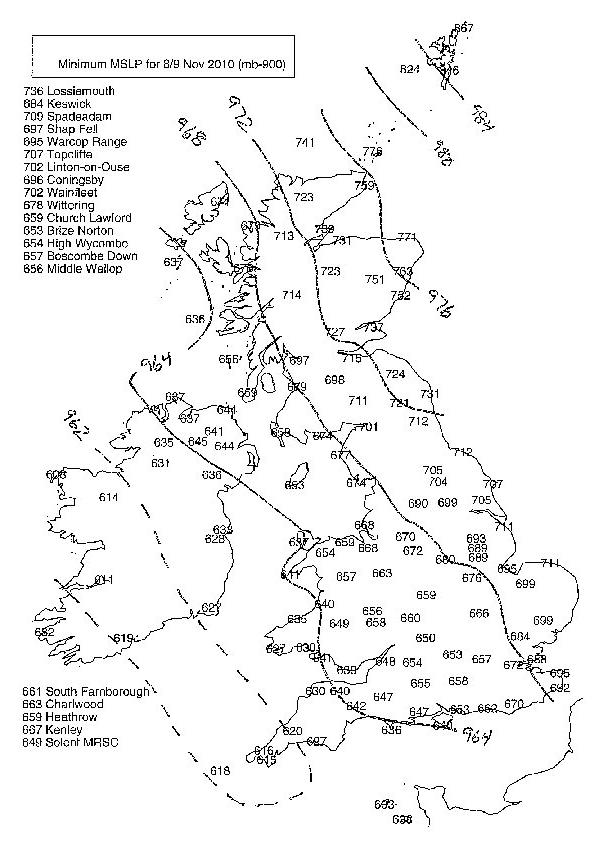