|
|
|
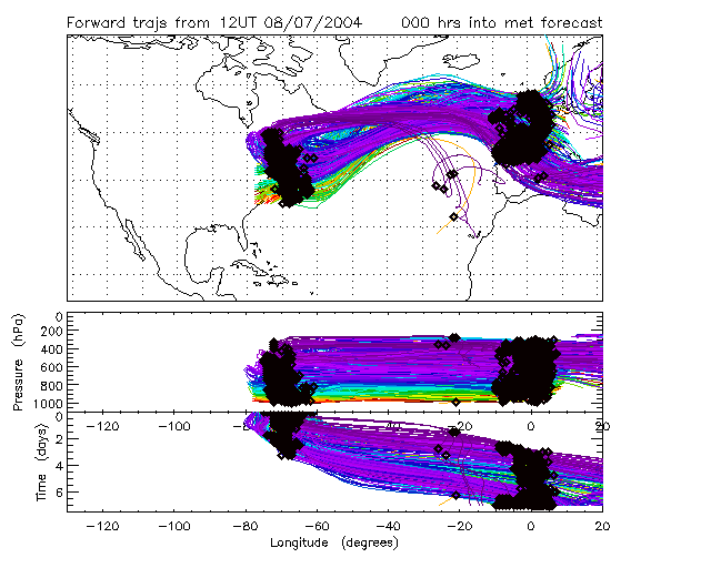
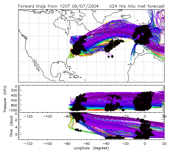
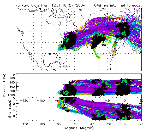
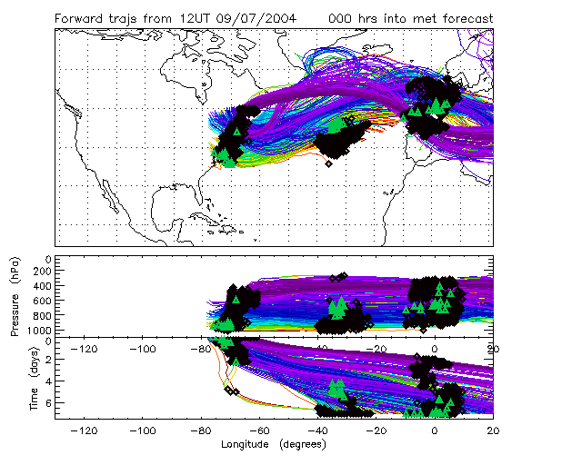
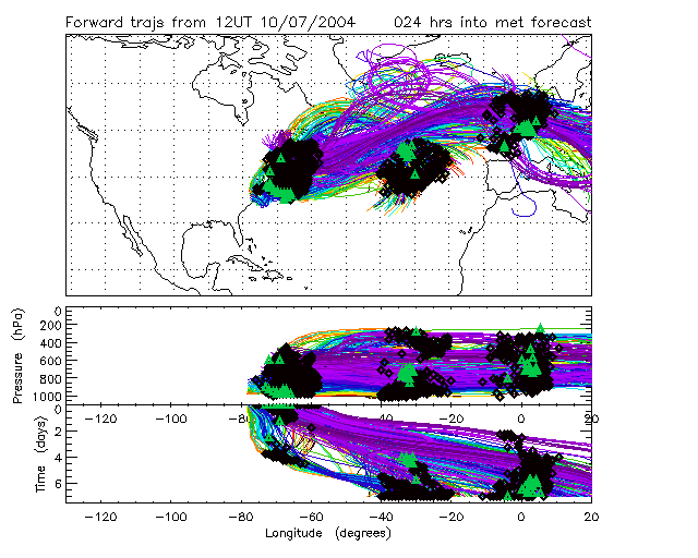
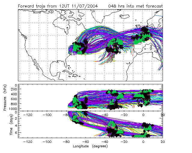
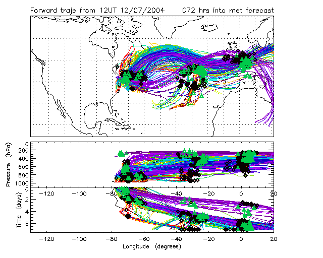
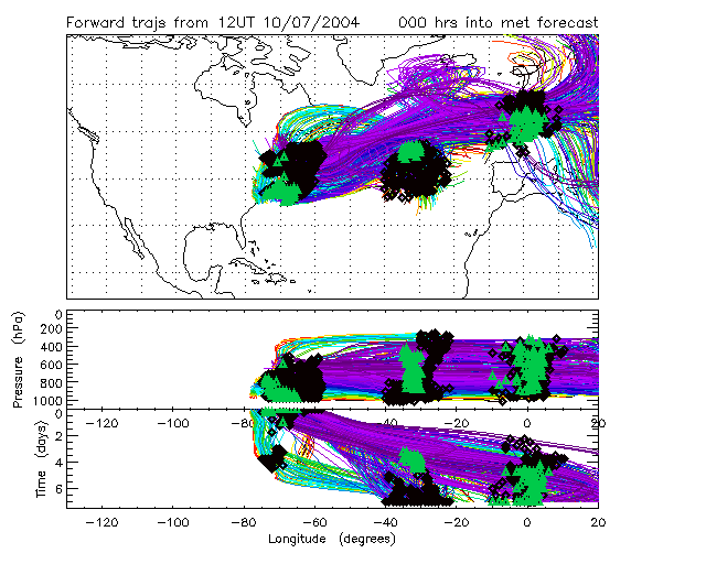
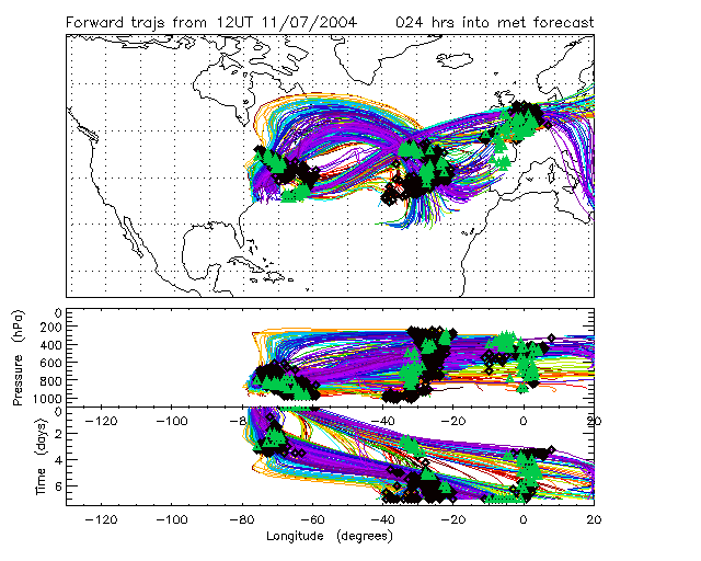
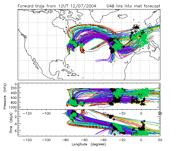
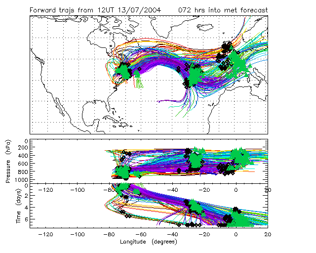
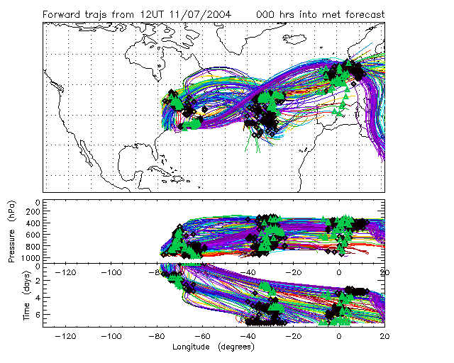
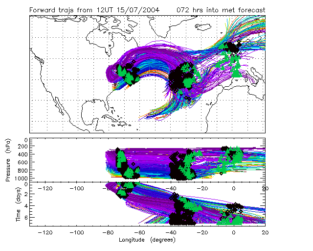
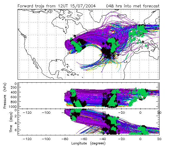
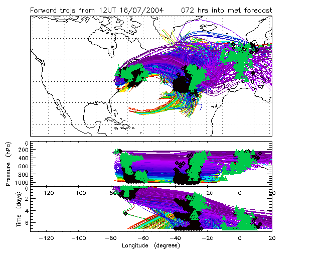
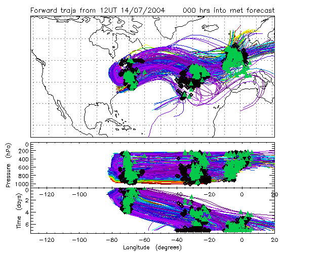
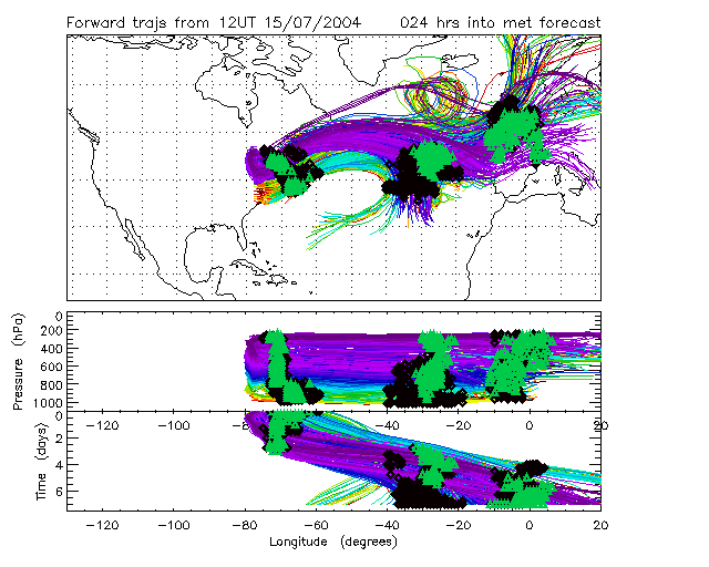
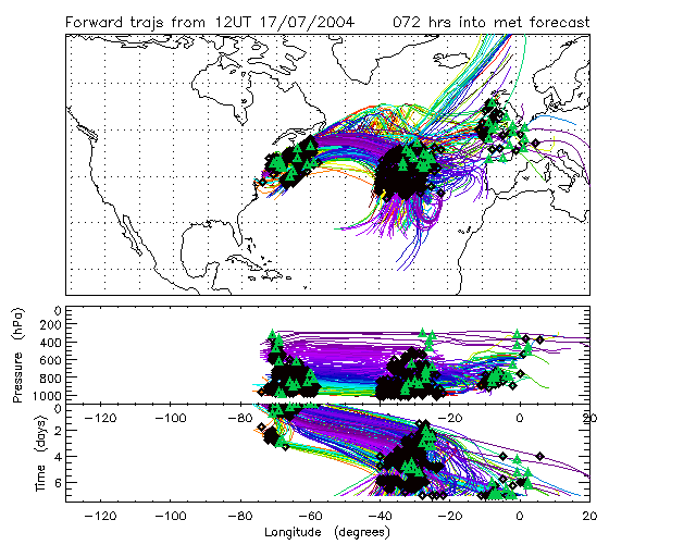
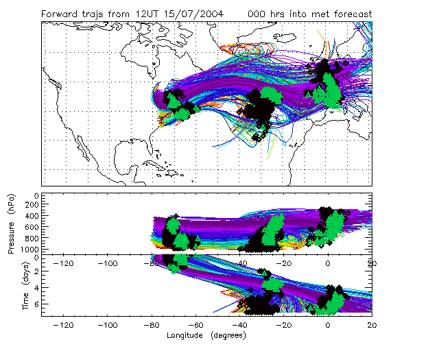
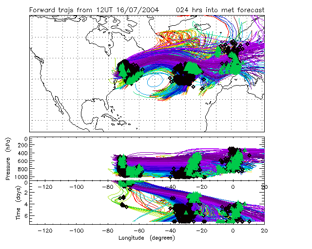
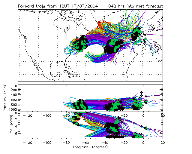
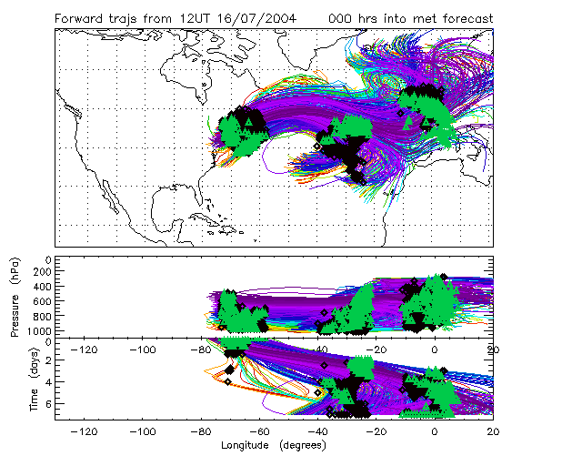
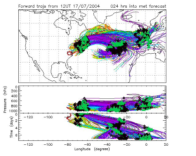
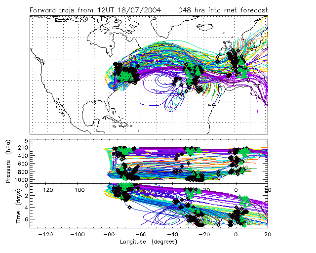
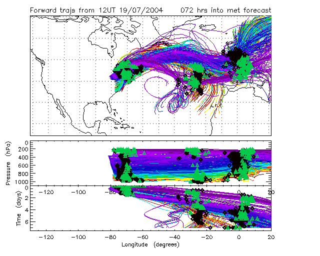
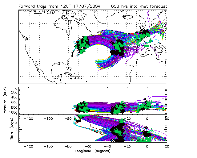
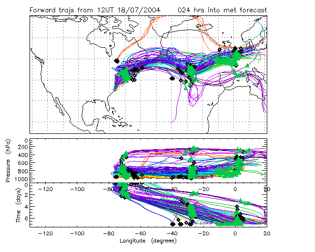
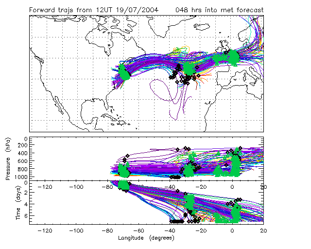
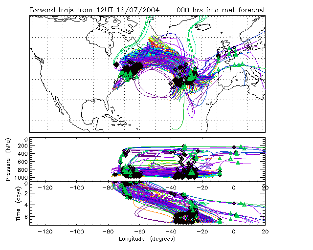
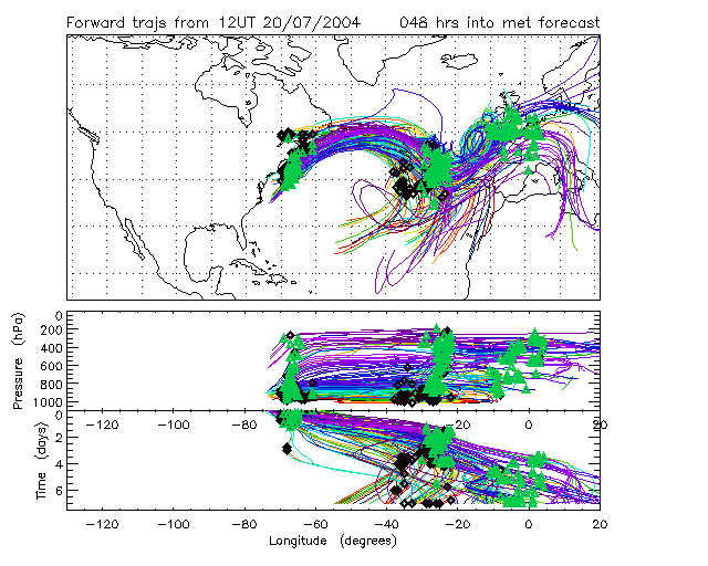
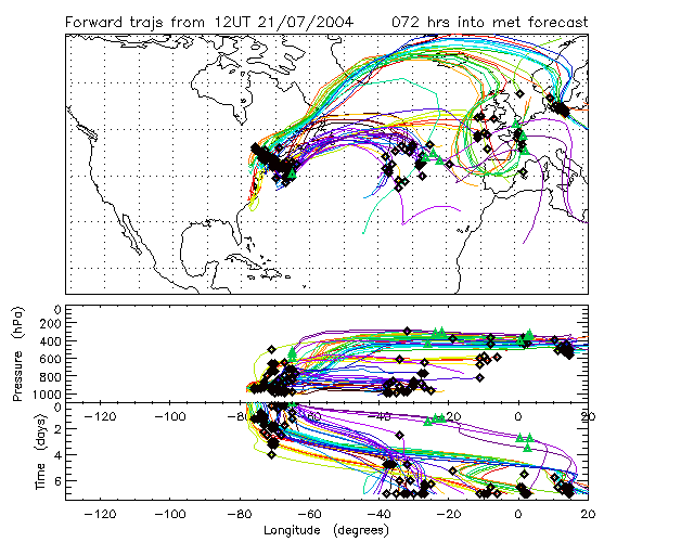
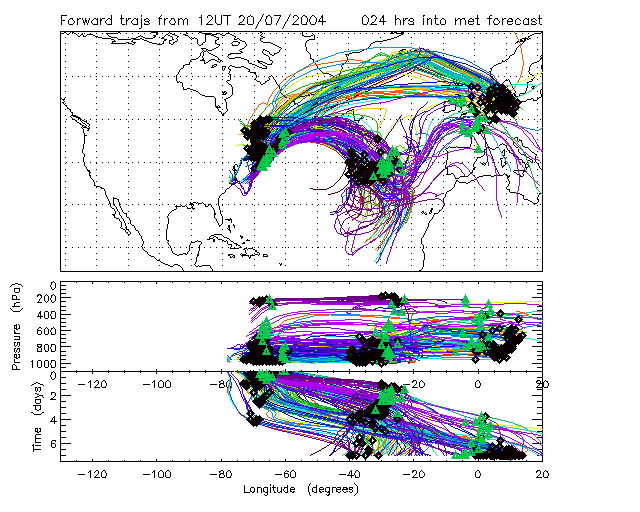
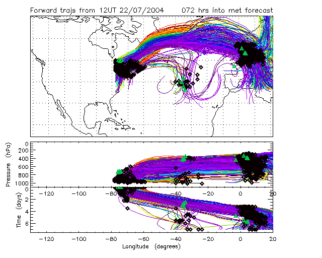
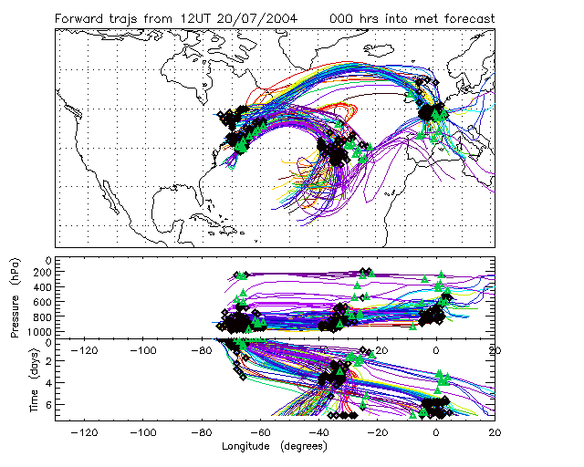
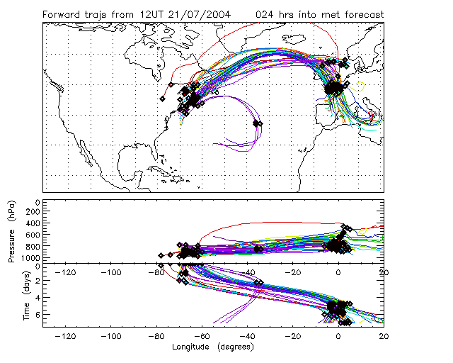
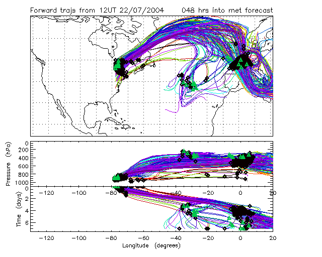
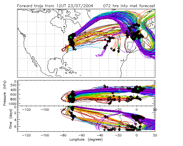
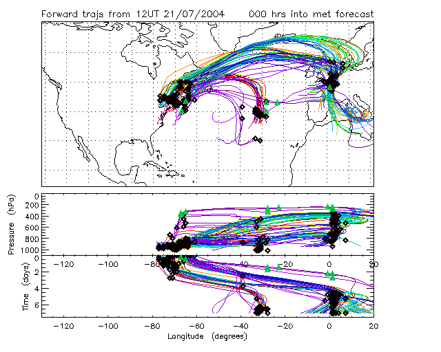
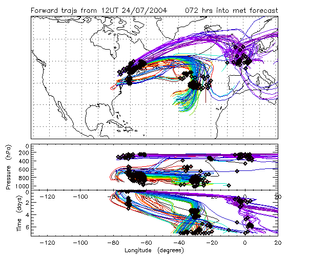
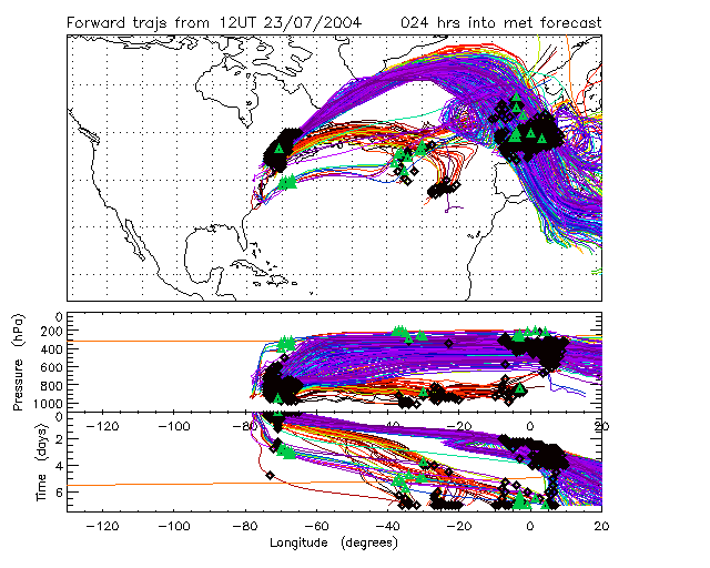
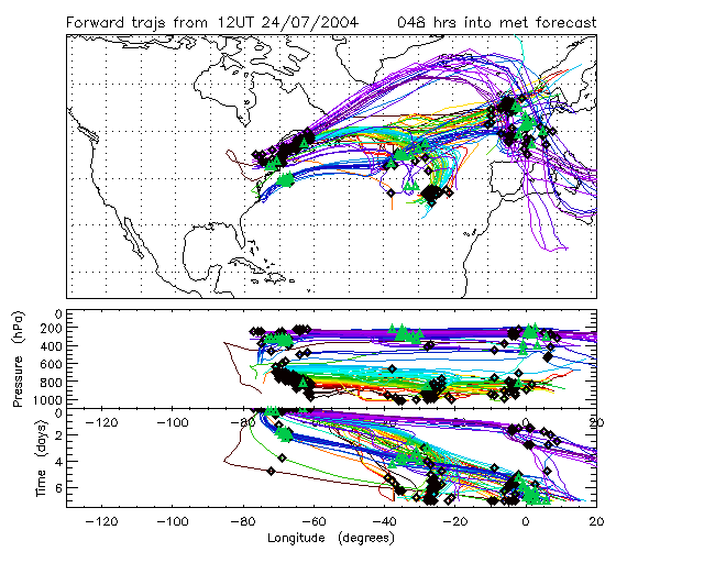
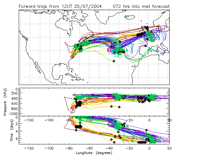
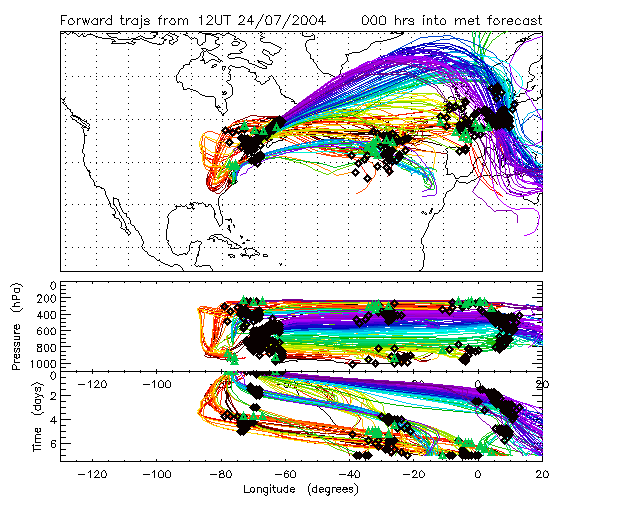
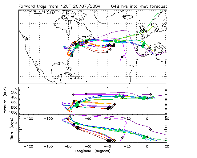
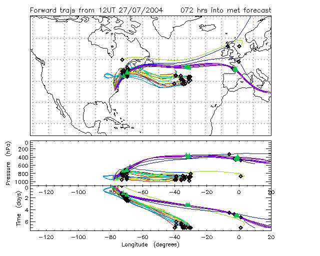
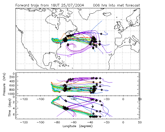
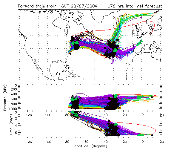
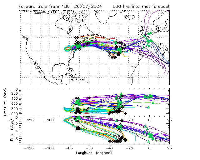
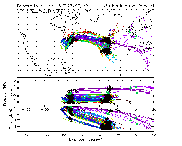
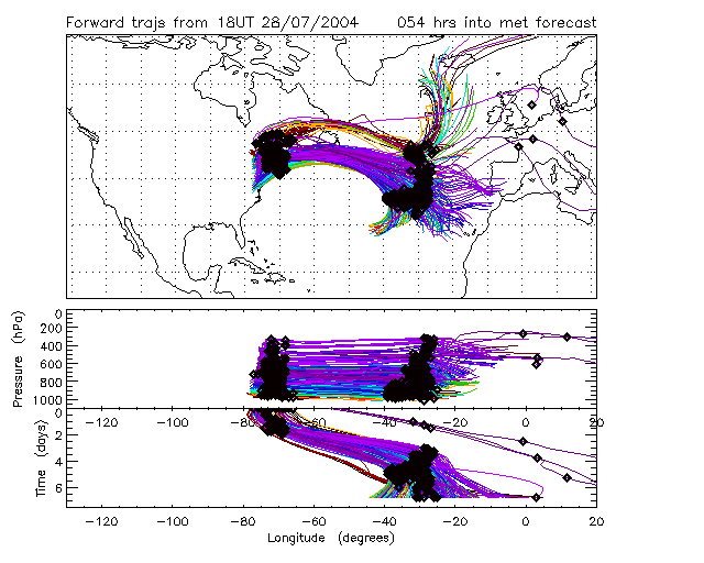
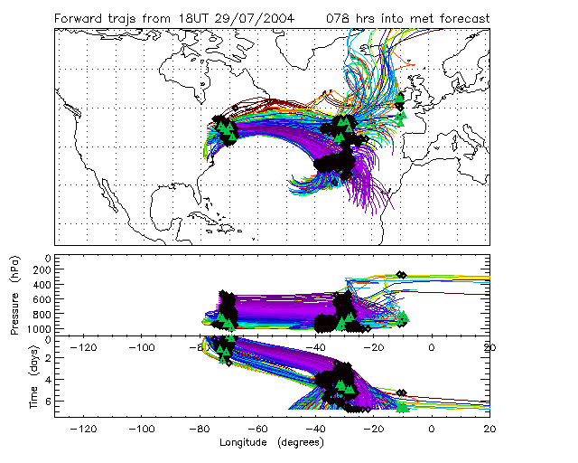
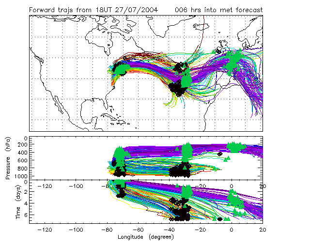
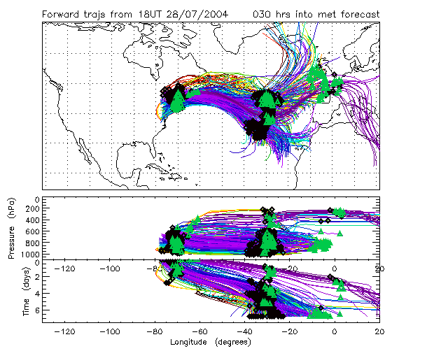
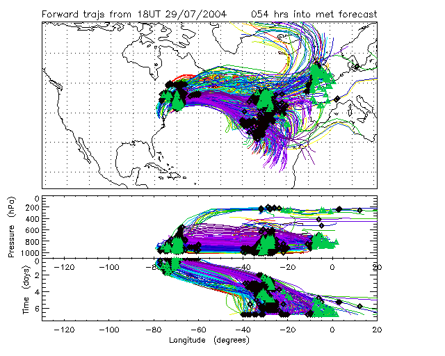
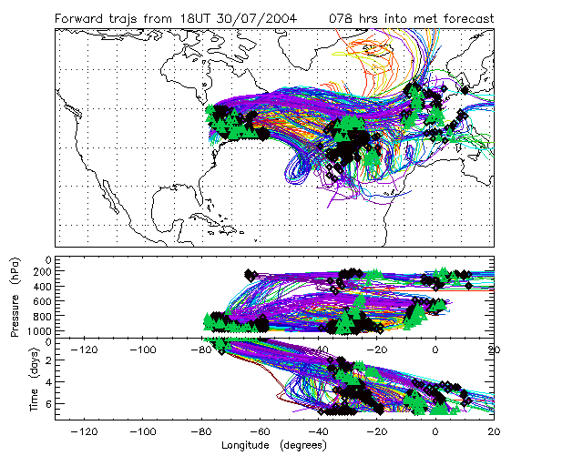
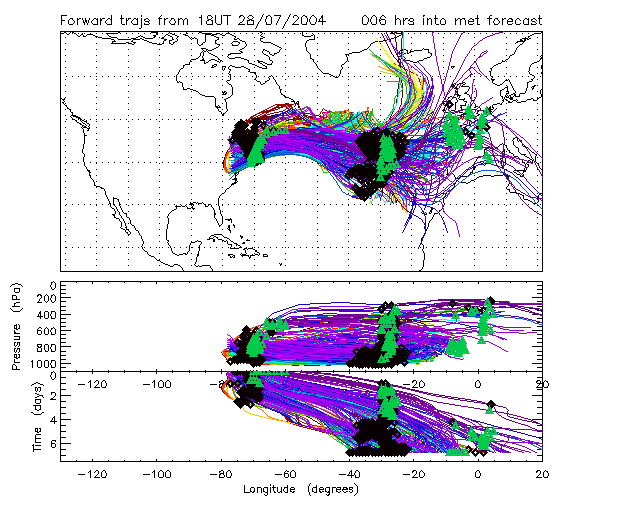
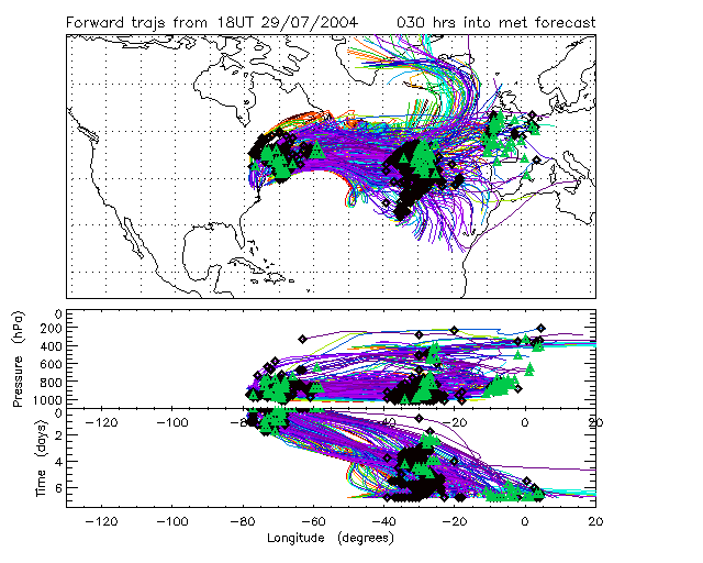
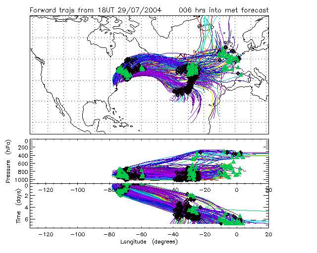
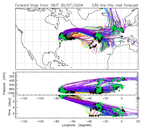
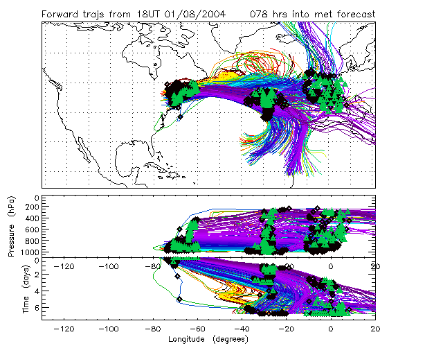
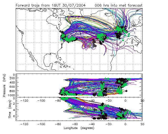
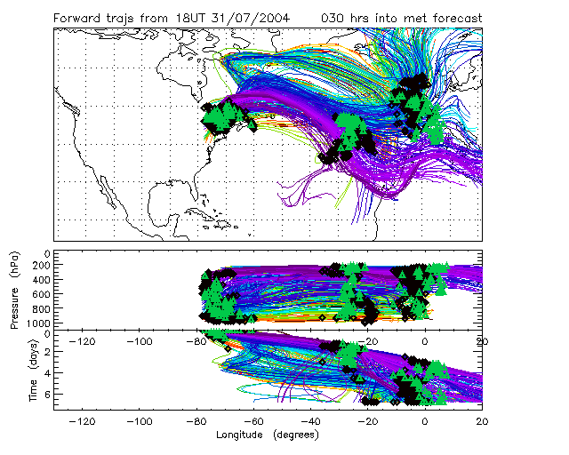
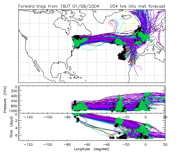
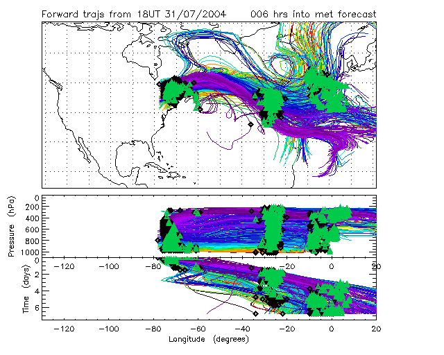
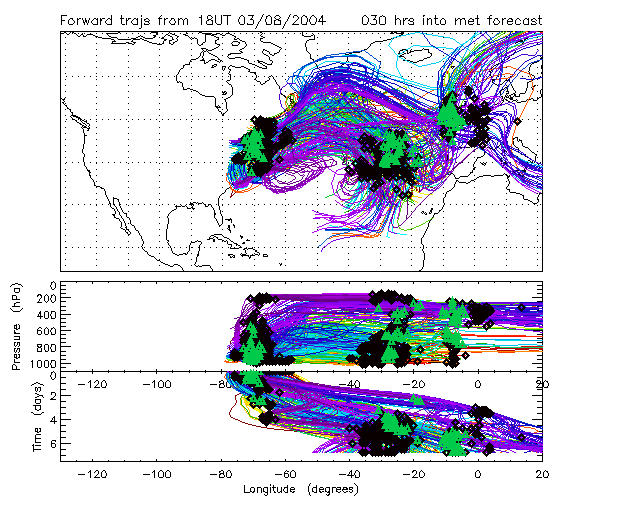
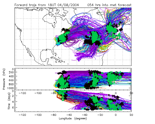
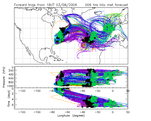
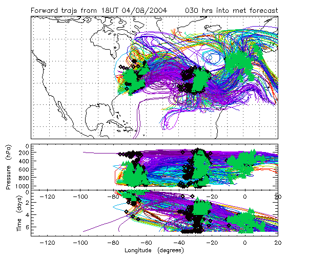
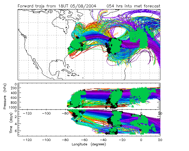
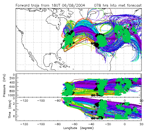
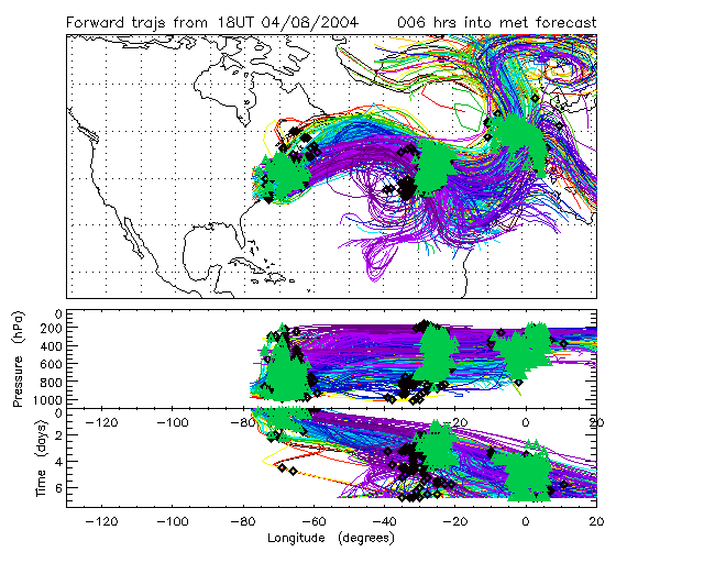
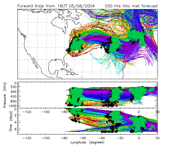
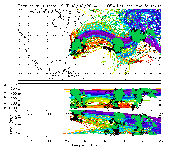
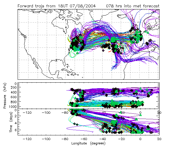
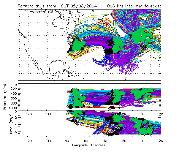
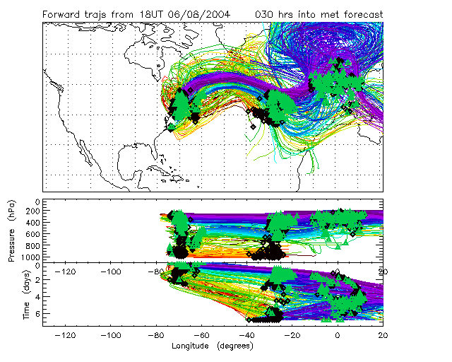
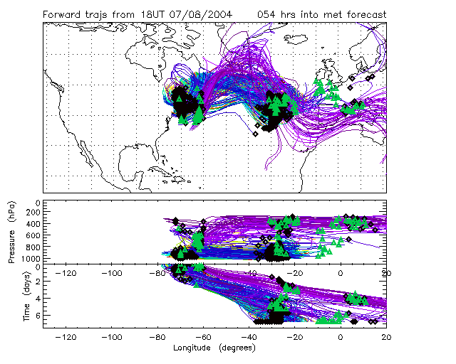
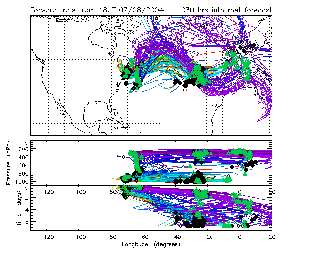
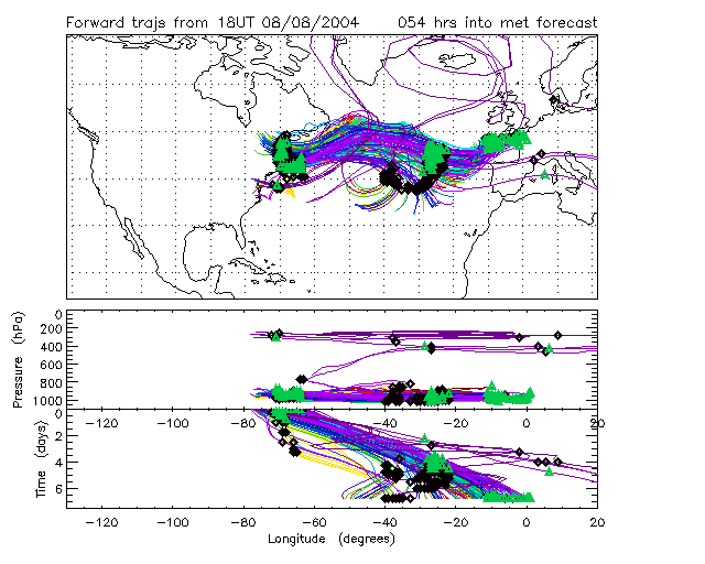
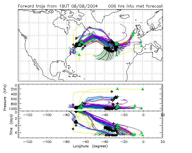
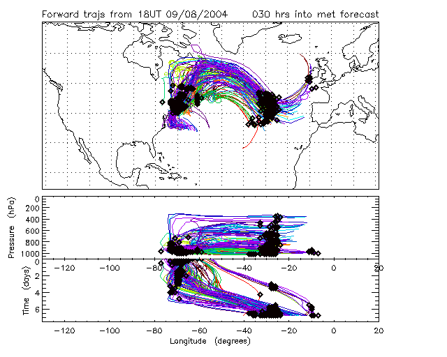
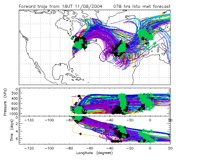
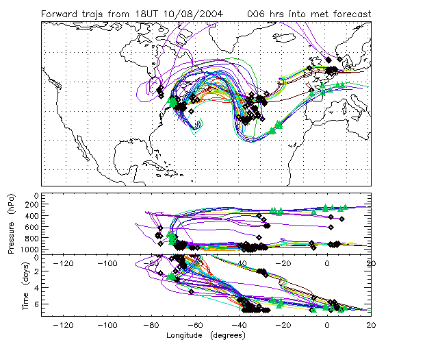
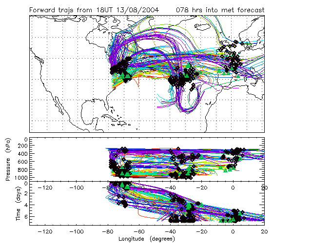
Forward trajectories from the US East Coast domain (7 days long)
Trajectories are only shown if they meet the following criteria
describing a "Lagrangian opportunity":
1) Passes within range (1000km) of any two out of three operational
bases,
2) Air mass has accumulated NOx emissions tracer > threshold amount
(along back trajs from domain).
3) Air mass will accumulate NOx emissions tracer < threshold amount
(along forward trajs from domain).
Symbols mark the best interception points: the closest approach (in
space and time) of Lagrangian opportunities to the bases (if within
range).
Black diamonds denote two-point opportunities where an air
mass passes within range of only two bases.
Green triangles denote three-point opportunities where an air
mass passes the US, Azores then Europe.
Red squares denote three-point opportunities where the
air mass passes from US-Europe-Azores, Europe-Azores-Europe or US-Azores-US.
Forecasts are listed by the date that the ECMWF meteorological
forecast was started (the `base time'). There are six forecasts
corresponding to trajectory release times 0, 24, 48 and 72
hours after the base time. On the plots the date refers to the
"release date" of the trajectories from the operational domain.
|
|