Menu
R4ASh: Radar-supported Next-Generation Forecasting of Volcanic Ash Hazard
Volcanic plume dispersal forecasts from Volcanic Ash Transport and Dispersion Models (VATDMs) are highly sensitive to the "source term" parameters, which cannot yet be measured reliably or in near real time, and for which uncertainties are poorly defined.
The aims of the R4Ash project are to:
(1) Develop a new VATDM model inversion-based approach to determine time-varying source term parameters, constrained by state-of-the-art satellite ash retrievals.
(2) Quantify VATDM uncertainties and provide critical insight into processes such as particle aggregation by comparing inversion results with those from near-source forward models.
(3) Develop a new multi-frequency radar ash retrieval algorithm, capable of providing simultaneous particle size distribution and mass loading measurements.
At Reading we will be focusing on using ensembles of meteorological fields to investigate the dependence of inverted source term estimates on wind field and wet deposition uncertainty. We will working closely with the Met Office on this project and will be using the Met Office inversion system Inversion Technique for Emission Modelling (InTEM). This system uses a Bayesian inversion technique to give an optimal estimate of the volcanic ash emission profile using satellite retrievals combined with dispersion modelling and an a priori estimate of the emissions.
More information on the R4Ash project can be found here.
Our recent paper on the combination of the InTEM inversion system and ensemble meterology to investigate the impact of wet deposition on the 2011 Grimsvotn eruption can be found here.
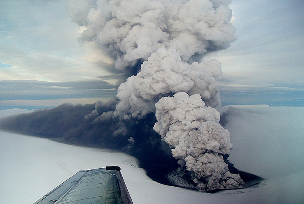
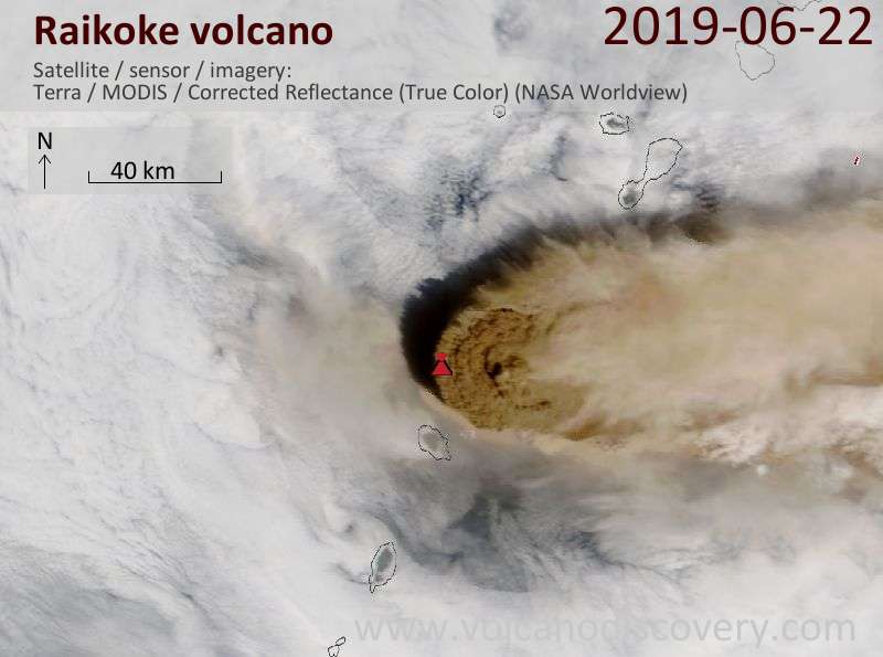
We are now focussing on the 2019 eruption of the Russian Volcano, Raikoke. We are applying a similar approach to that used when exploring the Grimsvotn eruption. Further work has focussed on using satellite observations to refine a large ensemble of VATDM simulations. To hear more about this click here to watch a presentation by Anto Capponi (Lancaster).